October to December 2020 rainfall outlook
Wet end to 2020 for much of Australia; particularly during October
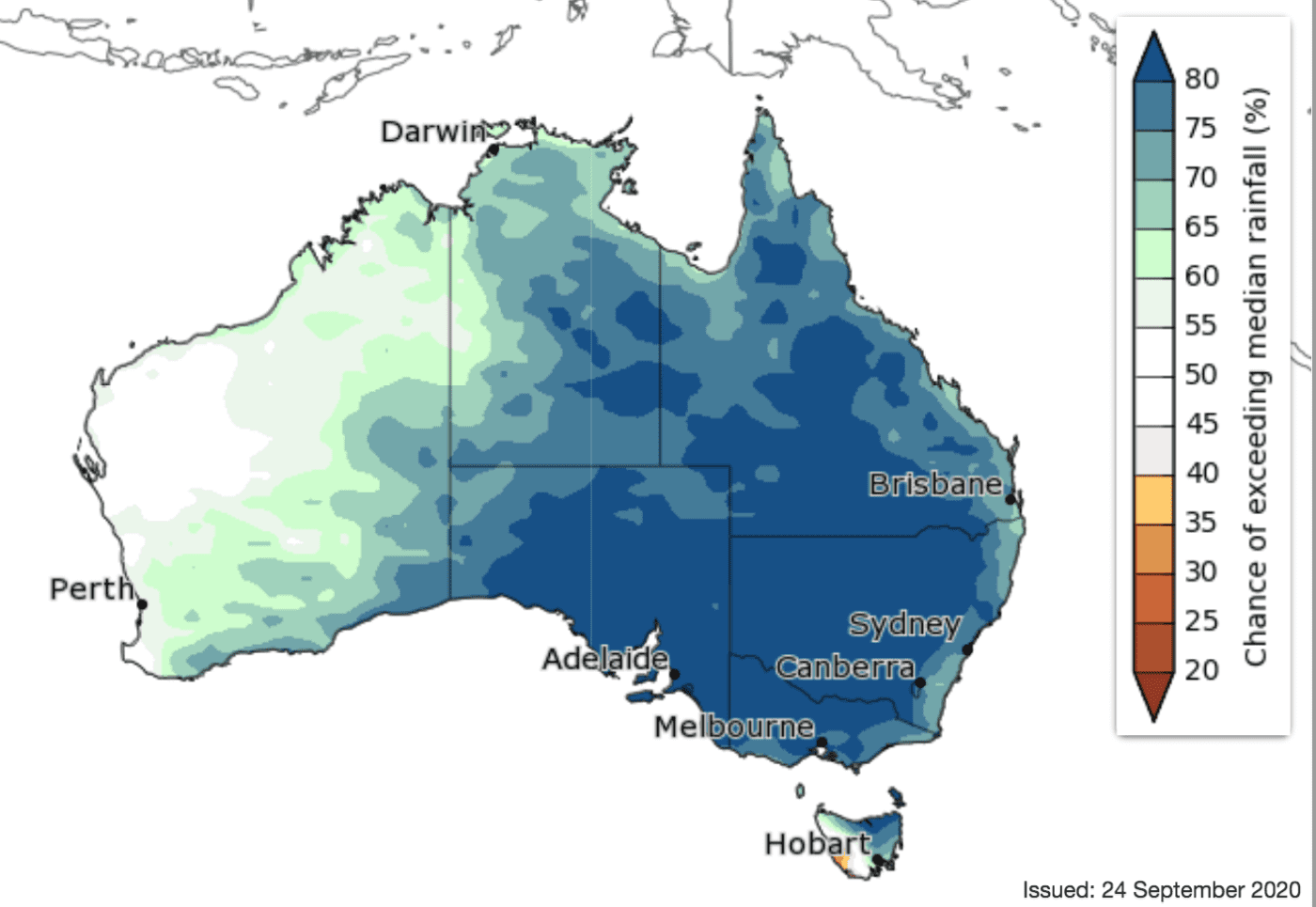
Rainfall outlook for October
October to December is likely to be wetter than average for much of mainland Australia and northern and eastern Tasmania (greater than 75% chance in much of this area).
Chances of a wetter or drier than average three months are roughly equal for much of north-west WA and the Kimberley.
October is very likely (greater than 80%) to have above average rainfall across much of the eastern two thirds of mainland, and is also likely (65 to 75% chance) to be wetter than average for south-coast and eastern WA and north-east Tasmania. Most remaining parts of WA have roughly equal chances of a wetter or drier than average October.
In the shorter term, the fortnight 28 September to 11 October is likely to be wetter than average for large parts of northern, central, and eastern mainland Australia. Parts of north-west WA extending from the Pilbara coast into the state’s center are likely to be drier than average.
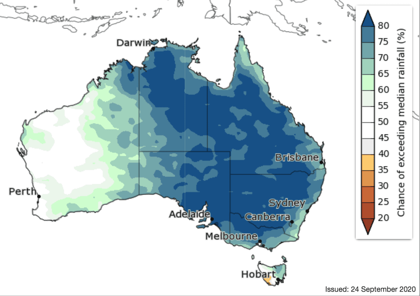
Rainfall outlook for November
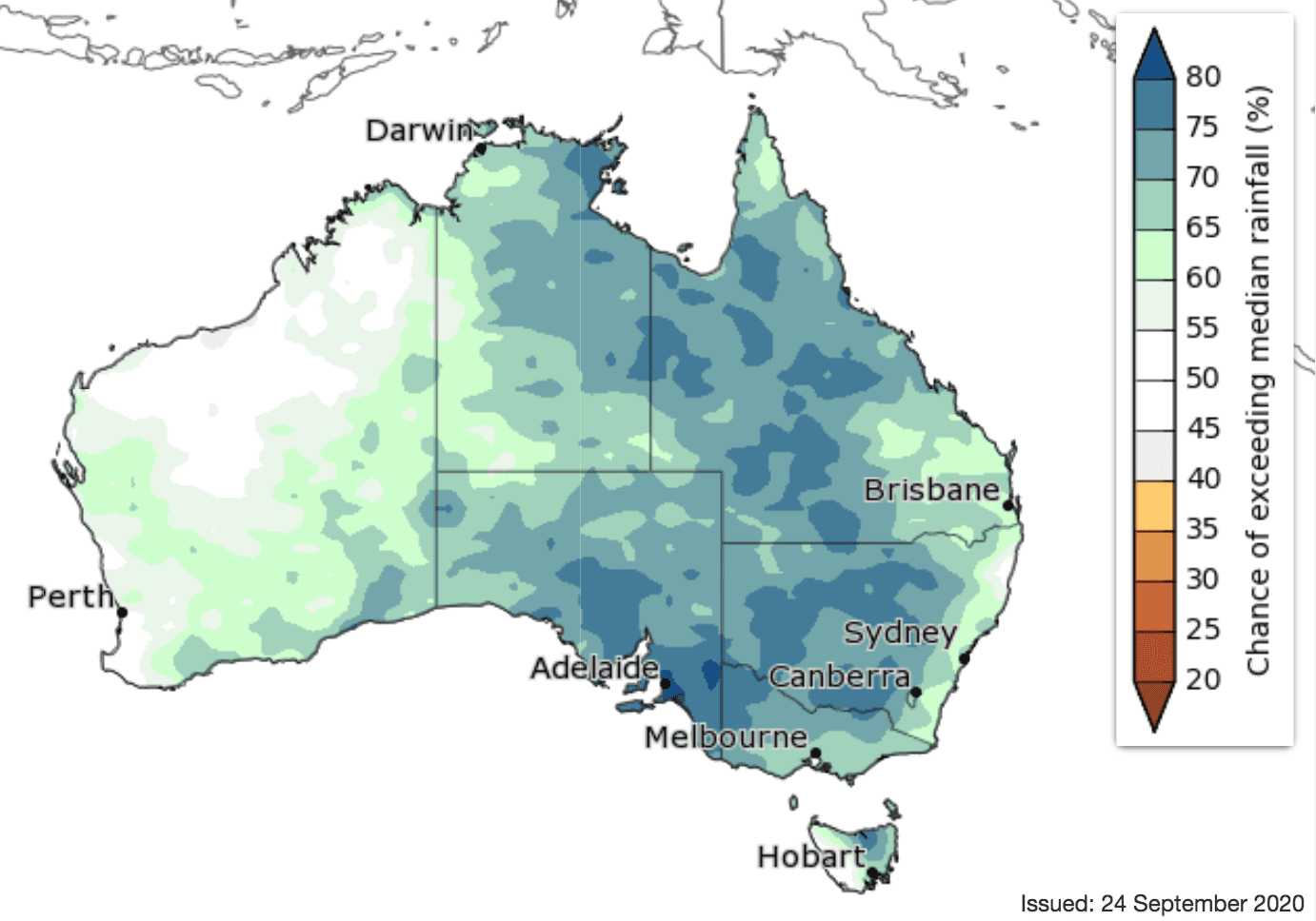
‘First look’ November to January outlook:
Temperature outlook
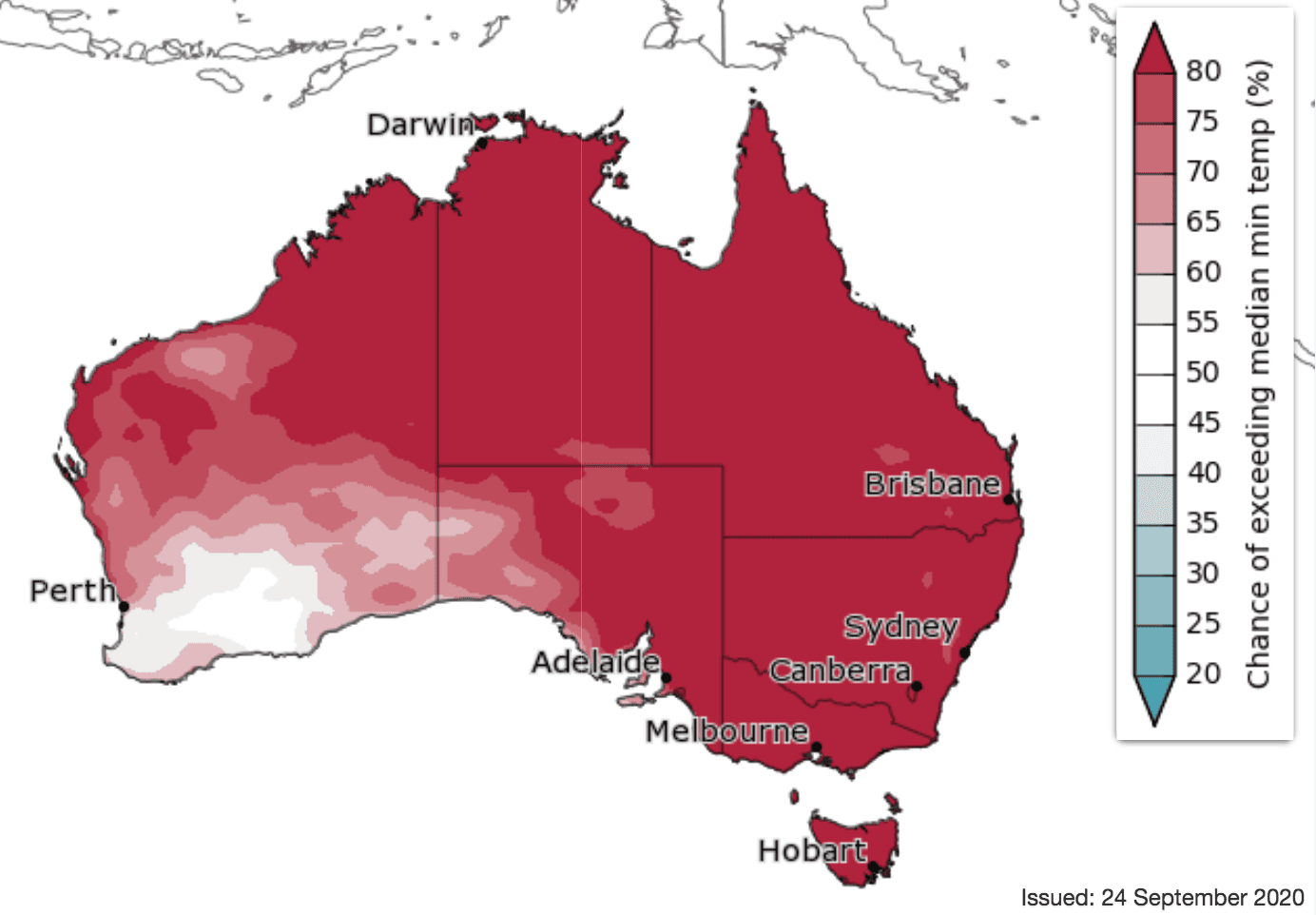
Minimum temperature outlook
Daytime temperatures for the fortnight 28 September to 11 October are likely to be above average for northern and western Australia, Tasmania, and Victoria.
Days are likely to be cooler than average in greater south-east Queensland. Nights during this period are likely or very likely to be warmer than average nearly everywhere.
For October, days are likely to be warmer than average for the far north, Tasmania, and much of Victoria; but cooler than average for large parts of southern WA, SA, NSW, north-west Victoria, and the southern half of Queensland. Nights are very likely to be warmer than average for most of Australia, but chances of above or below average minima are roughly equal in parts of south-west WA and the eastern Pilbara.
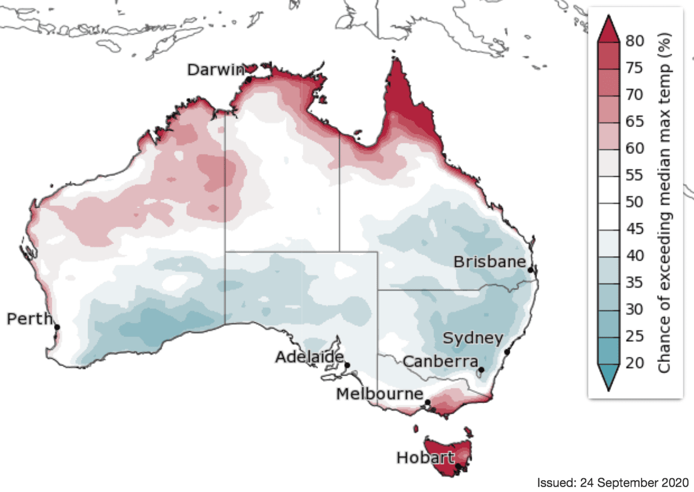
Days are likely to be warmer than average during October to December across the coasts of far northern Australia, extending into northern WA, and in the far south-east of the country. Cooler days are likely (60 to 75% chance) for much of southern WA, parts of SA, much of NSW, and central to south-eastern Queensland.
Night-time temperatures for October to December are very likely to be warmer than average for most of Australia (greater than 80% chance in most areas), although there are equal chances of above or below average temperatures for south-west WA.
Source: Bureau of Meteorology. To view more outlook maps for coming weeks and months click here
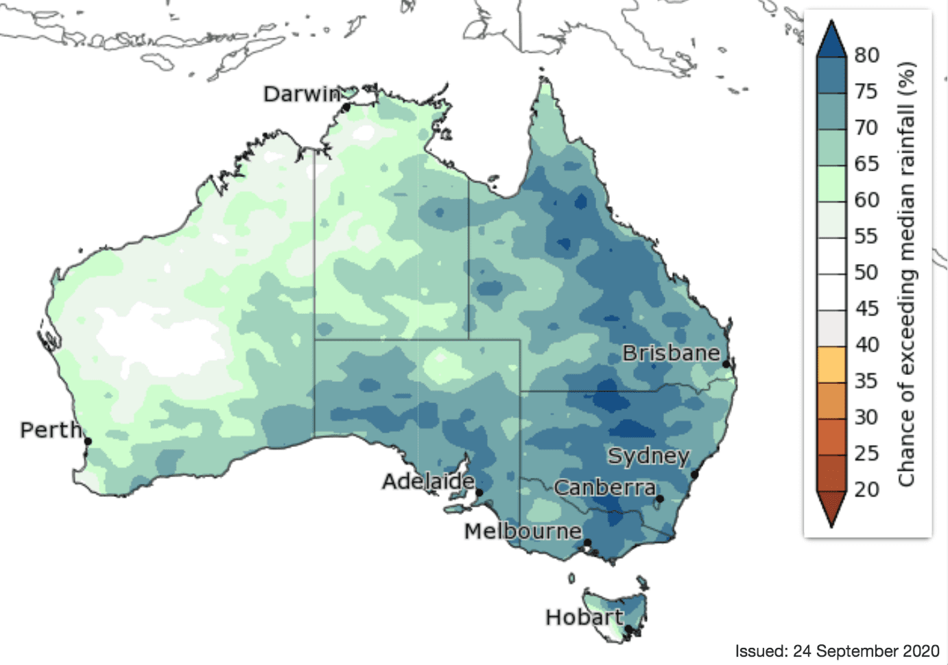
Previous forecast versus actual rainfall
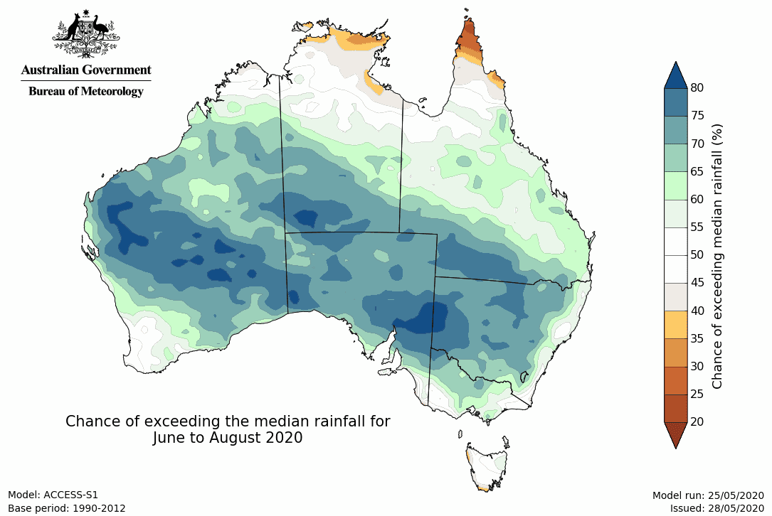
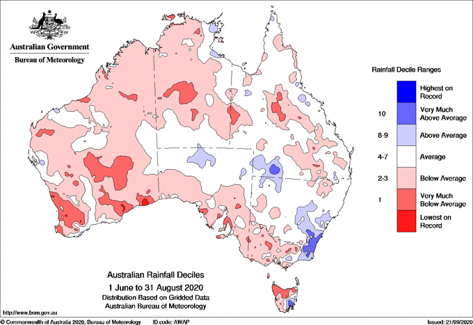
Maps below compare BOM’s rainfall forecast for June to August 2020, issued 28 May 2020, with actual rainfall recorded over the June to August 2020 period.
FORECAST MEDIAN RAINFALL JUNE to AUGUST 2020:
ACTUAL RAINFALL RECORDED JUNE to AUGUST 2020:
Source: Bureau of Meteorology


HAVE YOUR SAY