Weekly highlights
-
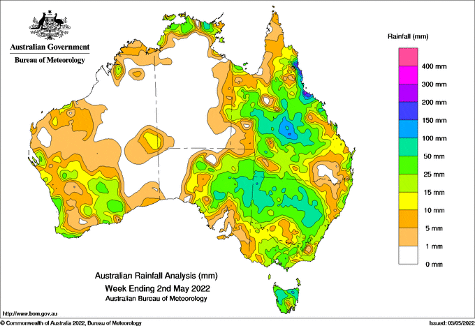
- Weekly totals of 150-300 millimetres were recorded around Townsville and along Queensland’s Tropical North Coast from a coastal trough at the start of the week
- The highest weekly total at a Bureau gauge was 337mm at Whyanbeel Valley, north of Cairns, including 311.2 mm in the 24 hours to 9am 26 April, an April daily record for the site.
- An upper trough over western Queensland interacted with tropical moisture, bringing 50-150 mm to inland areas of Queensland and New South Wales and north-eastern South Australia.
- Weekly rainfall was 3-5 times the April average in some inland areas, with riverine flooding reported for a number of river systems.
- Longreach, in central western Queensland, had 109mm in the 24 hours to 9am 26 April, its highest daily total since April 1989.
- Several cold fronts crossed southern Australia during the week with weekly totals of 25-50mm in parts of the South West Land Division in Western Australia, central Victoria and northern Tasmania, although south-west Victoria and south-east South Australia received only light falls.


HAVE YOUR SAY