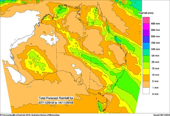
For today’s 14-day rainfall outlook – scroll to bottom of article
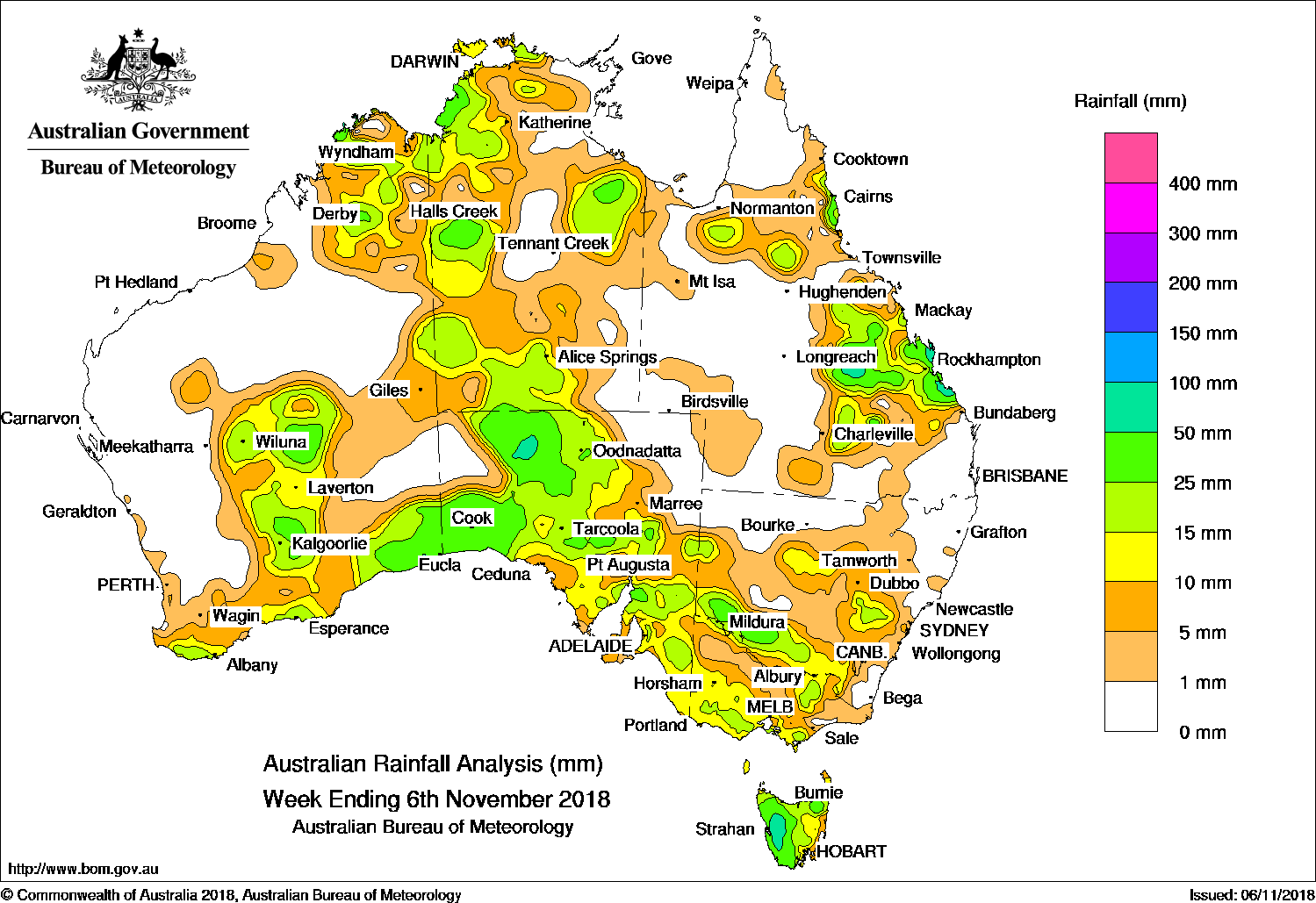
Broad surface troughs produced showers and thunderstorms in central, northern and eastern Australia, while a cold front and pre-frontal trough brought moderate falls to parts of southeast Australia. The highest weekly total was 110 mm at Byfield Childs Road in central Queensland.
Past seven days: At the start of the week, a surface trough and an upper level disturbance moved over central and southern parts of Queensland, maintaining unstable conditions. Thunderstorms and showers developed over the Central Highlands and the State’s southern interior, and produced moderate to locally heavy falls. Showers and thunderstorms remained active over the Capricornia coast due to humid easterly winds feeding into the surface trough. Showers and thunderstorms were also active about the Gulf Country, the eastern and Top End in the Northern Territory, and the Kimberley in Western Australia and the western half of South Australia, due to a broad low pressure trough.
By the middle of the week, a trough of low pressure moved slowly across South Australia, western New South Wales and Victoria, and generated light falls in the agricultural districts and southeastern South Australia, western Victoria and western Tasmania. The trough was followed by the passage of a weak cold front that brushed the southwest Western Australian coast, with light falls reported along the southern coast. As the cold front and pre-frontal trough tracked across southeast Australia, moderate falls were generated through parts of central and eastern New South Wales, central Victoria and western Tasmania.
A broad trough deepened inland from the west coast in Western Australia and across northern Australia. Moderate falls were recorded in the Goldfields and southeast of Western Australia; also in the Kimberley, the northwest Top End and the Carpentaria district in the Northern Territory. A cloudband, associated with the broad trough, later developed and extended from central to southeast Australia. Embedded thunderstorms and showers produced moderate falls over Central Australia, parts of South Australia, western to central Victoria, and southern New South Wales. Widespread, light falls were recorded along most of the southern coastline, and across southeast Australia.
Isolated rainfall totals exceeding 50 mm were observed in small areas in South Australia, western Tasmania, and in parts of central Queensland extending to the Capricornia coast.
Rainfall totals between 25 mm and 50 mm were recorded in parts of the southeast coast, the Goldfields and the Kimberley Districts in Western Australia; about the northwest Top End and Gulf Country in the Northern Territory; in areas of western and southeast South Australia; western Tasmania, southwest New South Wales, and in the Central Highlands, Capricornia coast and north tropical coast of Queensland.
Rainfall totals between 10 mm and 25 mm were recorded along parts of the southern coast, the Goldfields and the Kimberley Districts in Western Australia; most of western and southern South Australia, and across areas in the west and north of the Northern Territory. Similar totals were recorded in western to southern central Victoria, most of eastern Tasmania, southern and central New South Wales, and in northern and central Queensland.
Little or no rainfall was recorded in remaining areas of Western Australia, eastern parts of the Northern Territory, northeastern South Australia, eastern Victoria, northwestern and east coast New South Wales, and in western and southern Queensland; also the Cape York Peninsula.
Highest weekly totals
New South Wales and Australian Capital Territory
42 mm Balranald (RSL)
38 mm Wentworth (Burtundy)
36 mm Wentworth (Wamberra Station)
Victoria
31 mm Ovens River at Eurobin
26 mm Cape Schanck, Boolarra, SouthColac (Mount Gellibrand)
Queensland
110 mm Byfield Childs Road
103 mm Peakvale Station
76 mm Samuel Hill Aero
Western Australia
39 mm Seemore Downs
38 mm Moonera
36 mm Mundrabilla Station
South Australia
65 mm Tarcoola Aero
51 mm NullarborMintabie
Tasmania
89 mm Mount Read
58 mm Lake St Clair National Park
55 mm Warra
Northern Territory
41 mm Channel Point
31 mm Lajamanu Airport
30 mm Darwin Botanic Gardens
More weekly rainfall totals:
- NSW/ACT totals click here
- Vic totals click here
- Qld totals click here
- WA totals click here
- SA totals click here
- Tas totals click here
- NT totals click here
Rainfall outlook:


HAVE YOUR SAY