Surface troughs and a low pressure system triggered widespread thunderstorms across the eastern half of Australia.
Thunderstorms produced moderate falls in the Northern Territory.
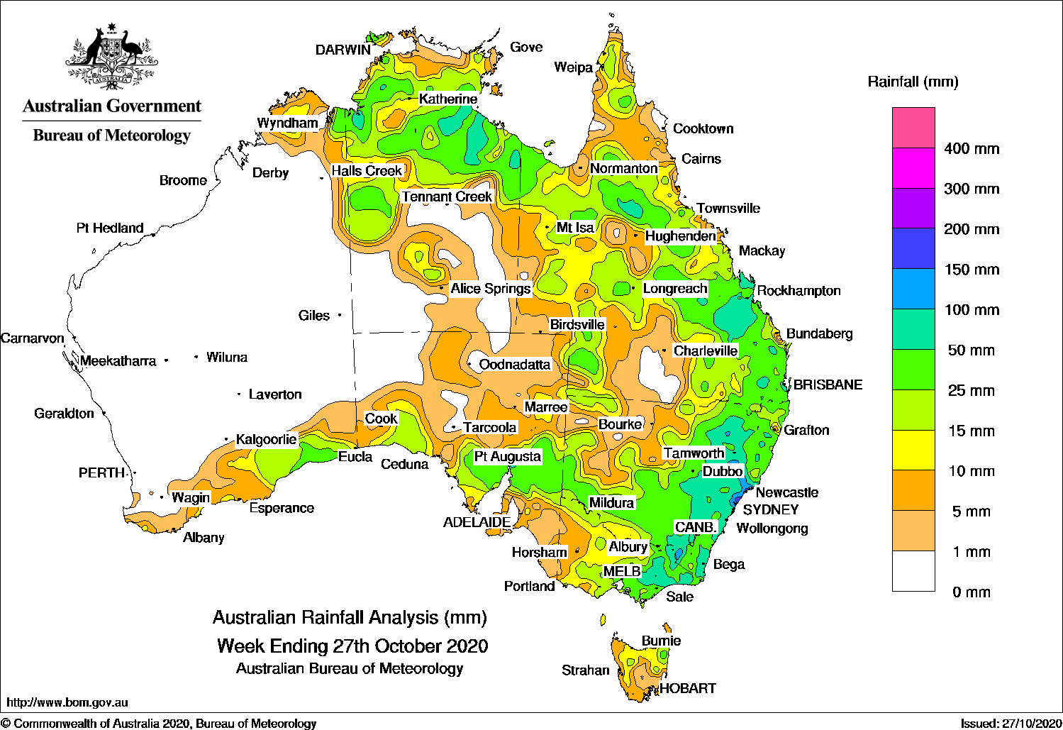
Past seven days: In the first part of the week, broad areas of low pressure extended across western, central and eastern parts of the continent, with thunderstorms developing over the south and north of Western Australia, north-western and southern parts of the Northern Territory, central to south-east Queensland and north-east New South Wales. A low pressure centre deepened along a trough over south-east Western Australia, and moved into western South Australia, producing a cloud band and moderate falls in south-east Western Australia, southern and eastern parts of South Australia, and triggered storms through parts of the Northern Territory and western Queensland. Showers and thunderstorms also developed near a trough along the New South Wales coast, with moderate falls reported in south-east Queensland, and north-eastern New South Wales.
By the middle of the week, the low pressure system and multiple surface troughs had moved into western New South Wales. Extensive areas of thunderstorms and showers developed across the Northern Agricultural District in South Australia; western, southern and along the Tablelands in New South Wales; southern central to north-eastern Victoria, and parts of northern Tasmania. An extensive cloud band with embedded thunderstorms also affected western, the northern and central interior, and south-east inland areas of Queensland.
In the last part of the week, the low pressure system tracked across northern New South Wales, with surface troughs extending north into Queensland, and across the base of the Top End in the Northern Territory. Thunderstorms produced moderate falls in areas of Arnhem Land and the Gulf Country, and the Cape York Peninsula. Thunderstorms also affected areas from the northern tropics, Central Highlands to south-east Queensland, much of central to eastern New South Wales, and the eastern half of Victoria. The low pressure system moved off the north-east New South Wales coast and the trough deepened over the east coast of Queensland and New South Wales. Thunderstorms developed over central to south-east Queensland, east coast New South Wales and eastern Victoria. Severe thunderstorms produced large hail, heavy rainfall and damaging winds over south-east Queensland, and areas around the Mid North Coast and Hunter districts in New South Wales reported isolated heavier falls.
At the end of the week, thunderstorms with widespread moderate falls were reported in the northern half of the Northern Territory. Thunderstorms also produced moderate falls along parts of the north tropical to central coasts of Queensland, and along the central to south-east coasts of New South Wales, with some isolated heavier falls in the Mid North Coast of that state.
Rainfall totals exceeding 200 mm were recorded in parts of the Mid North Coast and Hunter Districts in New South Wales, including the highest weekly total of 246 mm at Wyong (Mount Elliott) in the Hunter District in New South Wales. Falls in excess of 250 mm were reported from some sites with non-standard Bureau equipment.
Rainfall totals exceeding 50 mm were recorded in isolated areas of Gregory District and parts of the western Gulf Country in the Northern Territory and parts of the northern interior, Central Highlands and Darling Downs districts in Queensland. Similar totals were recorded in the Tablelands, Mid North Coast to south-east of New South Wales; in north-east and East Gippsland in Victoria; and in a small area of the Flinders District in South Australia.
Rainfall totals between 10 mm and 50 mm were recorded in the Kimberley and along the south coast of Western Australia; southern and eastern parts of South Australia; most of the northern half and southern parts of the Northern Territory; large parts of Queensland and New South Wales, most of Victoria, and northern and eastern Tasmania.
Highest weekly totals
New South Wales and Australian Capital Territory
246 mm Wyong (Mount Elliot)
240 mm Smiths Lake (Patsys Flat Road)
228 mm Williamtown RAAF
Victoria
95 mm Mount Moornapa
89 mm Mount Hotham
76 mm Falls Creek
Queensland
98 mm Yantumara
94 mm Melrose
91 mm Capalaba Water Treat
Western Australia
44 mm Kununurra Aero
34 mm Eyre
20 mm Mundrabilla Station
South Australia
87 mm Quorn
60 mm Braemar
56 mm Jamestown PirsaJamestown
Tasmania
51 mm Sheffield School Farm
47 mm Mount Victoria (Una Plain)
35 mm Pyengana (Forest Lodge Road)
Northern Territory
91 mm Bullo River
75 mm Ngukurr Airport, Tanumbirini
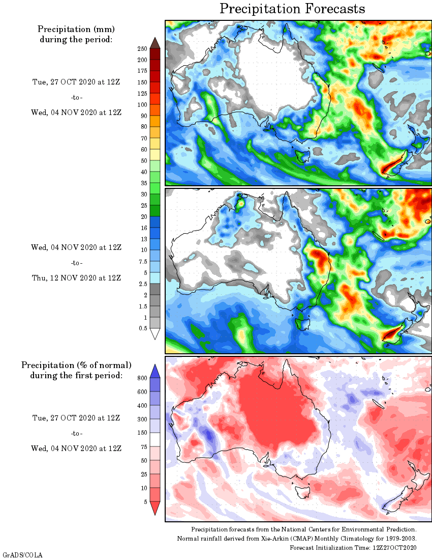
Rainfall outlook


HAVE YOUR SAY