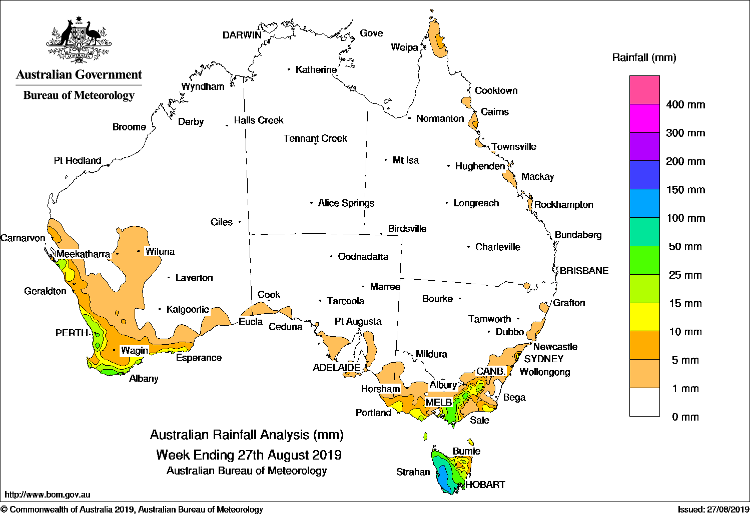
Cold fronts brought light to moderate falls to Western Australia’s west and south coast, and to Victoria. Fronts and westerly flow brought rain to Tasmania – heaviest in the west, with light falls in the northeast.
Past seven days: At the start of the week, a cold front followed by a strong southwesterly airstream with a small embedded low brought moderate rainfall to Tasmania, with lighter falls in West and South Gippsland in Victoria, and parts of the Australian Alps.
In the middle of the week, a frontal system and associated cloudband crossed the southern half of Western Australia, bringing light to moderate falls across the west and south coast, and light falls extending inland across the South West Land Division.
A low formed on the line of this front as it approached the southeast, with light to moderate falls across western and southern Tasmania, and light falls about parts of southern Victoria. Light falls continued in western Tasmania until the end of the week. Light falls were also observed in coastal Victoria, while in coastal New South Wales onshore flow associated with a high pressure system which had moved over the Bight in the wake of the frontal system also produced some light falls.
Rainfall totals exceeding 100 mm were recorded in western Tasmania and parts of the central plateau, including the highest weekly total of 113 mm at Queenstown.
Rainfall totals in excess of 25 mm were recorded in parts of the south coast of Western Australia, parts of Victoria extending from West and South Gippsland through to the northeast alpine region, and across most of the remainder of western and southern Tasmania.
Rainfall totals between 10 mm and 25 mm were observed in along much of the coast of the South West Land Division in Western Australia, isolated locations in southeastern South Australia, parts of coastal Victoria, about the alpine region in Victoria, extending into the Snowy Mountains in New South Wales, and in parts of northeastern Tasmania.
Little or no rainfall was recorded in Western Australia away from the South West Land Division, the Northern Territory, Queensland, South Australia, most of New South Wales away from the Snowy Mountains, and northwestern Victoria and along the Murray to the northeastern region.
Highest weekly totals
New South Wales and Australian Capital Territory
48 mm Mona Vale Golf Club
38 mm Collaroy (Long Reef Golf Club)
37 mm Cabramurra SMHEA AWS
Victoria
58 mm Mount Baw Baw*
43 mm Falls Creek*
38 mm Mount Buller*
Queensland
24 mm Bingil Bay
8 mm Hawkins Creek, South Johnstone Exp Stn
Western Australia
45 mm Bickley
39 mm Bungendore, Mount William
South Australia
15 mm Ashton
10 mm Ashton Co-Op, Mount Lofty
Tasmania
113 mm Queenstown (South Queenstown)
105 mm Warra, Lake Margaret Power Station**Lake St Clair National Park
Northern Territory
0.4 mm Centre Island Gove Airport
0.2 mm Multiple locations
*It is possible that some totals at elevated sites may include snow that fell last week, but which subsequently melted and has been measured this week. Some alpine sites may be affected by snow and wind, in such cases the true totals are most likely higher.
**Lake Margaret Power Station and Lake Margaret Dam have not yet reported rainfall for the final day of the week, so their weekly total is not yet known but will be higher. Mount Read was affected by snow during the week and did not report on several days; that station’s total is unknown but likely would have been amongst the highest for the week.
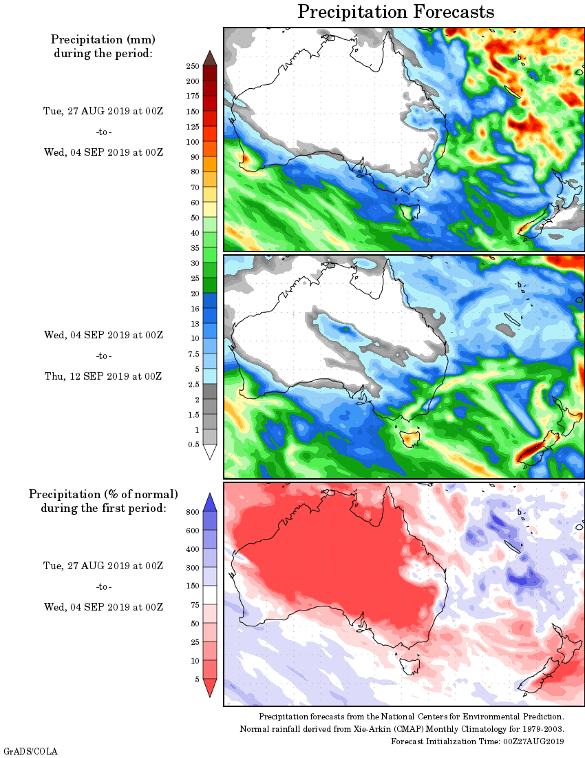
Rainfall outlook:


HAVE YOUR SAY