
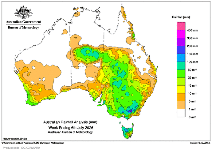
A SERIES of cold fronts and troughs resulted in moderate to heavy falls across south-west Western Australia, southern parts of South Australia, Tasmania, Victoria and inland parts of New South Wales and Queensland.
Weekly rainfall totals of 15-50mm were recorded across south-west WA, and large parts of the south-east, with falls greater than 50mm across south-eastern parts of SA, northern and south-western parts of Vic, northern and western Tas, and large parts of inland NSW.
Heavy rainfall totals led to flood warnings and watches issued in north-east Vic and northern Tas.
Early in the week, there was rainfall over central Australia due to a moist airstream and upper trough.
Weekly rainfall totals of 15-50mm were recorded across southern parts of the NT and south-western Qld.
Onshore flow resulted in scattered showers about the east coast for several days.
Weekly rainfall totals of 10-25mm were recorded across coastal areas of the Qld’s south-east, with falls up to 50mm in the north coast and Tablelands district.
The highest weekly total at a Bureau gauge of 252mm was recorded at Whitlands, Burder’s Lane, in Vic.
The highest daily total at a Bureau gauge of 85mm was recorded at Aldgate in SA in the 24 hours to 9am on July 2.
HAVE YOUR SAY