
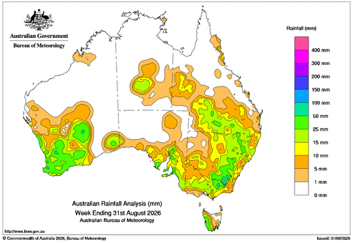
A LOW interacting with inland troughs crossed south-eastern Australia during August 24 and 25, producing heavy rain and localised flash flooding on the Fleurieu Peninsula in South Australia.
It also produced moderate to heavy rainfall along the ranges in the Victoria and New South Wales, with totals of 5-50 mm across much of the south-east.
Inland troughs directing tropical moisture from the north-west to the south-east produced light showers in central Australia, and weekly rainfall totals of 5-50mm across southern Queensland and eastern NSW.
From August 26, a slow-moving low-pressure system and associated trough and upper cut-off low, produced a broad cloud band and widespread rain and thunderstorms across the south of WA.
Weekly totals of 10-50mm were recorded across much of the region, with higher totals near the west coast.
During the week, onshore winds directed light rain to some coastal areas of Qld, with weekly totals generally below 10mm.
The highest weekly total at a Bureau gauge was 83mm at Carabost in NSW.
The highest daily total at a Bureau gauge was 79mm at Mount Compass in SA in the 24 hours to 9am on August 25.
HAVE YOUR SAY