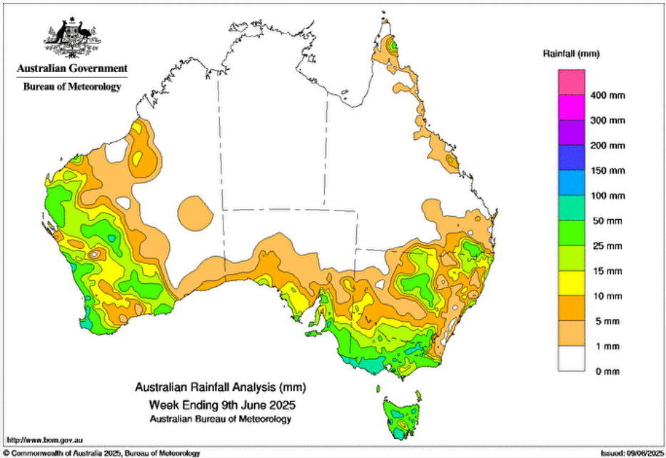
AT THE beginning of the week commencing June 2, a low-pressure trough off the Australian east coast caused showers across northern New South Wales and far southern Queensland.
A cold front and an associated low-pressure trough brought rain and showers to western parts of Western Australia on June 2-4.
Later in the week, cold fronts and a slow-moving low pressure system brought widespread rainfall to south-eastern parts of the country and snow to alpine areas.
Weekly rainfall totals of 15-50mm, with locally higher totals, were recorded across western parts of WA, south-eastern South Australia, most of Victoria and Tasmania, areas of northern New South Wales and far south-eastern Qld.
The highest weekly total at a Bureau gauge was 170mm at Haines Junction, Mount Sabine in Vic, which included the highest daily total at a Bureau gauge of 69mm in the 24 hours to 9am on June 8.
HAVE YOUR SAY