
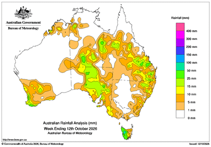
AN INLAND trough interacting with a low-pressure system east of Australia from October 6 to 8 produced generally light patchy showers in inland and the south-east of Queensland, and in north-eastern New South Wales.
Weekly rainfall totals of 5-25 mm, locally higher, were recorded across the region.
A series of cold fronts crossed southern Australia during the week, bringing weekly totals of 5-50mm, locally higher, along parts of the coast in south-western Australia and to western Tasmania.
Fronts over southern Australia connecting with an inland trough October 8-11 resulted in storms and showers across northern-inland areas and South Australia.
Large areas through the Northern Territory, into western Qld and through SA recorded weekly rainfall totals of 5-25mm, and lower totals were recorded in the south-east.
The highest weekly total at a Bureau gauge of 89mm was recorded at Mount Read, Tasmania.
The highest daily rainfall total was 50mm at Gladstone Airport in Qld in the 24 hours to 9am on October 8.
HAVE YOUR SAY