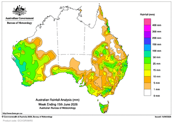
DURING the week, a slow-moving low pressure system with embedded cold fronts interacted with an inland trough and moisture feeding from a north-west cloudband to produce widespread rainfall and showers from the west, across the far south, and over much of eastern Australia.
Weekly totals of 25-100mm were recorded across the west of Western Australia, coastal South Australia, western Tasmania, the south-eastern ranges, and areas of southern Queensland to north-eastern New South Wales.
A persistent high-pressure system in the Tasman Sea brought onshore flow with showers along the east coast, resulting in weekly rainfall totals of 10-50mm, and locally higher falls to some coastal areas, particularly in northern Qld.
The highest weekly total at a Bureau gauge of 171mm was recorded at Topaz Alert, Qld.
The highest daily total at a Bureau gauge of 82mm was recorded at Eurardy, WA, in the 24 hours to 9am on June 12.
HAVE YOUR SAY