
A COLD front moved over the south-east on 13 July, followed by a trough on 14 July.
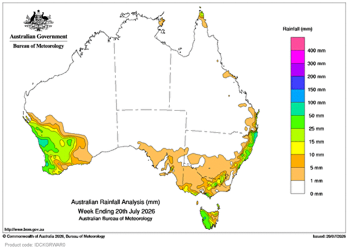
Weekly totals up to 10mm were recorded about the south-east with locally higher totals of 10-50mm about western Tasmania and southern and alpine regions of Victoria.
A trough developed along the east coast, enhancing showers as it developed into a low-pressure system later in the week with isolated thunderstorms.
Weekly totals of 25-50mm were recorded about the east coast with locally higher totals of 50-150mm about the Mid North Coast and Northern Rivers in New South Wales.
A cold front moved over Western Australia on July 16, resulting in rain and showers about the south-west, and was followed by another cold front on July 17 and 18.
Weekly totals of 15-25 mm were recorded about the South West Land Division in WA with locally higher totals up to 80mm near the coast.
The highest weekly total at a Bureau gauge of 150mm was recorded at Meldrum, Coolawarrah, in NSW.
The highest daily total at a Bureau gauge of 81mm was recorded at Green Grove in WA in the 24 hours to 9am on July 18.
HAVE YOUR SAY