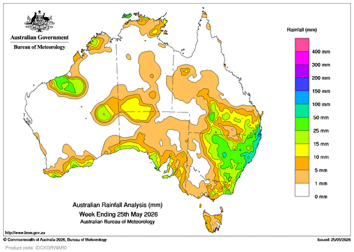
ON MAY 19, a north-west cloudband interacting with onshore flow along the east coast, contributed most of the weekly rainfall totals of 25-100mm and locally higher falls, in far-eastern Victoria, central and eastern New South Wales and parts of southern Queensland.
Some sites in south-east Qld recorded more than 200mm of rain for the week, and experienced intense falls on May 18 and 19.
A cold front brought light to moderate rainfall to southern coastal areas during the week, including weekly totals of 5mm to locally more than 25mm in Western Australia and South Australia, and generally lighter falls in Vic and Tasmania.
The cold front also interacted with an inland trough, triggering thunderstorms in areas between the north-west and the central interior, with the highest weekly rainfall totals of 25-50mm recorded in the Pilbara in WA.
The highest weekly total at a Bureau gauge of 217mm was recorded at Lower Springbrook Alert, Qld.
The highest daily total at a Bureau gauge of 177mm was recorded at Lower Springbrook Alert and th nearby Springbrook Road in the 24 hours to 9am on May 19.

HAVE YOUR SAY