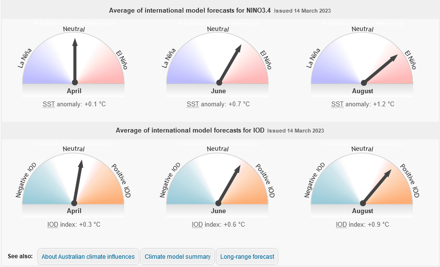
Average of international model forecasts for ENSO and IOD. Source: BOM
THE La Niña event in the tropical Pacific Ocean which brought above-average rainfall and flooding to eastern Australia has ended, according to the fortnightly Climate Driver Update released on Tuesday by the Bureau of Meteorology.
The El Niño-Southern Oscillation (ENSO) is now neutral (neither La Niña nor El Niño) with oceanic and atmospheric indicators having returned to neutral ENSO levels.
International climate models suggest neutral ENSO conditions are likely to persist through the southern autumn.
Some signs exist that an El Niño could form later in the year, and the bureau has therefore issued its first El Niño Watch since June 2019 because there is around a 50 percent chance of an El Niño developing in 2023.
The Madden-Julian Oscillation (MJO) is currently very strong over the Pacific Ocean but is forecast to move into the Atlantic Ocean in the coming fortnight; this may bring drier conditions to Australia for the latter half of March.
The Southern Annular Mode (SAM) index is currently strongly negative but is expected to return to neutral values over the coming week.
Warmer-than-average sea-surface temperatures persist around south-eastern Australia, New Zealand and the west coast of Australia, but close to average temperatures prevail around northern Australia.
The Indian Ocean Dipole (IOD) is neutral; it typically has little influence on Australian climate while the monsoon trough is in the southern hemisphere, typically from December to April.
Forecasts for the IOD made at this time of the year have low accuracy beyond April.
Long-term changes
Australia’s climate warmed by around 1.47 degrees Celsius between 1910 and 2021.
There has also been a trend towards a greater proportion of rainfall from high-intensity rainfall events of short duration, especially across northern Australia.
In southern Australia, a reduction of 10-20pc in rainfall during the cooler months of April to October has been seen in recent decades.
Source: Bureau of Meteorology

HAVE YOUR SAY