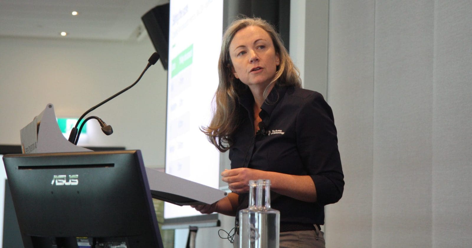
Bureau of Meterology meteorologist Claire Yeo presenting at the GRDC Update in Perth on Monday.
GROWERS in Western Australia are anxiously watching for signs that the coming cropping season will be kinder than the one just gone.
It brought a below-average season for many growers who, come Friday, will be scanning weather sites from Australia and beyond once the more-reliable autumn forecasting season officially clicks in.
In her address at the 2024 Grains Research Update in Perth on Monday entitled Getting the most out of computer models in your pocket, Bureau of Meteorology senior meteorologist Claire Yeo did not discredit the validity of weather platforms including Elders, YR, OzForecast, and WillyWeather as used by Australian growers.
Ms Yeo did, however, encourage those in the grains industry to look at BoM regularly to get a handle on what’s coming for grain-growing areas through expert interpretation that factors in our three climate drivers: the El Niño-Southern Oscillation, the Indian Ocean Dipole, and the Southern Annular Mode.
On a personalised level, BoM also encourages the use of My Climate View, where menus allow growers to select location and crop to generate historic and predicted data in relation to factors including maximum and minimum temperatures and rainfall.
“I don’t care what apps you use…but maybe we can work with you,” Ms Yeo said.
Looking dry on early call
Ms Yeo said BoM does its own modelling, and incorporates information from other agencies from around the globe to generate outlooks.
She said models looking further than 30 days ahead provided indications rather than forecasts.
“We simulate the atmosphere with computer models…to then be able to produce a forecast.
“The atmosphere is driven by physics; the model is simulating those physics.”
“The longer you push a model out, the less accurate it is.”
WA Department of Primary Industries and Regional Development scientist Dr Meredith Guthrie, who presented at the GRDC Update in Perth on climate drivers, will be discussing what’s in store weather-wise for WA growers in the autumn planting window at the GRDC Update at Mukinbudin on March 19.
Ahead of BoM’s prediction for WA’s planting season, Giru grower Rod Birch of Catalina Farms gave the bureau a tip from the floor: “You’re always in front if you under-promise and over-deliver.”

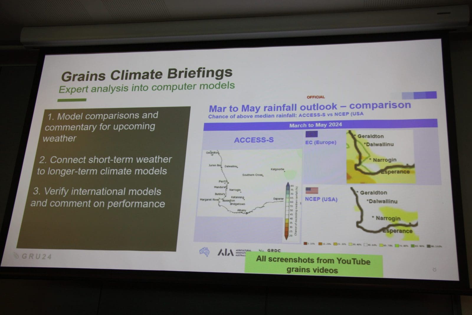
Claire Yeo’s presentation included this depiction of the ACCESS-S Australian model, the European Centre for Medium-Range Weather Forecasts, and the US Global Forecast System in relation to March-May rainfall probability.
Ms Yeo said three of the four models in focus, including BoM’s own ACCESS-S model, were pointing to a dryish autumn for WA’s grain-growing regions.
“The ACCESS-S model is the drier of the models at the moment (and) the European model is about in between.”
The current BoM model is a blend of the European, US and Australian models.
“The international models are leaning towards drier outcomes (and) the ACCESS models are leaning towards much drier outcomes.
“The US model is the outlier; it’s going for a wetter outcome in some parts of the state, noting that it’s not verifying particularly well for WA; perhaps when you’re doing your analysis, take that into consideration.
“The US model has not been the best model for WA but it has been a better prediction for the eastern states.”
Ms Yeo said there was no right or wrong in probability outlooks, but BoM was attempting to give its audience more confidence in its predictions.
She said the impact of Tropical Cyclone Lincoln, which formed earlier this month, was a case in point.

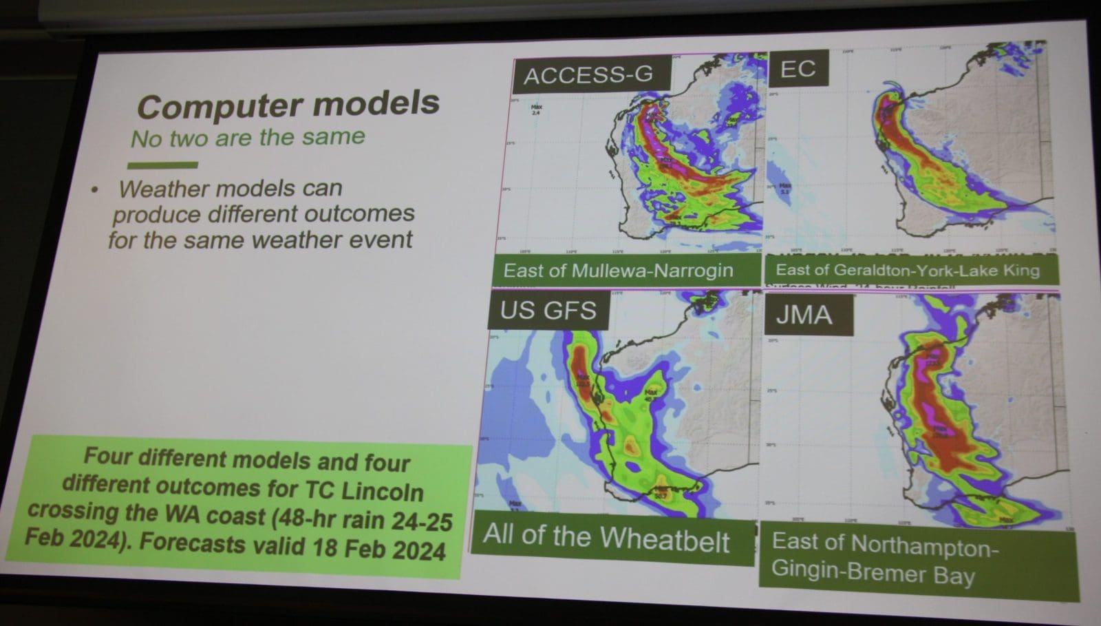
Models predicting outcomes for Tropical Cyclone Lincoln’s crossing of the coast from the Australian Bureau of Meteorology, the European Centre for Medium-Range Weather Forecasts, the US Global Forecast System, and the Japan Meteorological Agency show how much models can vary.
While two models forecast it would redevelop after being downgraded, and bring significant rainfall with it, the maximum rainfall it brought was 80mm to the coastal settlement of Carnarvon.
“The difference between models has to do with resolution.”
“Bureau information is a blend of all of that data; where it falls down is extremes.”
In a session at the Perth GRDC Update on sustainability, BoM customer engagement lead Stephanie Dickson ran through the My Climate View app, which factors in the possible impact of ENSO, IOD and SAM, and offers a choice of medium and high-emissions scenarios.
“Most climatologists would agree we’re tracking somewhere between these two,” Ms Dickson said.
My Climate View uses gridded climate data gained via interpolation, which Ms Dickson said addresses inconsistencies in historic weather data, for example from weather stations that have recorded rainfall only.
“We don’t have stations everywhere, we have inconsistent record lengths…and we have some missing data.”
Expert interpretation paramount
One extreme event that was picked up by the BoM last year was a major rain event for South Australia’s Eyre and Yorke peninsulas in December.
It prompted BoM to issue a weather alert to SA growers so they could accelerate harvest ahead of the system.
“We let them know we were expecting more than 100mm in five days’ time…and people harvested pretty quickly,” Ms Yeo said.
“I would like it if we could do more of these weather alerts.”
On a regular basis, BoM meteorologist Jonathan How presents a Grains Climate Outlook video update every two to three weeks for three regions: Queensland and New South Wales; Victoria, Tasmania and South Australia, and WA.
Ms Yeo said these help to put the impact of climate drivers into perspective by allowing BoM expertise to interpret data and climate drivers.
“This season’s been particularly unusual, having positive SAM during El Niño, and…that’s related to less see ice.”
“In the past 20 years, we are seeing a mean increase in temperature…and we’re really starting to see the outcomes in our day-to-day weather and also in our climate drivers.”
Grain Central: Get our free news straight to your inbox – Click here

HAVE YOUR SAY