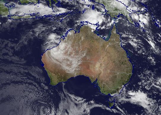
The cloud/surface composite image showing tropical lows off the Northern Territory and Western Australian coasts at 1130 AEST 8 January 2020. Source: Bureau of Meteorology
Extreme weather conditions and unprecedented bushfires across many parts of the Australian continent have been dominating the news cycle over the past few weeks. The extent of the catastrophe and the tragic loss of human life has touched all Australians, and many across the globe.
While all this has been happening the weather phenomenon that underpinned Australia’s warmest and driest year since records began has finally broken down, returning to a neutral state in late December after sitting in positive territory since July last year.
The Indian Ocean Dipole (IOD) is one of the key drivers of Australia’s climate. The IOD measures the difference between sea surface temperatures in the tropical parts of the western and eastern Indian Ocean.
It has three phases; positive, neutral and negative. The different phases impact rainfall and temperature patterns over the Australian continent by influencing the trajectory of weather systems to the south of the country.
Under a negative IOD phase the sea surface temperatures in the eastern Indian Ocean (off the northwest coast of Australia) are warmer than average, while in the western Indian Ocean the sea surface temperatures are cooler than average.
This usually results in above-average winter and spring rainfall over many parts of southern Australia as the warmer waters off the northwest coast deliver more available moisture to weather systems crossing the country. This is the most favourable phase for agricultural production in Australia, particularly in the southern two thirds of the continent.
A positive phase means that the sea surface temperatures in the eastern Indian Ocean are cooler than average with the opposite occurring in the western Indian Ocean. The result is an increase in the intensity of easterly winds across the equatorial Indian Ocean region pushing the warmer waters towards Africa.
This generally means there is less moisture than normal in the atmosphere to the northwest of Australia, frequently resulting in less rainfall and higher than normal temperatures over Australia during winter and spring. The impact of a strongly positive IOD on agricultural production can be dramatic, as we have seen over the past six months. A positive IOD is also often associated with a more severe bushfire season in the southeast of the continent.
The latest positive IOD phase peaked in mid-October with a weekly index value of +2.2 °C, one of the highest readings since IOD records began. Since then the temperature gradient across the Indian Ocean has continued to ease. The latest value (for the week ending 5 January) is +0.17 °C, well below the +0.4 °C threshold for a positive IOD phase.
IOD events, whether positive or negative, generally end in late spring or early December, meaning the decline of the positive event in 2019 was much later than normal. This is tied to the delayed migration of the monsoon trough into the southern hemisphere and the accompanying changes to wind patterns over the tropical reaches of the Indian Ocean.
It is the monsoon’s interaction with the IOD that normally brings about the end of an IOD phase. The delay in the southern passage of the monsoon in late 2019 has meant the widespread drier and warmer than average conditions have continued well into the southern hemisphere summer.
The majority of global climate models are now predicting that IOD values will remain in the 0.0 °C to +0.4 °C range in the first half of 2020.
Meanwhile, most models of the El Niño–Southern Oscillation (ENSO), the primary climate driver in the Pacific Ocean, have it continuing in a neutral band until at least April of this year. The latest sea surface temperatures have cooled compared to the preceding two weeks, but they do remain warmer than average in the far western equatorial Pacific.
Under a neutral ENSO (neither El Niño nor La Niña) the trade winds blow as normal from east to west across the surface of the tropical Pacific Ocean. This brings warm moist air and warmer sea surface waters towards the western Pacific and keeps the central Pacific Ocean region relatively cool.
A neutral ENSO generally means that its influence on Australian and global weather patterns is much reduced compared to El Niño or La Niña phases.
With both the IOD and ENSO now in neutral territory we start 2020 with fewer impediments to more normal weather patterns. While this doesn’t portend the weather in Australia will change immediately, if the models are correct, it does take these two prevailing climate drivers out of calculations ahead of the next winter crop planting window.
This article was written by Grain Brokers Australia
HAVE YOUR SAY