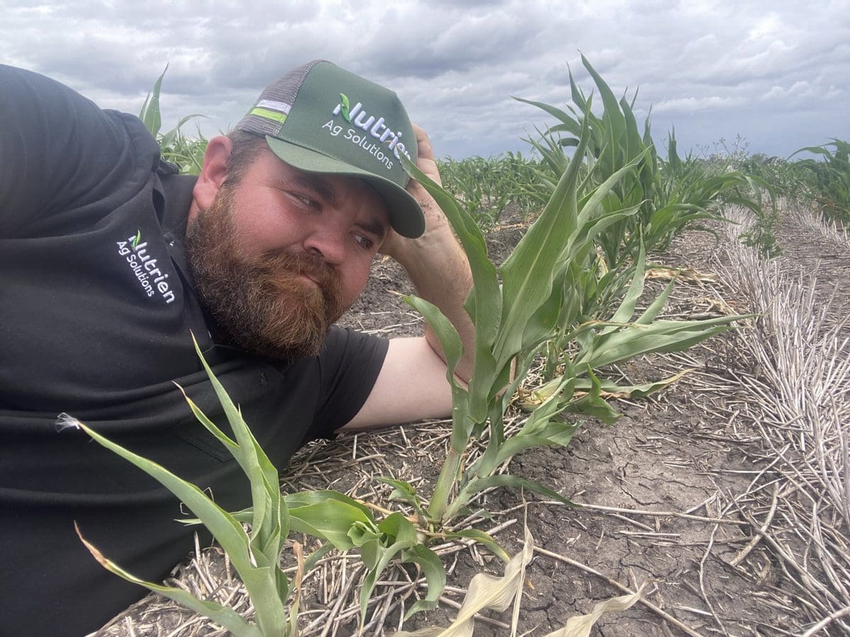
Nutrien Ag Solutions Dalby agronomist gives a sorghum crop “a motivational pep talk” as dry conditions take hold in much of the summer-cropping region. Photo: Angus Dalgliesh
IF FORECASTS hit their mark, eastern Australia is in for its first dry harvest in three years as the possibility builds for a return to La Niña conditions.
While many parts of tropical Australia have had a dousing in January, regions to its south could all of a sudden do with a drink.
That includes summer crops in southern Queensland and northern New South Wales, where growers are crossing their fingers for rain, in contrast to hopes for it to stop during last year’s closing months.
Conditions are looking and feeling drier over much of the grainbelt, particularly after some scorching temperatures since Christmas, and Delta Ag Moree agronomist Rob Long said lack of rain has crept back into conversations in recent weeks.
“We’re waiting for rain to top up those soil-moisture profiles,” Mr Long said.
“There are good moisture levels from 15-20cm down, but the top has dried out with a reasonably dry December and January.”
“There are a lot of dry summer crops with their tongues out waiting for 50-60mm of rain.”
In his Twitter caption posted with the photo above, Nutrian Ag Solutions Dalby agronomist Angus Dalgliesh summed it up: “Oh how things can change in a couple of months”.
Rain likely ahead of winter plant
Sowing of Australia’s winter crop is expected to start in earnest in April, and growers are hoping the tap does not turn off prematurely.
World Weather Inc. principal and senior agricultural meteorologist Drew Lerner said for Australia’s winter-cropping area, the implications should be favourable for autumn planting of wheat, barley and canola.
“The Indian Ocean Dipole is neutral and the Southern Hemisphere general weather pattern seems poised for a relatively normal finish to the summer and start of autumn,” Mr Lerner said.
However, drier months are tipped to follow.
“La Niña is certainly on its way out,” Mr Lerner said.
“The influence from this phenomenon will be greatly diminished over the next few weeks.”
Mr Lerner said potential existed for the positive phase of Indian Ocean Dipole later this winter.
“If that prevails into early spring, there may be some drier biases beginning to evolve over the south-east part of the nation, but that should occur after winter crops are planted and mostly well established.”
“Dryness in Queensland right now should be partially eased in the dryland production areas of the west, but that area may continue a little drier biased for a while.”
Mr Lerner said eastern Queensland and most summer-cropping areas in NSW should see relatively favourable weather in February.
BOM yet to call El Niño
According to the January 31 Bureau of Meteorology ENSO Forecast, La Niña is weakening, but the agency to predict the next El Niño.
“While ocean temperatures have eased from La Niña thresholds, the atmosphere has yet to respond, and remains indicative of La Niña,” the BOM statement said.
“All climate models anticipate sea-surface temperatures in the tropical Pacific…are likely to be consistent with neutral ENSO during February 2023.”
La Niña typically increases the chance of above-average summer rainfall in northern and eastern Australia.
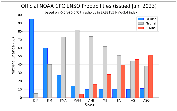
Graph 1: The Climate Prediction Centre’s January 30 update shows a 50pc probability of La Nina redeveloping by the Australian spring. Source: NOAA
In an article published on The Conversation website on January 27, University of Leeds PhD candidate in climate science Paloma Trascasa-Castro said the El Niño Southern Oscillation (ENSO) occurs every two to seven years.
Caused by the equatorial Pacific Ocean being either 3 degrees Celsius warmer for an El Niño, or cooler than usual for La Nina, Ms Trascasa-Castro said the cycle incorporates some months of neutral conditions in between events.
“It is not surprising for La Niña conditions to last two consecutive years, but a three-year La Niña, which the world has had since 2020, is more rare,” her article states.
“The US National Oceanic and Atmospheric Administration (NOAA) has reported that the equatorial Pacific Ocean will return to its neutral state between March and May of 2023, and it is likely that El Niño conditions will develop during the Northern Hemisphere’s autumn and winter.”
Grain Central: Get our free news straight to your inbox – Click here
HAVE YOUR SAY