La Niña slowly weakening into winter but above-average rainfall expected for eastern Australia
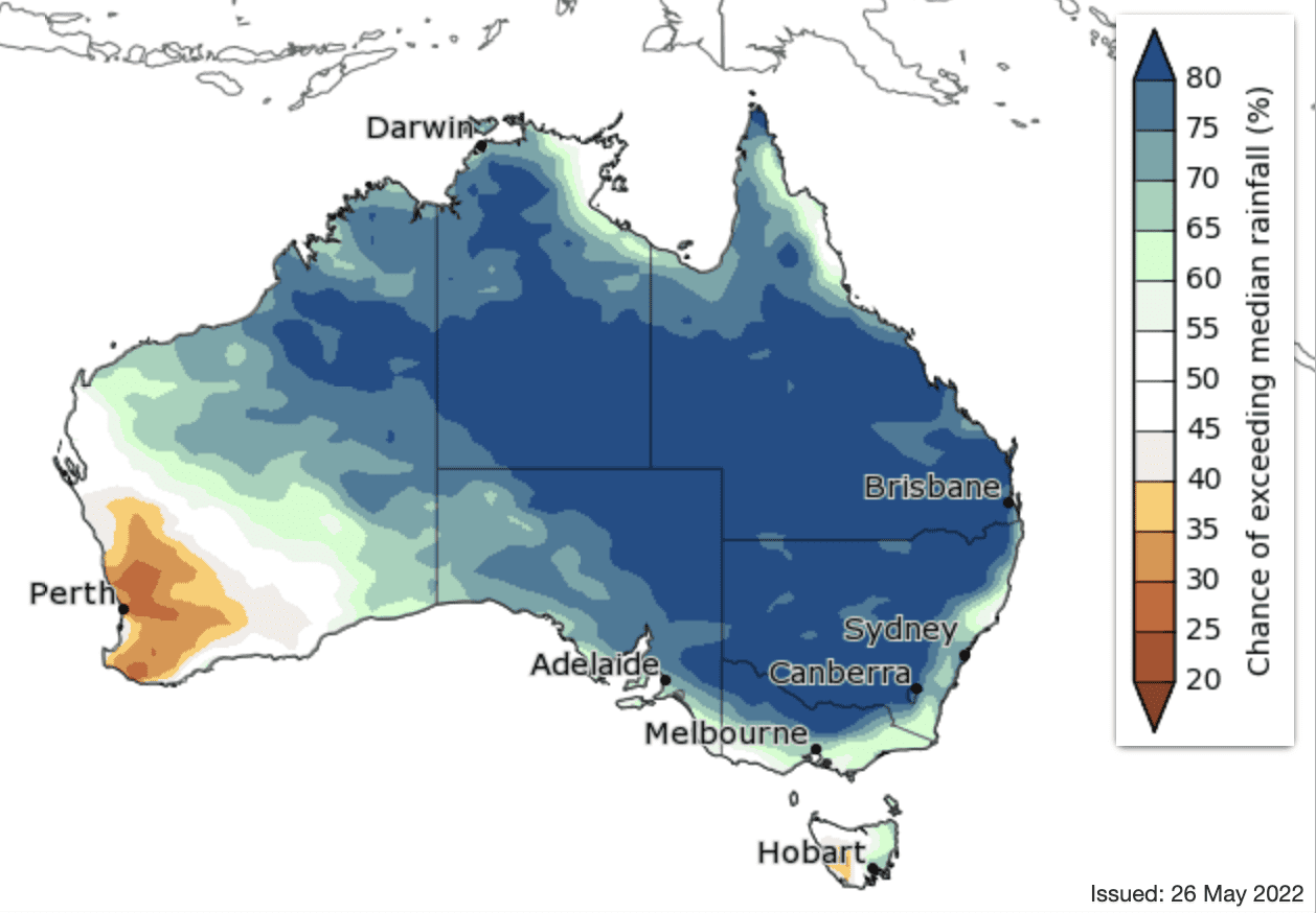
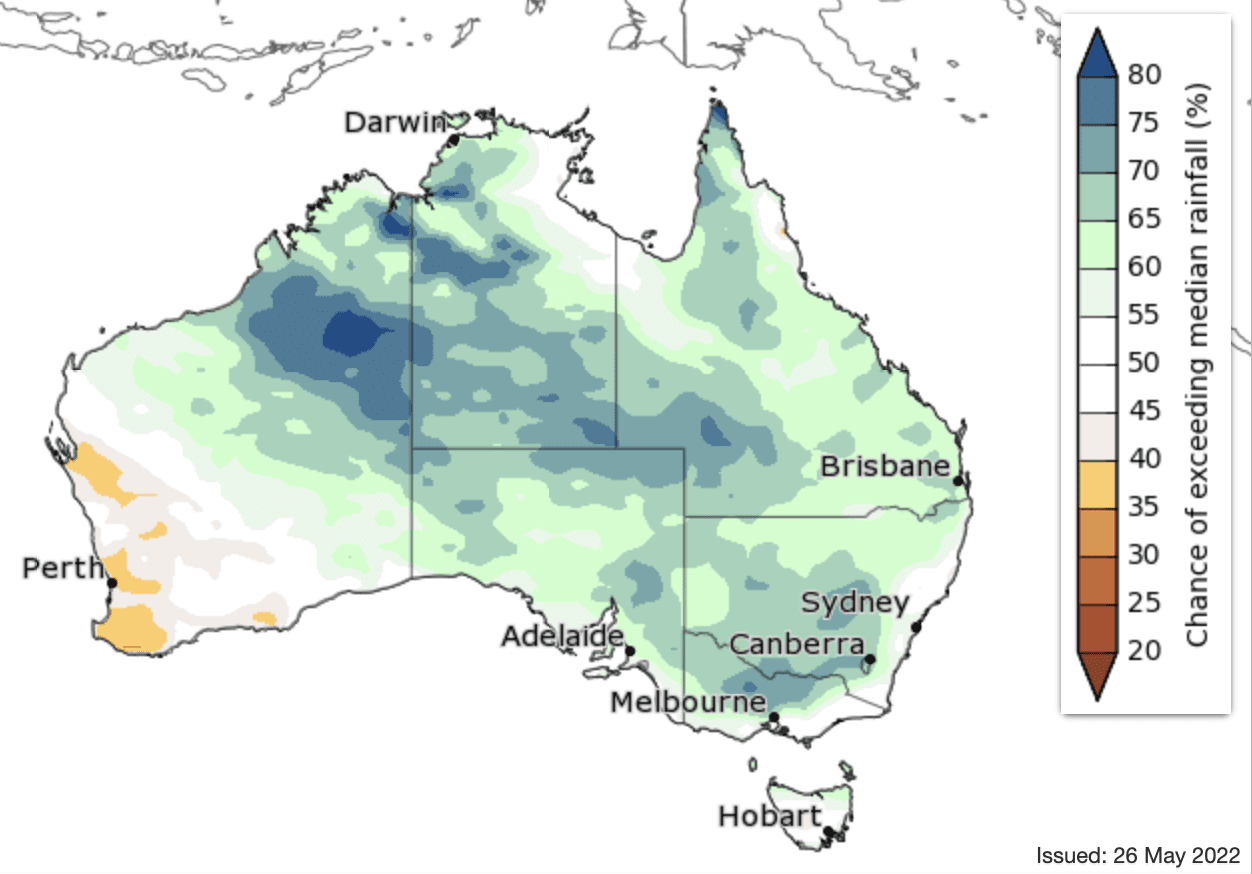
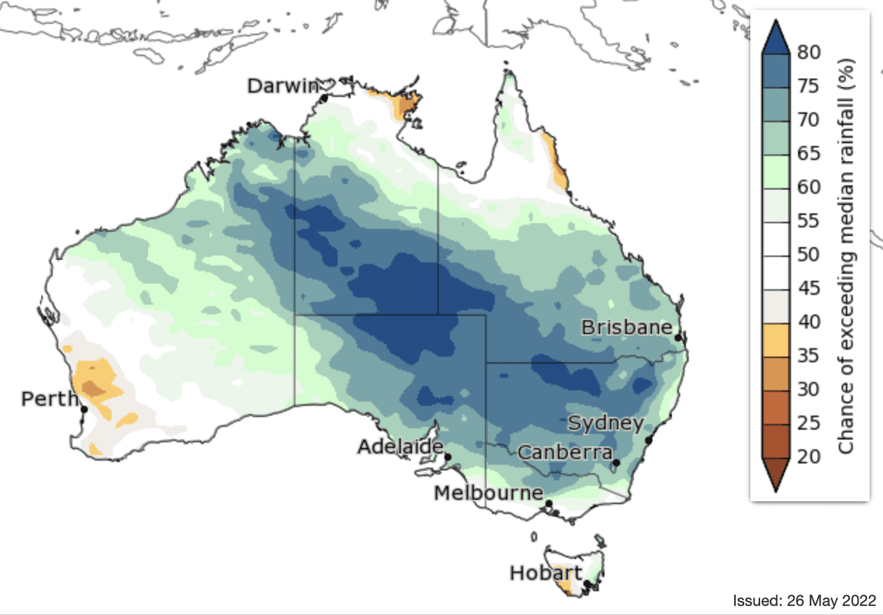
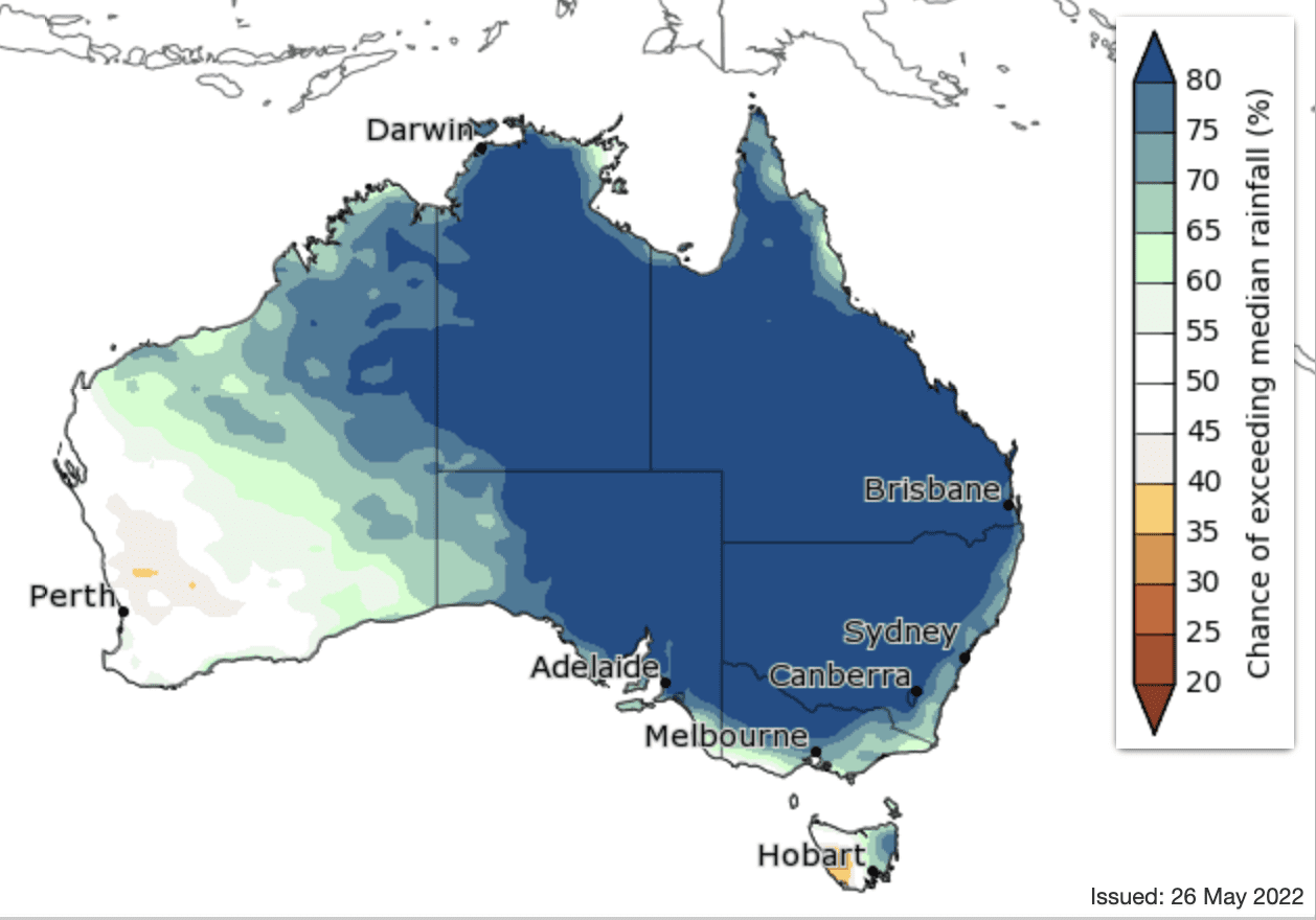
The Bureau of Meteorology’s Winter 2022 Climate Outlook shows a slowly weakening La Niña is one climate factor influencing above-average winter rainfall for most of central and eastern Australia in coming months.
Parts of south-western Australia and south-western Tasmania are likely to have below-average rainfall this winter.
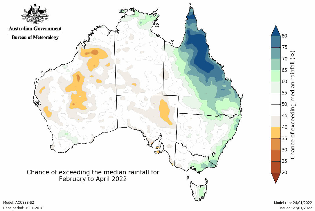
The Outlook predicts the unusually wet conditions for inland parts of New South Wales, South Australia, Queensland and the Northern Territory are likely to be in the top 20 per cent of wettest winters. With northern Australia’s dry season starting in May, it only takes a small amount of extra rain to be above average at this time of year.
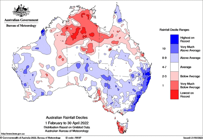
With already saturated catchments in south-eastern Australia, the winter rain extends the flood risk for these regions.
The flood waters in low lying areas in Queensland and NSW will slowly move inland towards South Australia over coming months.
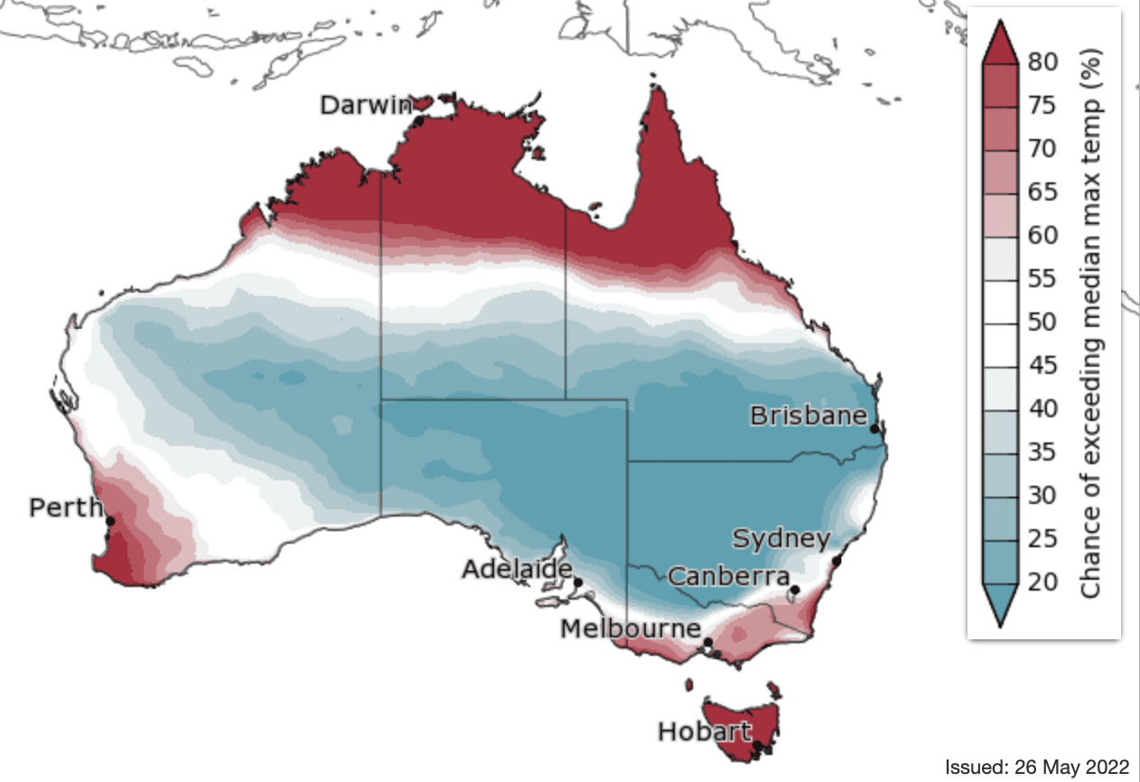
There is an above 80pc chance of unusually high winter temperatures in coastal, south-western and northern parts of WA, coastal northern areas of the NT and Queensland, south-eastern NSW, southern and eastern Victoria, and all of Tasmania.
A large section of central Australia has an increased chance of unusually low winter daytime temperatures, in the coolest 20pc of past winters. This extends from WA’s eastern area through central Australia into the eastern states.
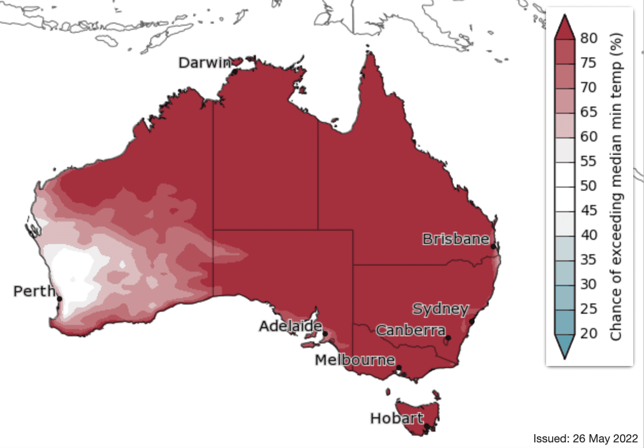
Warmer-than-average nights are likely almost everywhere, with at least an 80pc chance of higher minimum temperatures for most of Australia.
The winter outlooks reflect several climate influences, including a developing negative Indian Ocean Dipole, a slowly declining La Niña in the Pacific Ocean, and warmer-than-average waters around northern Australia.

HAVE YOUR SAY