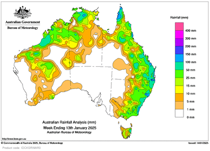
COLD fronts and associated troughs during the week brought widespread showers and scattered storms, some severe, to the New South Wales and Queensland coasts, eastern Victoria, Tasmania, and southern parts of Western Australia.
Persistent low-pressure troughs through the interior, eastern states and WA triggered storms and scattered rainfall in these regions.
Weekly rainfall totals greater than 25mm were recorded across northern and western parts of the Northern Territory, northern and eastern Qld, eastern NSW, Vic, north-eastern Tas, and northern and isolated pockets of southern WA.
Weekly rainfall totals of 50-100mm were recorded across isolated areas of northern WA, northern and central parts of the NT, northern and eastern regions of Qld, eastern NSW and in north-eastern Vic and Tas.
Weekly rainfall totals greater than 100mm were recorded in isolated parts of Qld’s north and south-east, along the NSW coast, north-eastern Tas, and in northern WA and NT.
The highest weekly total at a bureau gauge was 317mm at Careys Peak, Barrington Tops, in NSW.
The highest daily total at a bureau gauge was 195mm at Tully Sugar Mill in Qld in the 24 hours to 9am on January 7.
HAVE YOUR SAY