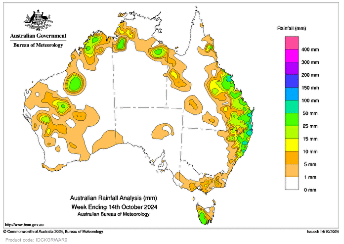
WIDESPREAD thunderstorms, some severe, impacted parts of south-eastern Queensland and north-eastern New South Wales on October 8 and 9, resulting in heavy falls, flash flooding, high hail accumulations, and reports of locally giant hail of more than 5cm.
Thunderstorms and showers impacted parts of the Kimberley, Pilbara, Gascoyne and Interior in Western Australia on October 9 and 10, and parts of Qld and the Northern Territory on October 12 and 13.
During the week, there were showers across the North Tropical Coast and Tablelands district of Qld, due to onshore airflow, while several cold fronts moved across Tasmania with light to moderate daily rainfall.
Weekly rainfall totals greater than 15mm and smaller areas with totals of 25-50mm were recorded in parts of the west and north of WA, in the north of the NT, eastern Qld, north-eastern NSW, and western and southern Tas.
Weekly totals greater than 50mm were recorded in isolated areas along the Qld and north-eastern NSW coast.
The highest weekly total at a Bureau gauge was 202mm at Bray Park, Murwillumbah in NSW, including the highest daily rainfall total of 183mm in the 24 hours to 9am on October 10.


HAVE YOUR SAY