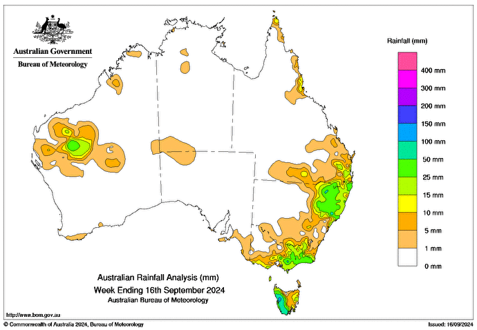
SEVERAL cold fronts moved through south-eastern Australia during the week, bringing showers, isolated thunderstorms, below-average temperatures and snow on elevated areas of Tasmania, Victoria and New South Wales.
A deep trough moved up the east coast of NSW and south-eastern Queensland between September 11 and 12, bringing enhanced shower and storm activity.
A trough over the Gascoyne district in Western Australia brought rainfall and isolated thunderstorms between September 10 and 12.
Weekly rainfall totals of 25-50mm were recorded across most of western Tas, eastern Vic and north-eastern NSW, and parts of the inland Gascoyne district in WA.
Weekly rainfall totals of 50-100mm were recorded in western Tas, with falls of 100-150mm across small areas near Queenstown.
The highest weekly total at a Bureau gauge was 181mm at Mount Read in Tas in the seven days to September 16.
The highest daily rainfall total at a Bureau gauge was 75mm at Barrington Tops in NSW, in the 24 hours to 9am on September 13.


HAVE YOUR SAY