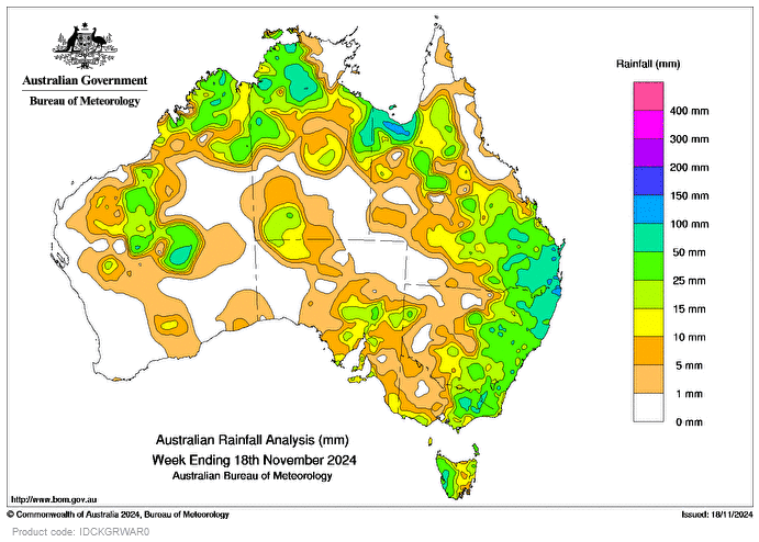
DURING the week, a series of low-pressure troughs generated several days of widespread thunderstorms and locally heavy showers in the north and east of Australia.
Several days of severe thunderstorms in south-eastern Queensland and north-eastern New South Wales brought widespread rainfall, and strong to damaging wind gusts and hail, with reports of flash flooding.
A strong cold front and associated low pressure trough moved across south-east Australia, bringing widespread rainfall to Tasmania, Victoria and NSW.
Weekly rainfall totals of 25-50mm were recorded across western Tas, a broad area extending from north-eastern Vic to central Qld, the western Top End of the Northern Territory, and the north-west of Western Australia.
Weekly rainfall totals of 50-100mm were recorded in areas of western Tas, north-eastern Vic, large parts of north-eastern NSW and south-eastern Qld, the Gulf Country in north-western Qld, and northern and eastern parts of the NT, with totals greater than 100mm in some areas.
The highest weekly total at a bureau gauge was 185mm at Capabala Water Treatment Plant, Qld.
The highest daily rainfall total at a Bureau gauge was 131mm Ripple Downs Alert, Qld, in the 24 hours to 9am on November 16.


HAVE YOUR SAY