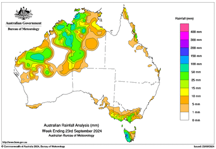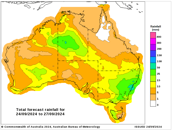
AN UPPER-LEVEL trough, combined with tropical moisture, triggered several days of widespread rainfall and isolated thunderstorms across the north of Western Australia and western parts of the Northern Territory.
A series of cold fronts crossed Australia’s south-east during the week, bringing widespread rainfall, isolated thunderstorms, below-average temperatures and snow on elevated areas.
Weekly rainfall totals of 25-50mm were recorded across WA’s north, western parts of the NT, Queensland’s North Tropical Coast and Tablelands district, southern parts of Victoria, including the ranges, and western and central Tasmania.
Weekly rainfall totals of 50-100mm were recorded in parts of the Pilbara and Kimberley districts of WA, isolated areas of the NT’s western Top End, including around Darwin, and western Tas.
Weekly rainfall totals greater than 100mm were recorded in an isolated pocket of WA’s Kimberley district and an area of western Tas.
The highest weekly total at a Bureau gauge was 185mm at Mount Read in Tas and the highest daily rainfall total at a Bureau gauge was 86mm at Nicholls in WA, in the 24 hours to 9am on September 23.


HAVE YOUR SAY