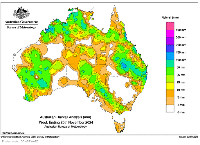
RAIN and thunderstorms impacted large parts of Western Australia, driven by a deepening low-pressure trough and low-pressure system along the west coast.
Severe thunderstorms triggered by low pressure troughs developed on multiple days in parts of Queensland and north-eastern New South Wales.
Late in the week, a slow-moving low-pressure trough that extended from the interior into south-eastern parts of the country bringing moist tropical air, widespread rainfall and isolated thunderstorms.
Weekly rainfall totals of 15-50mm were recorded in large parts of WA, the Northern Territory, northern and eastern Qld, northern and eastern South Australia, and areas of south-western NSW and Victoria.
Weekly rainfall totals of 50-100mm were recorded in parts of north-western and south-western WA, the north-western NT, south-eastern Qld and areas along the coast, and north-eastern and south-western NSW, with totals above 100mm in some areas.
The highest weekly total at a Bureau gauge was 252mm at Tweed Heads Golf Club, NSW.
The highest daily rainfall total at a Bureau gauge was 155mm at Coolangatta, Qld in the 24 hours to 9am on November 22.


HAVE YOUR SAY