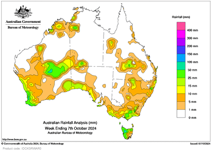
A STRONG cold front and a low-pressure trough moved across southern Australia between October 2 and 4, bringing rain, thunderstorms and showers.
Several cold fronts crossed south-eastern Australia during the week bringing more showers to south-eastern South Australia, Victoria and Tasmania, while a low-pressure trough resulted in light to moderate rainfall in New South Wales.
Thunderstorms impacted parts of northern Australia on October 5, delivering light to moderate rainfall to the northern Kimberley in Western Australia, adjacent areas in the north-west of the Northern Territory, and parts of Queensland’s Gulf Country.
Weekly rainfall totals of 25-50mm were recorded across most of western and northern Tas, parts of eastern Vic, the South West Land Division and Southern Interior districts in WA, and small areas in the west of the NT, central Qld and north-east NSW.
Weekly rainfall totals of 50-100mm were recorded in areas of north-western Tas and locally in south-west WA.
The highest weekly total at a bureau gauge was 117mm at Mount Read in Tas, where the highest daily rainfall total in the week, 53mm, was also recorded in the 24 hours to 9am on October 7.


HAVE YOUR SAY