THE subtropical ridge has remained further south than usual at this time of year, producing clear skies and settled dry weather with warm days and cold nights across Australia’s south-east.
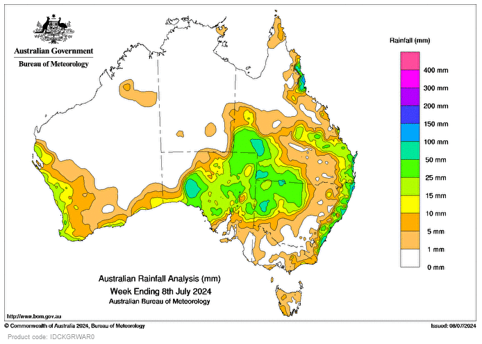
Persistent easterly and south-easterly onshore winds caused by a strengthening of the subtropical ridge brought showers to the east coast, setting several July daily rainfall records for coastal Queensland and New South Wales.
On July 7 and 8, an inland trough passed through South Australia, south-western Qld, and western NSW, bringing rainfall and thunderstorms to those regions and resulting in a number of daily rainfall records for July.
A cold front swept through south-west Western Australia and brought 10-25mm of rainfall to coastal regions.
Weekly totals of 25-50mm were recorded in many areas of the eastern half of SA, south-western Qld, western NSW, and much of the east coast.
Weekly totals of 50-100 mm were recorded in areas of inland Qld and NSW, with small pockets of more than 100mm in north-eastern coastal Qld.
Tully Sugar Mill in North Qld had the highest daily rainfall total at a bureau rain gauge of 132mm in the 24 hours to 9 am on July 6, and also the highest weekly total of 180mm.
HAVE YOUR SAY