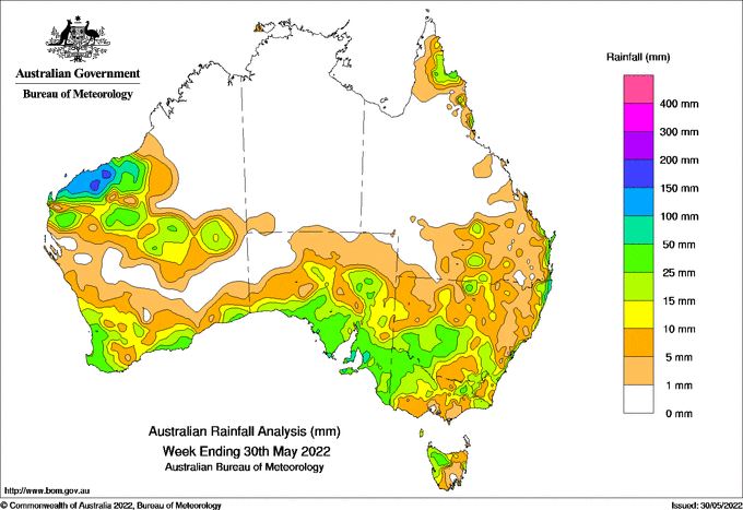
A VIGOROUS cold front crossed south-west Western Australia early on May 24 and continued along the southern coast; the mass of cold and unstable air that followed it has delivered widespread showers and storms.
Storms brought widespread moderate to locally heavy falls to parts of eastern Queensland and New South Wales in the first few days of the week, while light-to-moderate scattered showers followed later in the week.
There was another pulse of showers and storms for the Pilbara and Gascoyne districts of Western Australia; from a cloudband stretching from the Pilbara towards the centre of the continent, some sites in the Pilbara recorded daily rainfall totals of more than 100 millimetres.
A low-pressure trough and a series of fronts affected the south-east of Australia from May 26, with a strongt front on May 29 bringing widespread rainfall to south-eastern South Australia, western NSW and western Victoria.
Weekly rainfall totals in excess of 50mm were recorded in parts of the Pilbara coast and adjacent inland areas, and in parts of south-east South Australia, mostly around Greater Adelaide.
The highest weekly rainfall total was 199.4 mm at Varanus Island, WA.
HAVE YOUR SAY