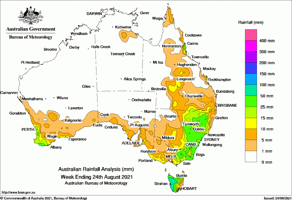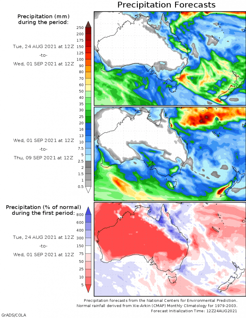
THE most significant rain in the past week fell in the south east of the continent and the far south west of Western Australia.
Widespread moderate falls were recorded in the eastern half of New South Wales, eastern Victoria and Tasmania.
There were light falls throughout Queensland, western NSW, South Australia and the WA grainbelt.
Past seven days: For the week to 24 August 2021, rainfall was recorded in the eastern half of New South Wales extended to the north-western Riverina District; southern and eastern Victoria; much of Tasmania, and small coastal areas in South Australia. Rainfall was also recorded in parts of the South West Land Division in Western Australia; and parts of southern, central and the North Tropical Coast in Queensland.
At the start of the week, a trough moved across southern Western Australia, and a weak cold front approached the state’s south-west. Light rainfall was recorded in the south, and moderate rainfall was confirmed in the far south-west.
Light rainfall was also recorded in western Tasmania and southern Victoria from westerly flow.
During the middle of the week, an embedded cold front and troughs in a westerly flow moved across Tasmania, and produced moderate rainfall in the north and west Tasmania, while a cloudland extended across South Australia and the south-east Australia with light falls recorded in southern South Australia and New South Wales, and in pockets of Victoria.
A weak cold front brushed the south-west of Western Australia, and produced light rainfall along the west and south coasts.
Moist onshore flow brought showers in the North Tropical Coast in Queensland.
In the last part of the week, the cold front strengthened and tracked from the Great Australian Bight through southern South Australia, then south-eastern and eastern Australia to southern Queensland. A low pressure system developed near the central coast of New South Wales as the strong cold front moved offshore.
Thunderstorms,damaging winds and widespread moderate falls were recorded in eastern New South Wales. Heavy daily falls of 50 mm to 60 mm were recorded in the central and south coasts and the adjacent inland districts. Moderate flooding was reached at the Belubula River
Widespread moderate rainfall was also recorded in eastern Victoria and the western half of Tasmania, while the south-west of New South Wales, southern and central parts of Queensland, south and west Victoria, and southern South Australia recorded light to moderate rainfall.
Snow fell in the Blue Mountains in New South Wales, the Alps in Victoria, and elevated locations as low as 500 m in Tasmania.
Rainfall totals of 50 mm to 100 mm were reported in western Tasmania, and the central and south coasts, and adjacent Tablelands in New South Wales. The highest weekly rainfall total was 123 mm at Mount Read in Tasmania. Isolated spots in Victoria ‘s Alps and the south-west of Western Australia also recorded weekly rainfall totals in excess of 50 mm.
Rainfall totals between 10 mm and 50 mm were recorded along the parts of the South West Land Division in Western Australia; coastal areas in South Australia; southern and eastern Victoria; the eastern half of New South Wales; much of Tasmania; and the North Tropical Coast, central and southern parts of Queensland.
Highest weekly totals list and map
New South Wales and Australian Capital Territory
65 mm Beaumont (The Cedars)
62 mm Guyra Hospital
56 mm Nundle (Malonga)
Victoria
59 mm Mount Baw Baw
45 mm Mount Hotham
35 mm Marlo
Queensland
47 mm Cowley Beach (Defence)
44 mm Tully Sugar Mill
33 mm Bingil Bay
Western Australia
57 mm Cowaramup
47 mm North Walpole
46 mm Windy Harbour
South Australia
19 mm Rodwell Creek (Highland Valley
18 mm Multiple locations
Tasmania
123 mm Mount Read
94 mm Lake Margaret Dam
85 mm Lake Margaret Power Station
Northern Territory
6 mm Nutwood Downs
3 mm Borroloola Airport
1.8 mm Wagait Beach

Source: Bureau of Meteorology

HAVE YOUR SAY