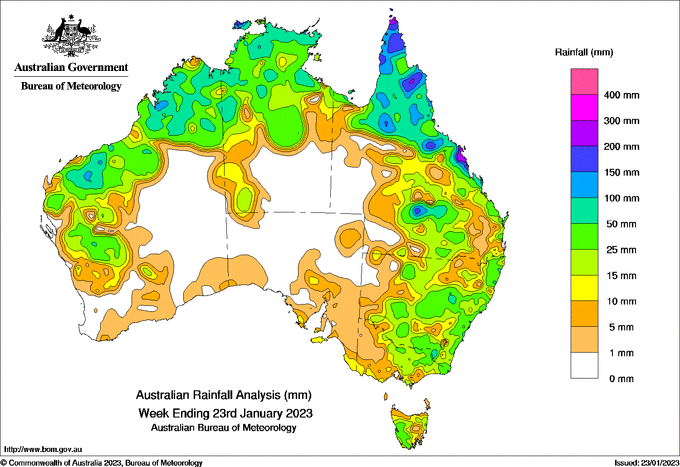
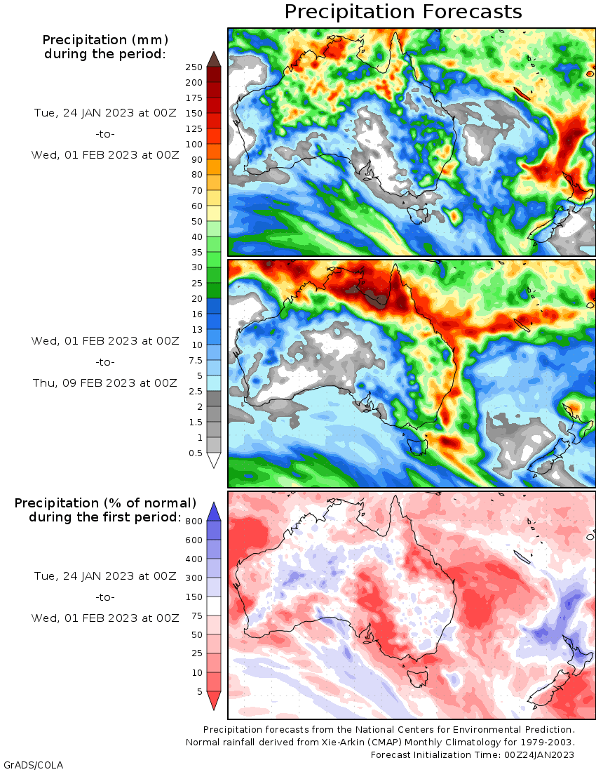
EARLY in the week, a slow-moving tropical low brought heavy rainfall along the north Queensland coast, with flash and riverine flooding in some areas.
The heaviest falls were on the Queensland Central Coast between Ayr and Mackay and adjacent inland districts, with weekly totals of 150-300mm, while weekly totals of 50-200mm were recorded over the Cape York Peninsula.
There were storms during the week over inland Queensland and New South Wales and parts of north-west Western Australia, with weekly rainfall totals of 25-100mm in some areas.
The monsoon trough was to the north of Darwin during the week, but brought heavy rain to the Tiwi Islands.
The highest weekly total at a Bureau gauge was 372 mm at Pirlangimpi Airport on the Tiwi Islands, including 290mm in the 12 hours to 4pm on January 20.
The highest daily total at a Bureau gauge was 240mm at Mount Charlton on Queensland’s Central Coast in the 24 hours to 9am on January 17.
Flood conditions are slowly easing in western NSW and along the River Murray in South Australia.
Major flood warnings remain for Georgina River and Eyre Creek in the eastern Northern Territory and adjacent parts of western Queensland.


HAVE YOUR SAY