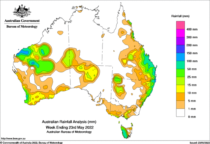
A STRONG cold front moved over the south-east Australia on May 17, bringing rainfall to western Tasmania.
A north-west cloudband stretched across the continent, from the Pilbara in Western Australia to the New South Wales Mid-North Coast, bringing rainfall and isolated showers to some areas.
More rainfall affected coastal and inland parts of Queensland and NSW on May 21-22; this was due to a surface trough off the central Queensland coast.
Major and moderate flood warnings for southern Queensland continue including Condamine, Balonne, Moonie and Thomson Rivers and Cooper Creek, as well as the Culgoa and Narran Rivers in New South Wales.
A vigorous cold front crossed south-western WA late on May 22, bringing heavy rainfall, hail and damaging winds.
Weekly rainfall totals of more than 50 millimetres were recorded in parts of the central and southern Queensland coast and adjacent inland areas, in the far north-east of NSW, in most of western Tasmania, and in parts of the Pilbara, Gascoyne and Southwest districts in WA.
The highest weekly rainfall total was 241mm at Queensland’s Rainbow Beach.
HAVE YOUR SAY