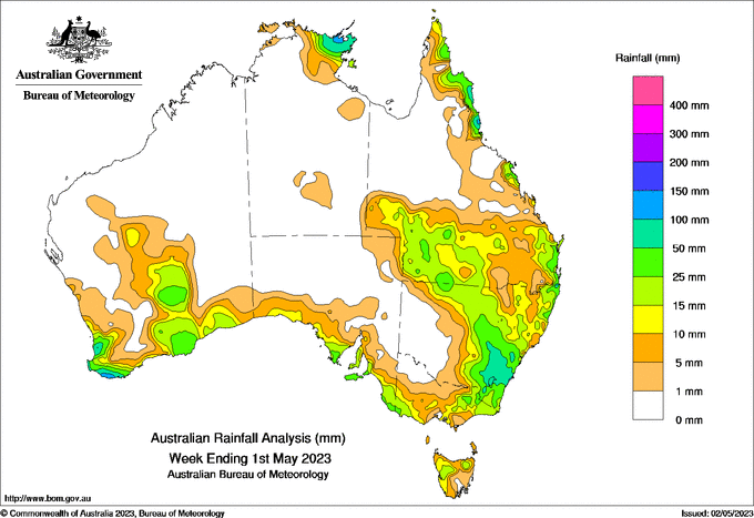
A LOW-PRESSURE system swept across south-west WA from April 25 and then through the Australian Bight, and reinforced cool, unstable, and showery weather with strong westerly winds and large waves across the southern coastline.
The front moved across South Australia and Victoria, delivering moderate amounts of rain on April 27.
A surface low-pressure system developed over coastal NSW and brought heavy falls in the Hunter, Illawarra and southern Tableland districts leading to the weekend.
Weekly totals greater than 50mm were recorded in south-east and coastal NSW, and pockets of Cape York Peninsula in Queensland, the Northern Territory’s Top End and south-west Western Australia.
The highest weekly total at a Bureau gauge was 214mm at Jervis Bay, NSW, which also had the highest daily total of 207mm to 9am on April 30.
HAVE YOUR SAY