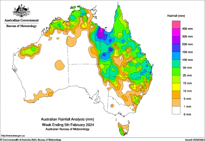
A COASTAL trough in south-eastern Queensland brought locally intense rainfall at the start of the week.
Ex-Tropical Cyclone Kirrily moved to north-western Qld and then southwards, bringing heavy rain and severe thunderstorms which caused damage to the roads in isolated communities.
Heavy falls also continued around Qld’s North Tropical Coast.
A number of sites in Qld and the Northern Territory recorded their highest January, February or annual daily rainfall records.
Weekly rainfall totals of 50-100mm were prevalent in Qld, the Top End of the NT, north-eastern New South Wales, northern Western Australia and western Tasmania.
Weekly rainfall totals of 100-200mm were recorded along the south-east and north-west Qld and NT border and the Carpentaria Coast, with pockets of 200-300mm along the ex-Tropical Cyclone Kirrily track.
The highest weekly total at a Bureau gauge was 611mm at Qld’s Westmoreland Station, which also recroded the highest daily total of 332mm at in the 24 hours to 9am on February 2.


HAVE YOUR SAY