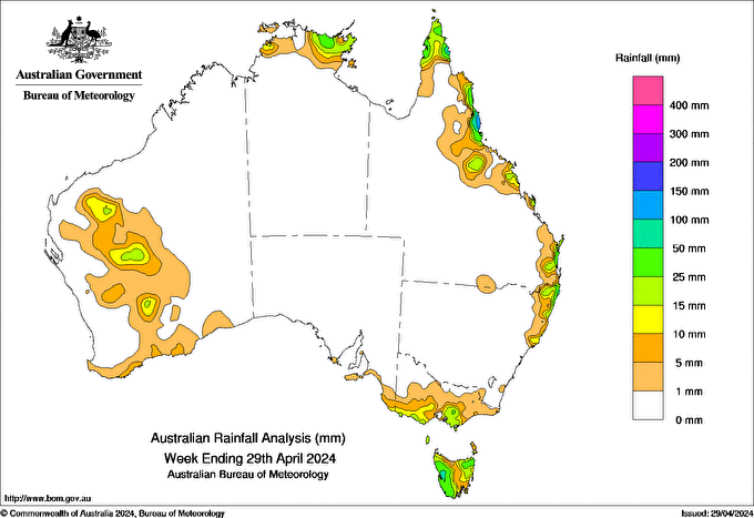
SETTLED weather dominated much of Australia during the week, as a high-pressure system extended a ridge across southern parts of the continent and gradually moved eastwards.
Rainfall was limited to the far-north, parts of the eastern and southern coasts, Tasmania, and patchy areas in the inland west of Western Australia.
A cold front passed over Tasmania on April 23-24 April and brought cool conditions, gusty winds and showers through most of the state.
A mid-level trough brought some showers and thunderstorms to WA’s south-west Gascoyne and Central West districts on April 25, and extended inland to south-east Gascoyne, Goldfields and Central Wheatbelt districts on 26 April.
Weekly totals greater than 100mm were recorded in north tropical Queensland.
Weekly totals of 50-100mm were recorded in coastal Qld, the Top End of the Northern Territory, north-eastern New South Wales and north-eastern and western Tas.
Areas in southern Victoria and WA received 5-25 mm of rainfall during the week.
The highest daily total, 107mm, was recorded at Bingil Bay, Qld, in the 24 hours to 9am on April 24, and the highest weekly total, 150mm, was recorded at Topaz Alert, Qld.
HAVE YOUR SAY