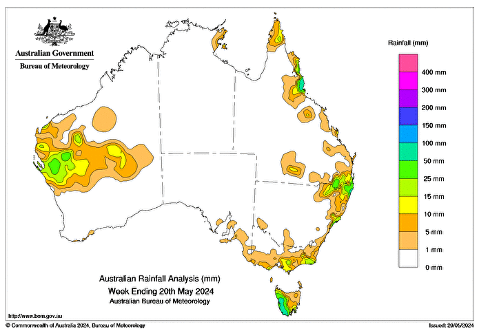
A LOW-PRESSURE trough lingered along the Western Australian coast May 14-16, bringing thunderstorms and showers to parts of WA’s Gascoyne, Central West and Southern Interior districts with daily totals of 5-15 mm and isolated areas with higher falls.
Several cold fronts affected Tasmania and much of Victoria during the week.
The strongest front, on May 17, brought showers and some snow to elevated areas.
Moist onshore airflow, directed by a strong high-pressure system, brought showers to the east Australian coast.
Weekly totals greater than 50mm were recorded in western Tas and parts of the North Tropical Coast and Tablelands district in Queensland.
Totals of 15-50mm were recorded in parts of WA’s northern Gascoyne district, western Tas, far eastern Victoria, and north-eastern New South Wales, extending into south-western Qld, and in pockets along the northern Qld coast.
The highest weekly total at a Bureau gauge was 150mm at Mount Read, Tas.
The highest daily rainfall during the week at a Bureau gauge was 59mm at Point Lookout, Qld, in the 24 hours to 9am on May 18.
Most of Australia recorded little to no rain during the week.
HAVE YOUR SAY