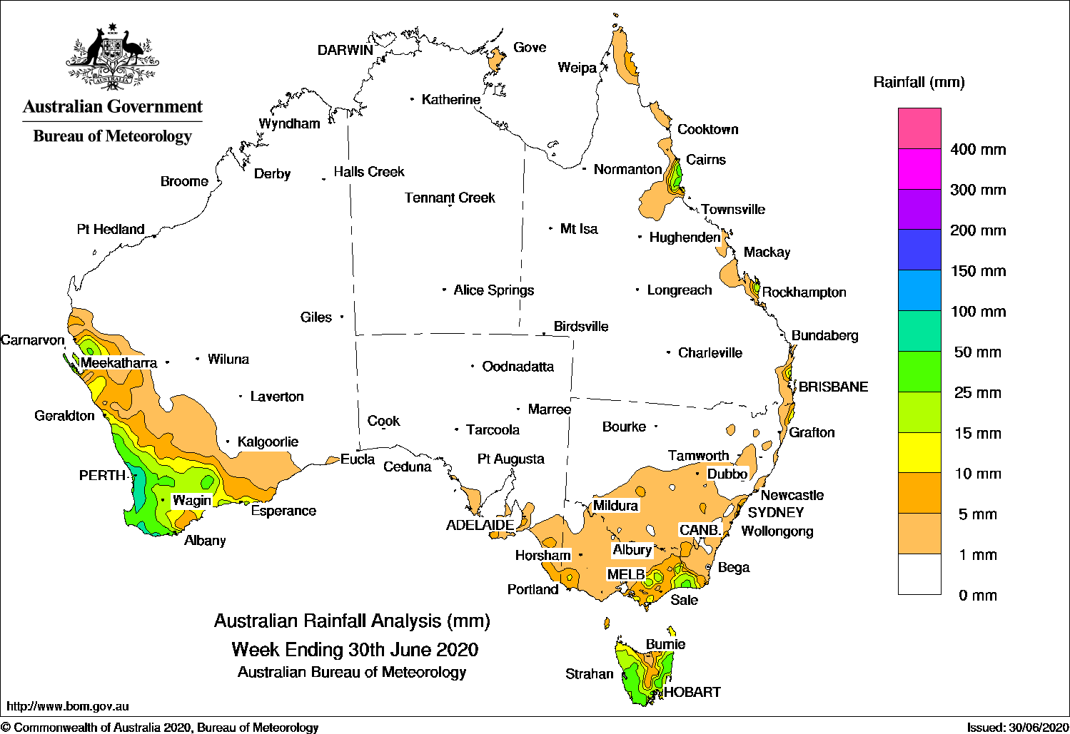
SEVERAL cold fronts brought moderate falls to southwest Western Australia, while a trough and low pressure system produced moderate falls in parts of the southeast.
Past seven days: At the start of the week, a weak cold front tracked across the southwest of Western Australia, generating light falls along the southwest coast. A trough and low pressure system along the east of Victoria brought showers and moderate falls to northeastern and East Gippsland in Victoria, and eastern Tasmania. Light falls were reported through southern inland New South Wales. A cold front embedded in a westerly flow tracked across Tasmania, and generated widespread light falls across southwest to central Victoria, and moderate falls in western Tasmania.
From the middle of the week, a series of cold fronts approached and tracked across southwest Western Australia. Moderate falls were recorded in the far southwest with the passage of the first front, with further moderate falls reported along the southwest coast following another frontal crossing. Another, more vigorous cold front followed, generating widespread moderate falls across much of the South West Land Division.
Moist onshore flow brought showers to parts of the east coast of Queensland and New South Wales during the week.
Rainfall totals in excess of 100 mm were recorded in pockets of the Lower West and South West districts of Western Australia, including the highest weekly total of 137 mm at Bickley in the Perth hills.
Rainfall totals in excess of 50 mm were recorded along the southwest coast of Western Australia.
Rainfall totals between 10 mm and 50 mm were recorded in the South West Land Division and the Gascoyne coast in Western Australia; small areas of southwest, southern central, northeast and East Gippsland in Victoria; western, southern and eastern Tasmania, and in pockets of the east coast of Queensland and New South Wales.
Falls of less than 10 mm were recorded across southeast South Australia, most of remaining parts of Victoria, remaining areas of Tasmania, southern and central inland districts of New South Wales, and pockets of the Northern Territory, Queensland and New South Wales coasts.
Highest weekly totals
New South Wales and Australian Capital Territory
60 mm Ballina Airport AWS
30 mm Randwick (Randwick St)
27 mm Montague Island Lighthouse
Victoria
44 mm Mallacoota
38 mm Mount Baw Baw
32 mm Club Terrace
Queensland
88 mm Point Lookout
48 mm Innisfail
34 mm Innisfail Aerodrome
Western Australia
137 mm Bickley
116 mm Huntly
105 mm Worsley Downs
South Australia
13 mm Lake George
12 mm Adelaide (Morphett Vale), Belair (St Johns)
Tasmania
113 mm kunanyi / Mount Wellington
76 mm Gray (Dalmayne Rd)
64 mm Longley (River Bend Road)
Northern Territory
4 mm Gove Airport
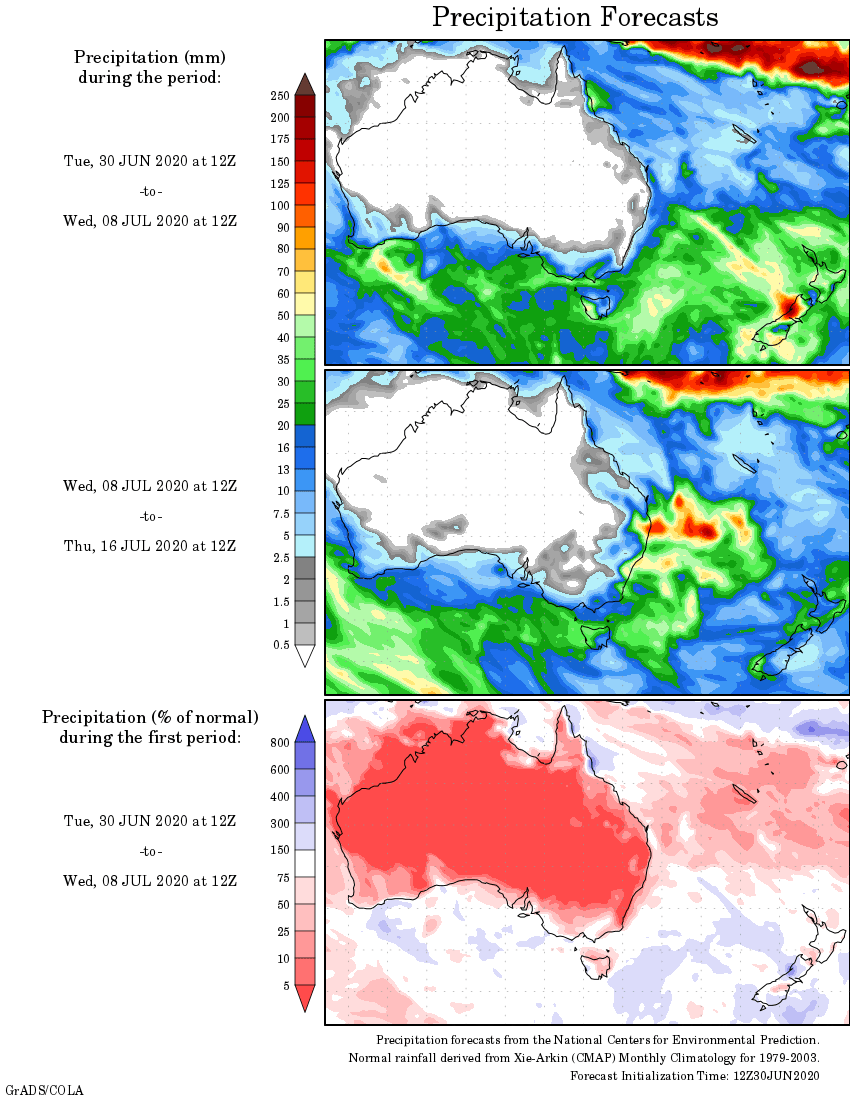
Rainfall outlook


HAVE YOUR SAY