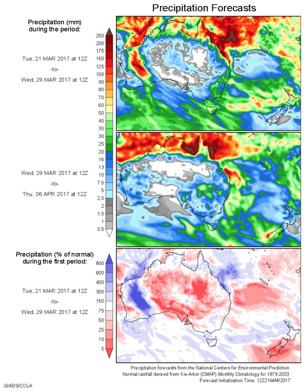
For today’s 14-day rainfall outlook – scroll to bottom of article
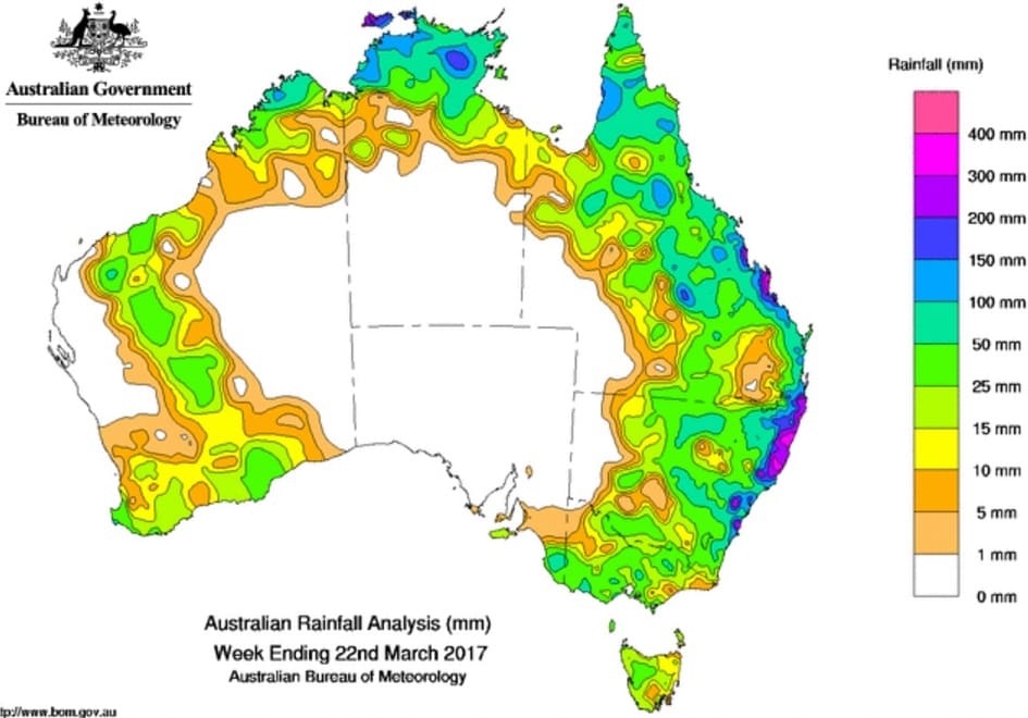
A number of upper-level troughs triggered thunderstorm activity across most of Queensland, as well as northern and eastern New South Wales, with moderate to locally heavy falls reported in some areas.
Past seven days: At the beginning of the week, a cloudband with areas of showers and thunderstorms extended from the Capricornia Coast in Queensland to the north coast of New South Wales. Humid, easterly winds fed into a low pressure trough, which combined with an upper-level low to generate moderate to heavy falls across the southeastern quarter of Queensland and eastern New South Wales. A cloudband associated with a cold front tracked across southeastern Australia, generating moderate falls in western Tasmania.
In the middle of the week, a low pressure trough was located along the New South Wales coast, with a small low pressure centre within this trough off the central New South Wales coast. The low and trough deepened in response to the upper-level system, and produced heavy falls about the Illawarra and South Coasts of New South Wales. Thunderstorms formed along the southeast coast of Queensland and produced moderate falls about the Capricornia, Wide Bay and Burnett, and southeast coast districts. A surface trough extended from the Pilbara down to Eucla in Western Australia, with moderate falls in parts of the Gascoyne and southern coast.
A vigorous easterly flow on the southern flank of the low pressure system generated thunderstorms and areas of heavy rain along the northeast coast and adjacent inland districts of New South Wales. An active monsoon trough stretching across northern Australia produced moderate to heavy falls in the northern tropics.
At the end of the week, a number of upper-level troughs moved over the northern New South Wales and Queensland’s interior, triggering thunderstorm activity across most of Queensland, as well as northern and eastern New South Wales, with moderate to locally heavy falls reported in some areas. A trough of low pressure extending through eastern parts of South Australia combined with an upper-level low west of Kangaroo Island and produced moderate falls in southeastern South Australia and parts of Victoria.
During the week, a monsoon trough across the far north of the country produced showers and thunderstorms over the Kimberley in Western Australia, the Top End in the Northern Territory, and the Cape York Peninsula in Queensland. A tropical low developed off northwest Australia in the vicinity of the monsoon trough later in the week.
Rainfall totals in excess of 200 mm were recorded in parts of the Capricornia and southeast coasts of Queensland, and along much of the east coast of New South Wales. Isolated totals in excess 300 mm were recorded in pockets of the southeast coast of Queensland; also the Illawarra and northeast coasts of New South Wales. Small areas of the southeast coast of Queensland as well as the Northern Rivers and Mid North Coast districts in New South Wales recorded falls in excess of 400 mm, including the highest weekly total of 528 mm at Springbrook Road in Queensland.
Rainfall totals between 100 mm and 200 mm were recorded parts of the northern Kimberley in Western Australia; the northwestern Top End of the Northern Territory; parts of the Cape York Peninsula, northern interior, and east coast south of Mackay in Queensland; and much of the eastern seaboard of New South Wales.
Rainfall totals between 50 mm and 100 mm were recorded the northern Kimberley, the Top End of the Northern Territory, northern and eastern Queensland, northeastern and eastern New South Wales, and isolated locations in central Victoria and southeastern South Australia.
Rainfall totals between 10 mm and 50 mm were recorded in the Kimberley, parts of the Pilbara, Gascoyne and Goldfields districts, and the southwest and southern coasts of Western Australia; southeastern South Australia; western, central and northeastern Victoria and western Tasmania. Similar totals were recorded across much of New South Wales and Queensland except in the west, and in the Top End in the Northern Territory.
Little or no rainfall was recorded in the west and central interior of Western Australia, most of South Australia away from the southeast corner, the southern two thirds of the Northern Territory, western Queensland, western New South Wales and northwestern Victoria. Mainly light falls were record in eastern Tasmania.
Highest weekly totals
New South Wales and Australian Capital Territory
524 mm Yarras (Mount Seaview)
518 mm Comboyne (Public School)
517 mm Dorrigo (Old Coramba Rd)
Victoria
66 mm Strath Creek, Rosewhite Fld
51 mm Yea
Queensland
528 mm Springbrook Road
357 mm Noosaville
276 mm Tewantin Rsl Park
Western Australia
111 mm Theda
110 mm Doongan
78 mm Kalumburu
South Australia
99 mm Lucindale Post Office
51 mm Mount Gambier Aero
46 mm Frances, Naracoorte Aerodrome
Tasmania
32 mm Mount Read
27 mm Quamby Bluff
26 mm Jackeys Marsh
Northern Territory
203 mm Elizabeth Valley
198 mm Point Stuart
189 mm Leanyer
More weekly rainfall totals:
- NSW/ACT totals click here
- Vic totals click here
- Qld totals click here
- WA totals click here
- SA totals click here
- Tas totals click here
- NT totals click here
Source: BOM
HAVE YOUR SAY