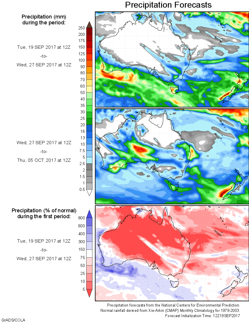
For today’s 14-day rainfall outlook – scroll to bottom of article
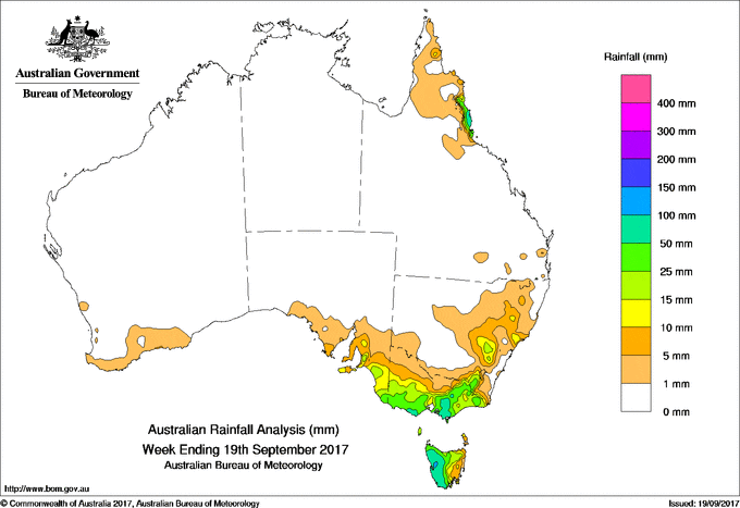
An upper-level trough triggered moderate rainfall over the Far North Queensland tropical coast. A vigorous westerly air stream with embedded cold fronts produced moderate rainfall in Victoria and Tasmania.
Past seven days: At the start of the week, a cold front connected to a low pressure system south of Tasmania moved slowly across southeastern Australia, triggering generally light falls over southeastern South Australia, Victoria and Tasmania. Higher totals were recorded in western Tasmania and elevated areas in Victoria’s southwest coast and West Gippsland. The cold front also brought showers to New South Wales, with rain falling in the Central West Slopes and Plains District and the alpine region.
During the middle of the week, another strong low passed south of Tasmania, while the associated cold front swept across the southeastern States. This front interacted with upper level troughs, with the vigorous westerly air stream leading to moderate falls in southern and alpine Victoria and western Tasmania. Much of the remainder of Victoria, southern Tasmania, and parts of southeastern New South Wales received light falls.
Light falls was also recorded along the south coast of Western Australia as a cold front skimmed the southwest mid-week.
Late in the week, an upper-level trough and associated cloudband triggered some heavy falls over Queensland’s Far North Coast district.
Meanwhile, a complex system of fronts brought moderate to heavy falls in western and northern Tasmania, with lighter rain falling broadly across southeastern South Australia and Victoria at the end of the week.
Rainfall totals of around 90 to 100 mm were recorded in western Tasmania and in coastal Far North Queensland, including the highest weekly totals of 148 mm at Babinda Post Office and 101 mm at Mount Read.
Rainfall totals over 50 mm were recorded in southern Victoria around the Otways and West Gippsland, and in western Tasmania.
Rainfall totals between 25 mm and 50 mm were recorded in southern alpine areas of New South Wales, extending along the ranges in northeastern Victoria and across southern Victoria. Falls in excess of 25 mm were observed surrounding isolated higher totals in coastal Far North Queensland. Totals of 10 to 25 mm were recorded in southeastern South Australia, through the middle of Victoria, and in areas of New South Wales’ Central West Slopes and Plain as well as the Central Coast districts.
Little or no rainfall was observed in the Northern Territory, Western Australia, South Australia away from the south coast, western and most of northern New South Wales, and nearly all of Queensland.
Highest weekly totals
New South Wales and Australian Capital Territory
69 mm Perisher Valley Aws
54 mm Thredbo Village
46 mm Cabramurra Smhea Aws
Victoria
95 mm Falls Creek (Rocky Valley)
85 mm Mount Baw Baw
Queensland
148 mm Babinda Post Office
93 mm Cowley Beach (Defence)
89 mm Bingil Bay
Western Australia
6 mm Pleasant Valley
5 mm Erinair, Munglinup, The Duke
South Australia
37 mm Uraidla
34 mm Mount Lofty
Tasmania
101 mm Mount Read
96 mm Queenstown (South Queenstown)
93 mm Zeehan (West Coast Pioneers Mu
Northern Territory
1.2 mm Charles Point
0.6 mm Centre Island
0.2 mm Port Keats Airport
More weekly rainfall totals:
- NSW/ACT totals click here
- Vic totals click here
- Qld totals click here
- WA totals click here
- SA totals click here
- Tas totals click here
- NT totals click here
Source: BOM
HAVE YOUR SAY