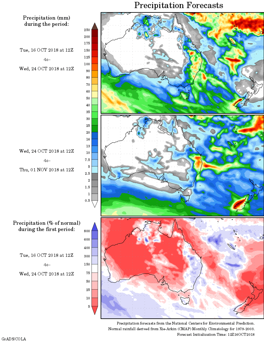
For today’s 14-day rainfall outlook – scroll to bottom of article
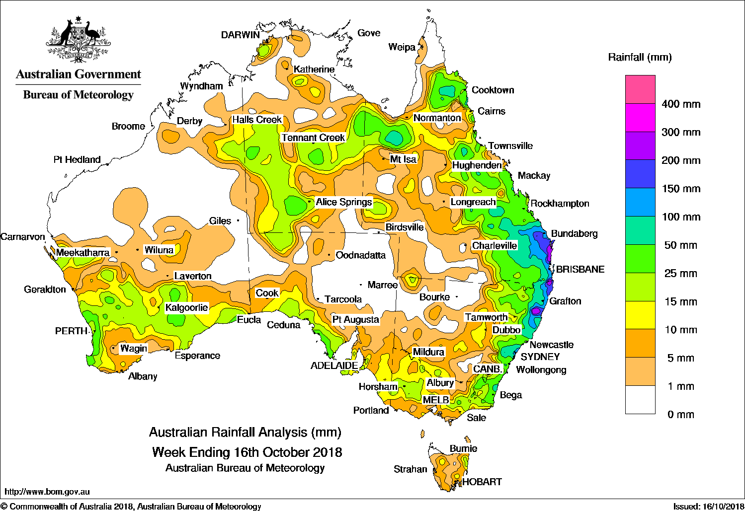
By the middle of the week, showers and storms associated with the trough extended around the Gulf Country and southern parts of the Northern Territory. The surface trough interacted with an upper level trough over eastern Queensland and triggered widespread showers, thunderstorms and areas of rain. Moderate falls were reported in northeastern New South Wales, and much of eastern Queensland. Locally heavy falls were reported in the Wide Bay and Burnett District, and parts of southeast Queensland. The severe thunderstorms that developed in the Wide Bay and Burnett produced very large hail, damaging winds along with two separate tornadoes: one at Tansey and the other at Coolabunia.
In the last part of the week, the surface trough shifted offshore but continued to produce showers and moderate falls across much of eastern Queensland and coastal New South Wales. Showers were enhanced about the southern Queensland coast, due to deepening low pressure near the coast, with moderate to locally heavier falls recorded in areas of the southeast Queensland and northeastern New South Wales coasts.
From the middle of the week, a trough near the west coast produced light to moderate falls in the southwest Gascoyne in Western Australia, while a low pressure system and cold front tracked across southern parts of the State in its wake, with moderate falls across the South West Land Division and Goldfields District in Western Australia. Extensive thunderstorm activity developed to the east of the system and brought moderate falls to the southeast of Western Australia and southwest South Australia, with lighter falls recorded in southeastern South Australia and western Victoria as the system traversed eastwards at the end of the week.
Rainfall totals exceeding 100 mm were recorded in southeastern Queensland and northeastern New South Wales, with falls in excess of 200 mm recorded in parts of the Sunshine Coast, the Gold Coast Hinterland, and the Mid North Coast and Northern Rivers in New South Wales. The highest weekly total was 378 mm at Tewantin in southeast Queensland.
Rainfall totals exceeding 50 mm were recorded in areas of northern, central and southeastern Queensland; also about the northeast, central and southeast coast of New South Wales.
Rainfall totals between 10 mm and 50 mm were recorded in southern Western Australia; southern South Australia; southern and central parts of the Northern Territory, extending into the southeastern Kimberley in Western Australia and northwestern South Australia, as well as isolated areas around Darwin; about the Gulf Country; isolated areas of far western Queensland; most of eastern Queensland and New South Wales; eastern, central and western Victoria away from the south coast, and in a small area of northeastern Tasmania.
Little or no rainfall was recorded in the central interior and most of northern Western Australia; most of the Top End in the Northern Territory; northeastern South Australia; northwestern Tasmania; northwestern New South Wales and far southwest Queensland.
Highest weekly totals
New South Wales and Australian Capital Territory
286 mm Bowra Sugarloaf
266 mm Kalang (Spicketts Ck)
247 mm Yarras (Mount Seaview)
Victoria
56 mm Mount Wellington
50 mm Reeves Knob
49 mm Wycheproof
Queensland
378 mm Tewantin RSL Park
363 mm Springbrook Road
280 mm Tin Can Bay (Defence)
Western Australia
67 mm Huntly
59 mm Cowaramup
44 mm Jarrahdale
South Australia
47 mm Coffin Bay
38 mm Coulta
36 mm Mount Hope (Fairview)
Tasmania
37 mm Gray (Dalmayne Rd)
22 mm Pyengana (Forest Lodge Road)
18 mm Mount Barrow (South Barrow)
Northern Territory
52 mm Walker Creek
37 mm Rabbit Flat
34 mm Owen Springs
More weekly rainfall totals:
- NSW/ACT totals click here
- Vic totals click here
- Qld totals click here
- WA totals click here
- SA totals click here
- Tas totals click here
- NT totals click here
Rainfall outlook:
HAVE YOUR SAY