A complex area of low pressure developed over Victoria, and brought moderate to locally heavy falls the southeast, while Tropical cyclone Owen brought heavy falls to the northern tropics and east coast of Queensland.
Past seven days: At the start of the week, tropical cyclone Owen intensified in the Gulf of Carpentaria, and lingered about the coast between Port Roper and Port McArthur in the Northern Territory as a severe tropical cyclone (category 3) . Extensive showers and heavy falls associated with Owen were recorded in Arnhem Land and the Top End in the Northern Territory, parts of the Gulf Country and the Cape York Peninsula. An outer clouband from Owen also brought showers to the Kimberley in Western Australia.
A broad surface trough extended from the central to inland southeast of the continent, and generated showers and thunderstorms across southern Queensland, parts of northern South Australia, and central New South Wales. A low pressure system and an associated cold front tracked to western parts of Victoria and New South Wales, while showers and thunderstorm activity over Victoria and southern New South Wales generated moderate to locally heavier falls.
By the middle of the week, severe tropical cyclone Owen had reversed its track and moved towards the eastern Gulf of Carpentaria, with a deep trough extending from Owen through the east of the continent to a low centered over Victoria and southwestern New South Wales. An extensive cloudband covered much of eastern Australia, with showers and thunderstorms generating moderate to heavy falls in parts of the northern tropics; northern, eastern and southern Queensland; eastern and southern New South Wales, and northern Victoria.
Severe tropical cyclone Owen crossed the west coast of the Cape York Peninsula on Saturday the 15th, and weakened to a tropical low as it tracked southeast through the northern inland to the north tropical coast of Queensland. Heavy falls were recorded in parts of western Cape York Peninsula, the north tropical coast, northern tropics and central Queensland. The remnants of ex-tropical cyclone Owen tracked along the central Queensland coast through to the end of the week, with moderate falls recorded across central Queensland.
At the end of the week, the extensive cloudband moved away from the east coast, while in the west a trough and associated low pressure system brought thunderstorms to southern Western Australia.
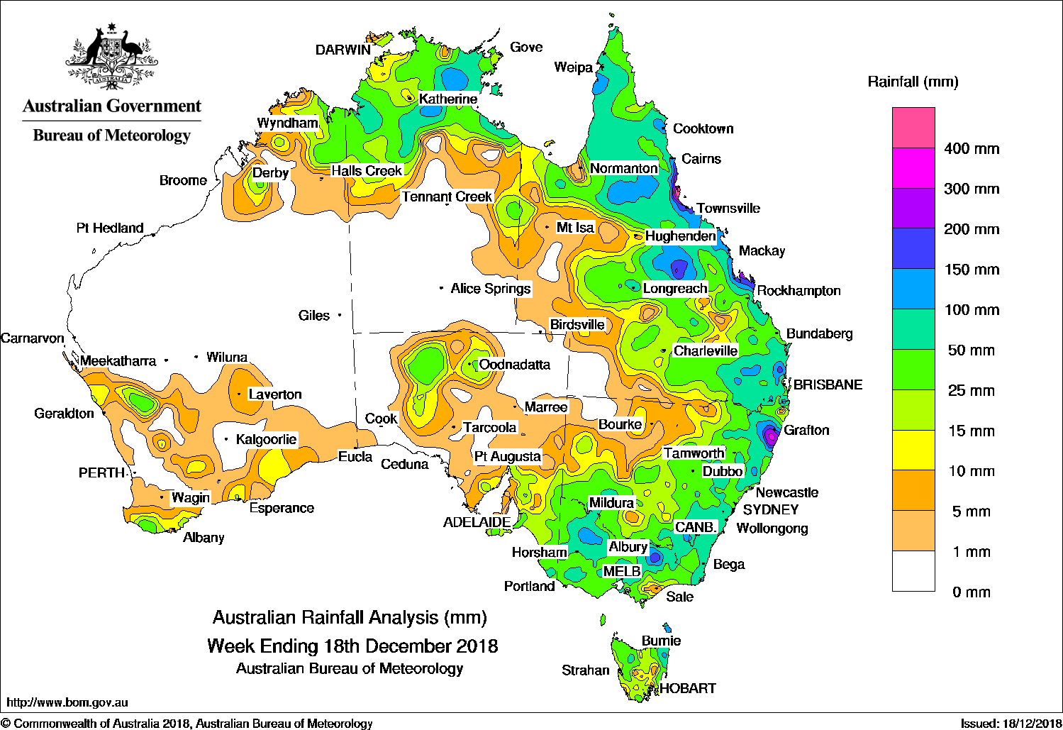
The highest weekly total was 735 mm at Halifax Macrossan St in the north tropical Queensland coast. Rainfall totals exceeding 200 mm were recorded around the north tropical Queensland coast, Capricornia coast and Low North Coast of New South Wales. Rainfall totals between 100 mm and 200 were recorded in parts of Arnhem Land in the Northern Territory; parts of the Cape York Peninsula; the northern interior and north tropical to central coasts of Queensland, and pockets of the State’s southeast; in parts of northeastern New South Wales; northern Victoria and northeastern Tasmania.
Rainfall totals between 10 mm and 50 mm were recorded in the Kimberley, and pockets of southern Western Australia; much of the northern half of the Northern Territory; most of Queensland except the far southwest; in the north and southeast of South Australia; most of New South Wales away from the northwest; most of Victoria and Tasmania.
Little or no rainfall was recorded in remaining parts of Western Australia, the southern half of the Northern Territory, the far southwest of Queensland, northwestern New South Wales, and much of western and northeastern South Australia.
Highest weekly totals
New South Wales and Australian Capital Territory
337 mm Nymboida (Sutton St)
314 mm Glenreagh (Coramba Street)
312 mm Nana Glen (Cowling Close)
Victoria
204 mm Eldorado
195 mm Birchip (Woodlands)
187 mm Bloomfield Park (Everton)
Queensland
735 mm Halifax Macrossan St
633 mm Victoria Sugar Mill
629 mm Cardwell Range
Western Australia
55 mm Parry Creek Farm
54 mm Camballin
52 mm Shannon
South Australia
122 mm Sevenhill
77 mm Frances
63 mm Parawa (Sharon)
Tasmania
185 mm Gray (Dalmayne Rd)
146 mm Pyengana (Forest Lodge Road)
133 mm Whitemark Post Office
Northern Territory
178 mm Cave Creek Station
152 mm Centre Island
123 mm Bulman
More weekly rainfall totals:
- NSW/ACT totals click here
- Vic totals click here
- Qld totals click here
- WA totals click here
- SA totals click here
- Tas totals click here
- NT totals click here
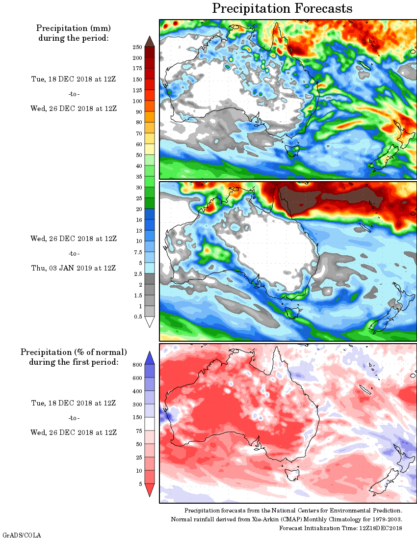
Rainfall outlook:
HAVE YOUR SAY