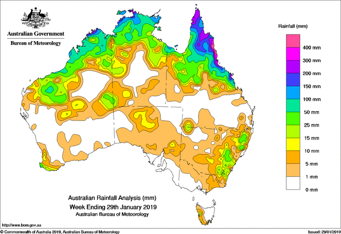
Two tropical lows identified along the monsoon trough – one off the west coast of the Cape York Peninsula, and the other north of the Kimberley – intensified, with the latter developing into tropical cyclone Riley on the 24th northwest of Broome in the west Kimberley. Moderate falls associated with Riley were recorded in the Pilbara in Western Australia as the system tracked parallel to the coast.
From the middle of the week, the monsoon trough shifted further south, and the lingering tropical low over the Gulf of Carpentaria moved across the Cape York Peninsula. Moderate to heavy falls were recorded over the Cape York Peninsula and the north tropical coast of Queensland, as well as in the Top End in the Northern Territory and in parts of the Kimberley and Pilbara in Western Australia. A broad low pressure trough and associated cloudband stretched from the northwest to southeast of the country to a low south of Tasmania, with mainly light rainfall totals recorded from central to southeastern Australia. An outer cloudband from Riley produced moderate falls in the Pilbara and Kimberley.
Moderate to heavy falls continued in Queensland’s north tropical coast, extending to the northern interior, Gulf Country and Cape York Peninsula as the tropical low lingered around the base of the Cape York Peninsula. Thunderstorms developed over parts of the Tablelands in New South Wales, generating isolated moderate falls.
Rainfall totals in excess of 400 mm were recorded from about Cooktown to Ingham, and around Bowen in Queensland, including the highest weekly total of 766 mm at Whyanbeel Valley in north Queensland.
Rainfall totals in excess of 200 mm were recorded in the Darwin–Daly district in the Northern Territory, the north Kimberley coast in Western Australia, parts of the northern Cape York Peninsula, and along the northeast coast of Queensland.
Rainfall totals exceeding 100 mm were recorded around Broome and the northern Kimberley in Western Australia, parts of the northwest and northeast of the Top End in the Northern Territory, an area of the Gulf Country, and large parts of the Cape York Peninsula and Queensland’s east coast south to Mackay.
Rainfall totals between 50 mm and 100 mm were recorded in parts of the Pilbara and Kimberley in Western Australia; much of the Top End in the Northern Territory; and area of the Gulf Country; much of the Cape York Peninsula, northern interior and north tropical to central coasts of Queensland.
Rainfall totals between 10 mm and 50 mm were recorded in the southwest, central interior and remaining parts of the Pilbara and Kimberley in Western Australia; in areas of the west and most of the northern half of the Northern Territory; most of remaining areas of northern Queensland, in parts of northwestern and eastern New South Wales; in isolated areas of the north and east of South Australia, and an area in western Tasmania.
Little or no rainfall was recorded in remaining areas of Western Australia; most of the southern half of the Northern Territory; in parts of southern, western and northeastern South Australia; most of western New South Wales; the western half of Victoria, and central to eastern Tasmania.
Highest weekly totals
New South Wales and Australian Capital Territory
85 mm Yarrowitch (Rushbrook)
73 mm Yarras (Mount Seaview)
64 mm Ulan Water
Victoria
15 mm Mount Hotham
14 mm Tangambalanga Ne Dairy
13 mm Bullumwaa, lMeerlieu (Springvale West)
Queensland
766 mm Whyanbeel Valley
664 mm Mossman South, Alchera Drive
592 mm Mt Sophia
Western Australia
264 mm Troughton Island
254 mm Truscott
199 mm Kalumburu
South Australia
10 mm Mintabie
9 mm Multiple locations
Tasmania
24 mm Mount Read
16 mm Lake Margaret Power Station
12 mm Strahan (Andrew Street)
Northern Territory
314 mm Croker Island Airport
265 mm Geriatric Park
251 mm Mccluer Island
More weekly rainfall totals:
- NSW/ACT totals click here
- Vic totals click here
- Qld totals click here
- WA totals click here
- SA totals click here
- Tas totals click here
- NT totals click here
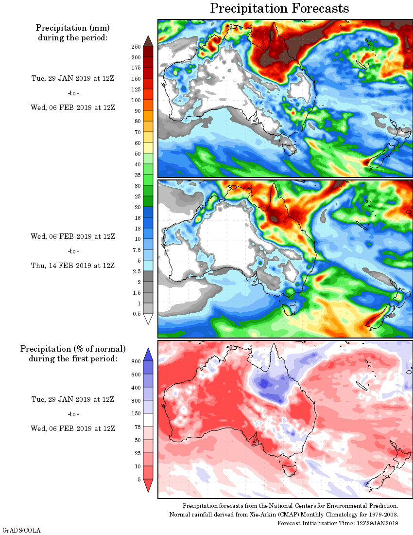
Rainfall outlook:
HAVE YOUR SAY