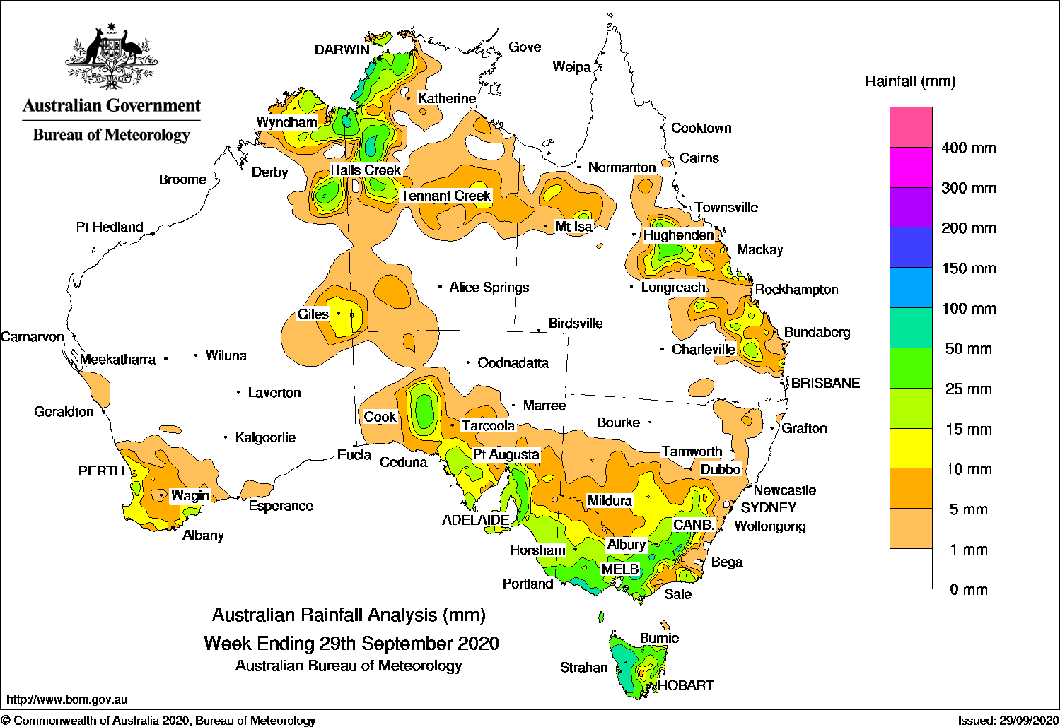
Past seven days: At the start of the week, a low pressure system moved to south-east of Tasmania, and associated troughs tracked across Tasmania and Victoria to bring mostly light rainfall, with moderate falls to western and inland north-east Tasmania.
A trough extending from the Top End of the Northern Territory to south-east Queensland, combined with an upper level trough, to generate isolated showers and thunderstorms in the north-west Top End and central Northern Territory, and inland north-west, central down to south-east in Queensland.
For most of the week, the south-east South Australia and the south-eastern states experienced wet, cold and windy weather conditions. A strong cold front pushed from the eastern Australian Bight through south-east South Australia and the south-eastern states, followed by a number of low pressure systems tracking along the Bass Strait before forming a complex low in the Tasman Sea. A cold pool of southerly air in the wake of cold front swept through the country’s south-east. Periods of rain and showers were recorded in south-east South Australia, Victoria, northern and eastern Tasmania, and south-east and central parts of New South Wales. Snow fell in the southern Flinders Ranges in South Australia, and to low levels in western Victoria , elevated locations in Tasmania, and further north in the New South Wales Southern and Central Tablelands. Light showers contracted to the western Tasmania and southern Victoria as a high pressure system moved across the Country’s south-east at the end of the week.
A trough, which formed across the western Top End to the Kimberley early in the week, remained near stationary, resulting in thunderstorms and showers. Moderate falls were recorded in the north-western Northern Territory, and adjacent areas in the Kimberley and Northern Interior districts in Western Australia during the week.
In the south-west Western Australia, a broad trough extended from the north on the 26th and brought light rainfall to the much of the South West Land Division. A weak cold front moved across the state’s south-west and brought further light falls at the end of the week.
Rainfall totals exceeding 50 mm were recorded in Darwin Area and Gregory District in Northern Territory, in Adelaide Metropolitan Area and Mount Lofty Ranges in South Australia, in western Tasmania, in the south-west coast, north central and alpine region in Victoria, and in the alpine region in New South Wales. The highest weekly rainfall was 129.6 mm at Mount Read in western Tasmania.
Rainfall totals between 10 mm and 50 mm were recorded in the Kimberley, eastern Southern Interior District, and along the south-west coast in Western Australia, north-west pastoral areas and much of southern South Australia, Victoria and Tasmania, inland south-east to central New South Wales, areas in the eastern and north-west Queensland, much of the north-western, central and far south-west corner of Northern Territory.
Highest weekly totals
New South Wales and Australian Capital Territory
64 mm Perisher Valley Aws
55 mm Argalong (Sandy Creek)
54 mm Cabramurra Smhea Aws
Victoria
72 mm Nullawarre
67 mm Cape Otway LighthouseWarrnambool Airport Ndb
Queensland
31 mm Lochington
30 mm Lake Julius Aws
29 mm Boondooma Dam, Gladstone Radar, Tewantin RSL Park
Western Australia
59 mm Kununurra Aero
37 mm Kununurra Checkpoint
35 mm El Questro
South Australia
83 mm Piccadilly (Woodhouse)
63 mm Uraidla
62 mm Lenswood
Tasmania
130 mm Mount Read
107 mm Lake Margaret Dam
84 mm Lake Margaret Power Station
Northern Territory
96 mm Dum In Mirrie Airstrip
78 mm Charles Darwin University
65 mm Darwin HospitalUpper Wickham River
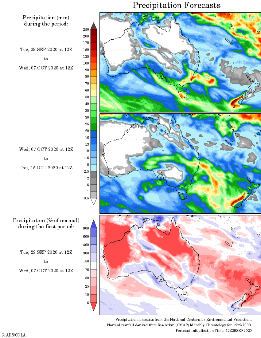
Rainfall outlook
HAVE YOUR SAY