Surface troughs triggered thunderstorms in the north-west and southern parts of the Northern Territory, and inland Queensland.
A slow-moving cold front and cloudband produced widespread falls in South Australia, and the south-east, including Tasmania.
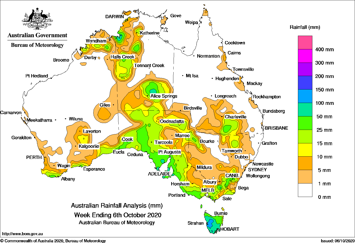
Past seven days:
For the week to 6 October 2020, rainfall was recorded in southern and the far north of Western Australia; in the west and south of the Northern Territory; South Australia; southern and east coast Queensland; in parts of the inland north, west, and south-east of New South Wales; Victoria and Tasmania.
In the early part of the week, low pressure troughs extended from northern Western Australia, through the Northern Territory into eastern Australia. A cold front behind the surface trough swept over south-east South Australia and south-east Australia. Showers and thunderstorms developed over the tropics from the Kimberley to the western Top End, southern inland parts of Queensland, and northern inland areas of New South Wales.
Areas of rain and showers produced moderate falls across large areas of south-east South Australia. Widespread falls were also recorded across Victoria, Tasmania and south-east New South Wales, with moderate falls in southern central to north-eastern Victoria, in the Snowy Mountains in New South Wales, and in western and northern Tasmania.
In the middle part of the week, a trough across the north and south-east of Western Australia moved east across the borders. A cold front behind the trough tracked across the south of the state to South Australia. Light falls were recorded in southern Western Australia, south-western parts of the Northern Territory, and western South Australia.
In the last part of the week, the cold front stretched across the southern Northern Territory and South Australia, and a pre-frontal trough extended north to the Kimberley in Western Australia. The systems and associated cloudband moved slowly eastward through the south-east of Australia, and brought widespread moderate falls to southern and western parts of the Northern Territory, most of South Australia, western Victoria, north-west and parts of south-east New South Wales, and Tasmania. An onshore flow produced mostly light falls along the southern coastal parts of Western Australia.
Rainfall totals exceeding 100 mm were recorded in western parts of Tasmania, including the highest weekly total of 119 mm at Lake Margaret Dam in Tasmania.
Rainfall totals exceeding 50 mm were recorded in the north-west and in the south of the Northern Territory, southern South Australia, and about two-thirds of south-west Tasmania.
Rainfall totals between 10 mm and 50 mm were recorded in the south and in the Kimberley in Western Australia; in the north-west and south of the Northern Territory; most of South Australia; most of Victoria except the north-west; north-west, northern inland and south-east inland parts of New South Wales; Tasmania, and southern inland areas of Queensland.
Highest weekly totals
New South Wales and Australian Capital Territory
41 mm Thredbo AWS
38 mm Perisher Valley AWS
35 mm Cabramurra AWS
Victoria
71 mm Falls Creek (Rocky Valley)
60 mm Falls Creek
57 mm Mount Hotham
Queensland
29 mm Karoola Park
25 mm Woodlands
23 mm Springfield
Western Australia
41 mm Kununurra Aero
31 mm KachanaEsperance
South Australia
76 mm Parawa
71 mm Cleve (Heggaton)
66 mm Cleve
Tasmania
119 mm Lake Margaret Dam
112 mm Mount Read
107 mm Queenstown (South Queenstown)
Northern Territory
64 mm Arltunga
63 mm The Garden
57 mm Gemtree Park
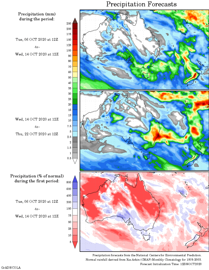
Rainfall outlook
HAVE YOUR SAY