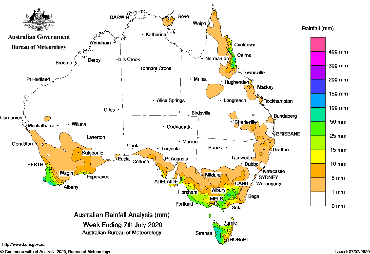
Cold fronts brought moderate falls to southwest and southeast Australia, while moist onshore flow produced showers and moderate falls in the north tropical Queensland coast.
Past seven days: At the start of the week, a high pressure system in the Tasman Sea extended a firm ridge up the east coast of Queensland and produced moist onshore flow. Light falls were recorded along exposed parts of the Queensland coast, with heavier falls recorded about the north tropical coast.
A cold front tracked across southwest Western Australia, producing widespread light falls across much of the South West Land Division. The cold front and associated cloudband then tracked across southern South Australia and then the southeast. Moderate falls were reported in far southeast South Australia, southwest and northeast Victoria, western Tasmania, and parts of the Snowy Mountains in New South Wales before the cold front moved offshore. A surface trough extended from southeast to northwest Queensland, and showers developed over southeast Queensland and northeastern New South Wales, with mainly light falls reported.
In the middle of the week, another cold front tracked across Tasmania and Victoria. Moderate falls were reported in southern central to northeastern Victoria and western Tasmania, while widespread light falls were recorded in southeastern South Australia, most of Victoria, Tasmania, and southern New South Wales. Southwesterly winds in the wake of the cold front produced moderate falls in western Tasmania and southern central Victoria, and light falls across much of southern Victoria.
In the last part of the week, a cold front and low pressure system tracked across southwest Western Australia, bringing strong gusty winds and moderate falls to the far southwest, and light falls to southeastern parts of the South West Land Division, and southern Goldfields. A weak cold front moved across Tasmania and produced light falls in southern and western Tasmania, and southern Victoria.
Rainfall totals in excess of 100 mm were recorded in western Tasmania, including the highest weekly total of 125 mm at Lake Margaret Dam.
Rainfall totals in excess of 50 mm were recorded about the north tropical coast of Queensland, in areas of West Gippsland and northeastern Victoria, small areas in southwest Western Australia, and western Tasmania.
Rainfall totals between 10 mm and 50 mm were recorded in far southwest and pockets of the south coast in Western Australia; in southeast South Australia; southwest, southern and northeastern Victoria; the Snowy Mountains in New South Wales; most of Tasmania except along the east coast; and about the north tropical coast of Queensland.
Falls of less than 10 mm were recorded across the South West Land Division and southern Goldfields in Western Australia, southern South Australia, Victoria, Tasmania, southern and northeastern New South Wales, in parts of central and eastern Queensland, and small pockets of Arnhem Land in the Northern Territory.
Highest weekly totals
New South Wales and Australian Capital Territory
48 mmPerisher Valley AWS
46 mmThredbo Village
28 mmThredbo AWS
Victoria
83 mm Falls Creek (Rocky Valley)
63 mm Ferny Creek, Mount Baw Baw
Queensland
84 mm Babinda Post Office
82 mm South Johnstone Exp Stn
77 mm Tully Sugar Mill
Western Australia
81 mm Witchcliffe
76 mm Margaret River
75 mm Walpole Forestry
South Australia
43 mm Lenswood
39 mm Uraidla
36 mm Hahndorf, Lenswood (Stringybark)
Tasmania
125 mm Lake Margaret Dam
107 mm Scotts Peak Dam
106 mm Zeehan
Northern Territory
7 mm Gove Airport
4 mm Ngayawili
0.4 mm Centre Island
*Mount Read in Tasmania was affected by snow and wind, and the true total is most likely higher.
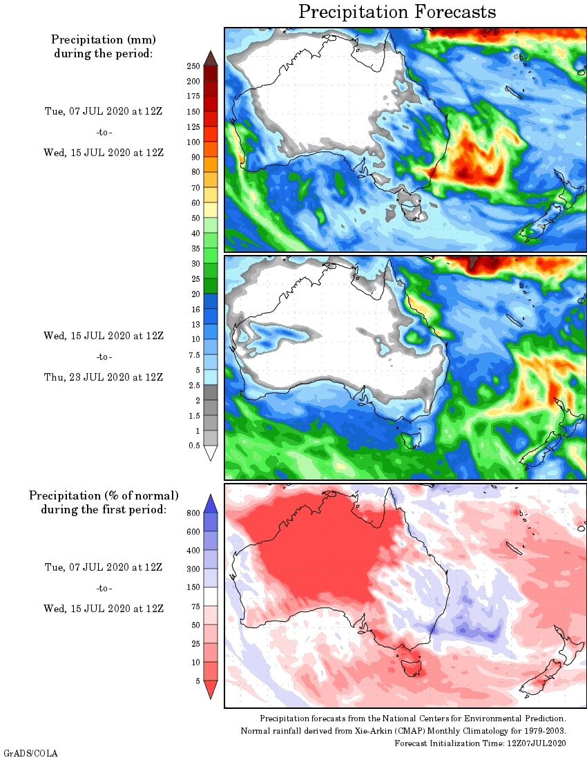
Rainfall outlook
HAVE YOUR SAY