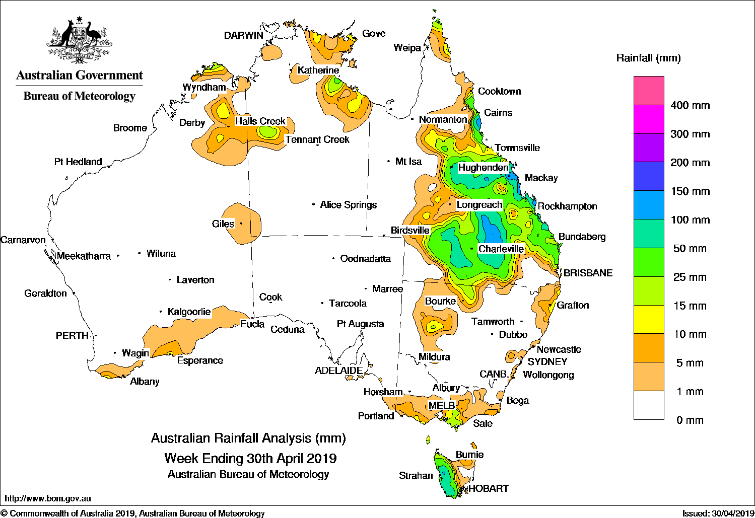
Surface and upper level troughs produced widespread moderate falls in eastern, central and southern Queensland, and a series of cold fronts tracked across southern Australia, producing moderate falls in western Tasmania.
Past seven days: In the first half of the week, a surface trough extending through inland Queensland combined with a broad upper-level low, and produced widespread showers and thunderstorms, with moderate falls reported over the southwestern and southern interiors of Queensland. As the systems moved slowly eastwards, further moderate falls were recorded through the central interior, and from the central coast to Wide Bay and Burnett district of Queensland. Onshore flow brought showers and moderate falls to areas from the north tropical to southeast coasts of that State for much of week.
In the second half of the week, moist easterly winds and later a cloudband produced some isolated thunderstorms and showers in the northern Cape York Peninsula and north tropical coast of Queensland, the Arnhem Land, eastern Carpentaria and northern Tanami districts in the Northern Territory, and parts of the Kimberley in Western Australia.
In the south, a pair of cold fronts tracked across southeast Australia, and the strong westerly flow brought moderate falls to western Tasmania and light falls to much of southern Victoria. A cold front and pre-frontal trough tracked across southern Western Australia, and produced light falls in the southwest and southern coast of Western Australia at the end of the week.
Rainfall totals in excess of 100 mm were recorded in the central interior, and the north tropical and central coasts of Queensland, and an area in western Tasmania. The highest weekly totals was 183 mm at Mt Read in Tasmania.
Rainfall totals in excess of 50 mm were recorded in parts of the northern, central and southwest interior, and east coast of Queensland; also large parts of western Tasmania.
Rainfall totals between 10 mm and 50 mm were recorded in parts of the Kimberley and south coast of Western Australia; Arnhem Land and eastern Carpentaria district in the Northern Territory, and the Cape York Peninsula. Similar totals were also recorded in large areas of eastern, central and southern Queensland; isolated parts of western and northeastern New South Wales; areas of southern Victoria and most of the western half of Tasmania.
Little or no rainfall was recorded across most of Western Australia away from the far north and southwest, most of the Northern Territory except in the northeast, South Australia, in the far west and southeastern interior of Queensland, remaining parts of New South Wales, northern Victoria and eastern Tasmania.
Highest weekly totals
New South Wales and Australian Capital Territory
33 mm Wanaaring (Borrona Downs AWS)
27 mm Nashua (Wilsons River)
20 mm Culburra Treatment Works
Victoria
33 mm Mount Baw Baw
30 mm Madalya
28 mm Mount Best (Upper Toora)
Queensland
172 mm Pleystowe Sugar Mill
168 mm Mount Jukes
163 mm Mungallala
Western Australia
19 mm Troughton Island
17 mm Truscott
14 mm Kalumburu
South Australia
6 mm Nangwarry Forestry SA Depot
5 mm Mount Gambier Aero, Ashton
Tasmania
183 mm Mount Read
130 mm Lake Margaret Dam
107 mm Lake Margaret Power Station
Northern Territory
39 mm Point Stuart
35 mm Alcan Minesite
17 mm Nathan River
Source: BOM
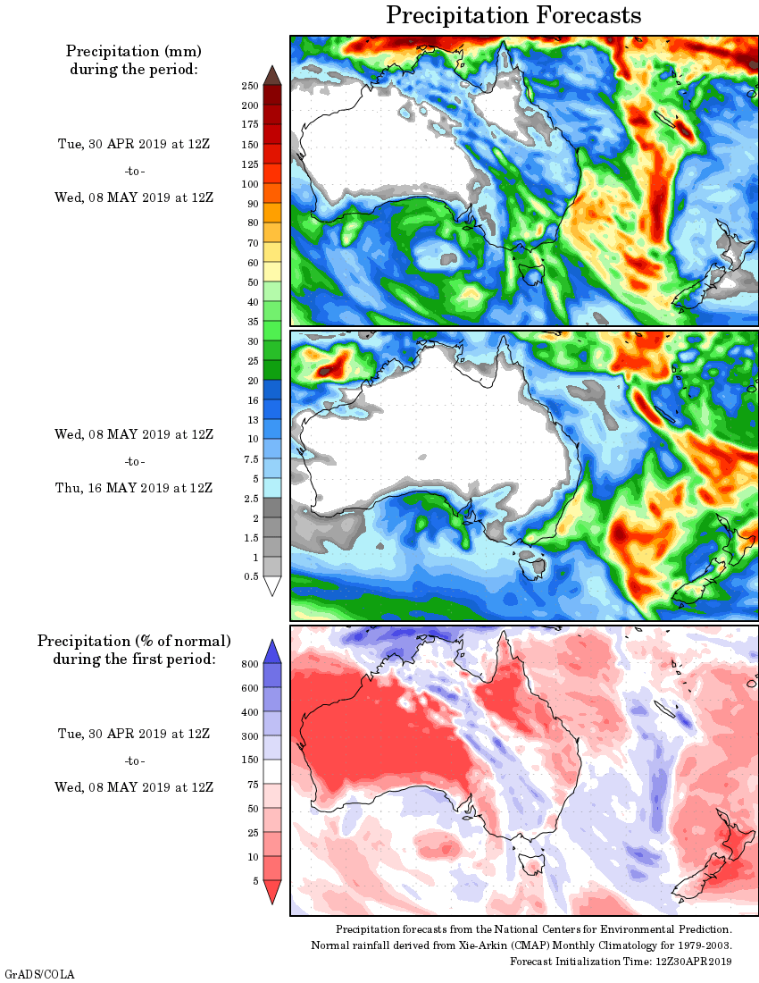
Rainfall outlook:
HAVE YOUR SAY