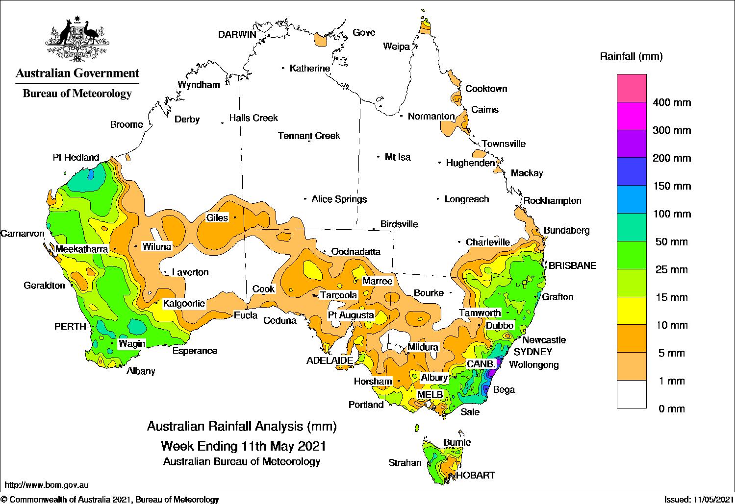
Widespread moderate falls over western parts of Western Australia, while a cold front, low pressure system and surface trough brought moderate falls to eastern New South Wales, and heavy falls across the South Coast District.
Past seven days: At the start of the week, a deep trough was located over the central Pilbara, and moisture streamed in from the Indian Ocean to generate a large cloudband over much of Western Australia. Isolated thunderstorm occurred along the coast of Western Australia from the Pilbara though to the South West District, and widespread moderate falls were recorded across the west of Western Australia.
In the east, a cold front and low pressure system located over southern New South Wales interacted with a surface trough extending along the south-east Queensland and New South Wales coasts. The systems generated widespread moderate to locally heavy falls in south-east Queensland, along the east coast of New South Wales, and eastern Victoria. The low pressure system and trough moved off the coast of New South Wales, but continued to generate moderate to heavy falls across the central to south-east coast of that state until the middle of the week.
In the middle of the week, surface troughs produced light falls over the south-west coast of Western Australia. The troughs moved eastwards, and brought light falls to the interior of Western Australia and across agricultural and central and eastern districts in South Australia, then western New South Wales and north-west Victoria. A series of cold front tracked across the Southern Ocean, and across western Tasmania, generating mainly light falls in the west of that state.
At the end of the week, isolated thunderstorms developed near a pre-frontal surface trough t over north-eastern New South Wales and south-east Queensland. A vigorous southerly flow associated with the passage of a complex low and cold fronts brought widespread light falls to the south-east, with moderate falls in southern, central and north-eastern Victoria, western Tasmania, and elevated areas of the Snowy Mountains in New South Wales. Light falls were also reported along the southern coastline of mainland Australia.
Rainfall totals in excess of 200 mm were recorded along the South Coast District of New South Wales, including the highest weekly rainfall total of 426 mm at Braidwood.
Rainfall totals in excess of 100 mm were recorded in small areas of the Pilbara coast in Western Australia, and in the Illawarra and South Coast districts of New South Wales.
Rainfall totals between 50 mm and 100 mm were recorded in the western Pilbara and an area of south-west Western Australia, a pocket in western Tasmania, areas of eastern Victoria, and the South Coast District in New South Wales.
Rainfall totals between 10 mm and 50 mm were recorded in the west of Western Australia, in agricultural and parts of eastern and central South Australia, and northern and western Tasmania. Similar totals were recorded in southern, central, eastern and north-eastern Victoria, eastern New South Wales, and south-east and southern inland parts of Queensland.
Weekly rainfall totals
New South Wales and Australian Capital Territory
426mm Braidwood
360mm Fitzroy Falls (Red Hills)
352mm Beaumont (The Cedars)
Victoria
103mm Mount Nowa Nowa
84mm Ensay
71mm Combienbar AWS
Queensland
60 mm Greenbank (Defence)
53 mm Regents Park, Greenbank Thompson Road
Western Australia
205 mm Roebourne Aero
107 mm Barrow Island Airport
98 mm Mardie
South Australia
28 mm Multiple locations
Tasmania
84mm Mount Read
66mm Lake Margaret Dam
50mm Mount Barrow (South Barrow)
Northern Territory
4 mm Yulara Airport
2 mm Milingimbi Airport
0.6 mm Groote Eylandt Airport
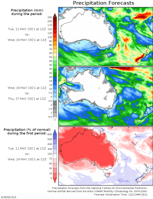
Rainfall outlook


HAVE YOUR SAY