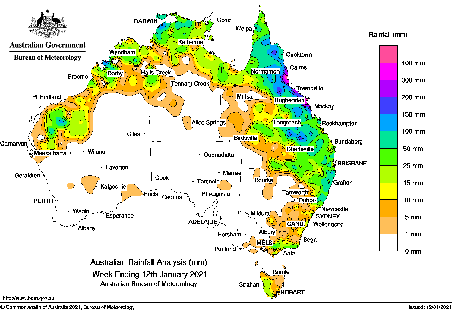
A surface trough and the remnants of ex-tropical cyclone Imogen near the north tropical coast of Queensland brought widespread moderate falls to northern and eastern Queensland. while thunderstorms and showers produced moderate falls across the Top End in the Northern Territory and northern Western Australia.
The highest weekly total was 502 mm at Gairloch in northern Queensland.
Past seven days: At the start of the week, a surface trough extended from the Kimberley in Western Australia, across the base of the Top End in the Northern Territory, to the remnants of ex-tropical cyclone Imogen, located over the north tropical coast of Queensland. Another surface trough extended from the Gulf Country through western Queensland and inland New South Wales. Widespread showers and thunderstorms developed across parts of the Gascoyne and Pilbara, and northern Kimberley; also through central and northern parts of the Northern Territory, and across large areas of northern and eastern Queensland. Thunderstorms and showers also developed in northern inland and eastern parts of New South Wales, and eastern Victoria.
The remnants of ex-tropical cyclone Imogen lingered near the north tropical coast of Queensland for several days. Moderate to locally heavy falls were reported in the north tropical coast, and the Herbert and Burdekin districts. The trough through inland Queensland and the coastal trough, combined to generate persistent showers and thunderstorms and widespread moderate falls across the north tropical coast, and central to southern inland Queensland. Heavier falls were reported about the north tropical, Burdekin and Herbert coasts in Queensland, with major flooding on the Herbert and Upper Burdekin rivers.
From the middle of the week, thunderstorms continued over parts of the Pilbara in Western Australia, and the Top End in the Northern Territory and in western Queensland. The trough remained near-stationary along the north-east coast of Queensland until the end of the week, with another trough still located further inland. Combined with an upper-level disturbance, the systems produced widespread moderate falls across the Cape York Peninsula, north tropical to central coasts, Central Highlands and south-east of Queensland.
At the end of the week, a cold front and pre-frontal trough tracked across south-east Australia, and produced moderate falls in western Tasmania.
Rainfall totals in excess of 200 mm were from the north tropical to central coasts of Queensland, including the highest weekly total of 502 mm at Gairloch in Herbert North Coast in Queensland.
Rainfall totals in excess of 100 mm were recorded in areas of the Pilbara and Kimberley in Western Australia, coastal parts of the north-west Top End in the Northern Territory, and along the north-east coast of Queensland from Cooktown to St Lawrence, as well as isolated areas in the Central Highlands.
Rainfall totals between 10 mm and 50 mm were recorded in the northern inland Gascoyne, Pilbara and Kimberley in Western Australia, most of the northern third of the Northern Territory, and remaining parts of Queensland away from the south-west, northern inland and most of the east coast of New South Wales, eastern Victoria, and western Tasmania.
Highest weekly totals
New South Wales and Australian Capital Territory
172 mm Green Pigeon (Morning View)
170 mm Careys Peak (Barrington Tops)
150 mm Dorrigo (Old Coramba Rd)
Victoria
60 mm Gabo Island Lighthouse
52 mm Madalya
43 mm Mount Baw Baw
Queensland
502 mm Gairloch
496 mm Ingham Composite
485 mm Hamilton Island
Western Australia
168 mm Yampi Sound (Defence)
75 mm Paraburdoo Aero
74 mm Ellenbrae
South Australia
4 mm Blinman
1.2 mm Beltana Roadhouse
0.6 mm Leigh Creek Airport
Tasmania
31 mm Mount Read
26 mm Lake Margaret Power Station
22 mm Zeehan
Northern Territory
166 mm Darwin River Dam
161 mm Middle Point
147 mm Labelle Downs
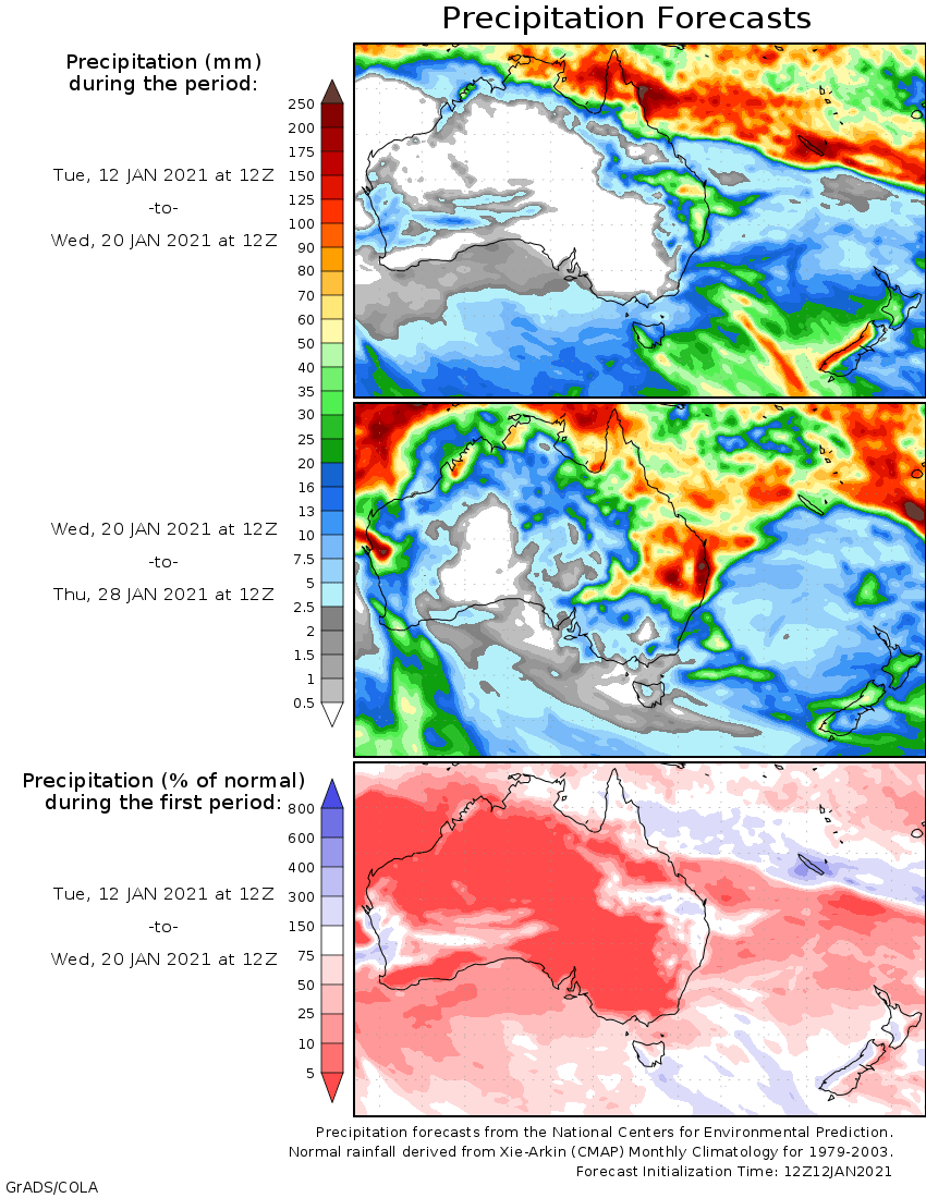
Rainfall outlook
HAVE YOUR SAY