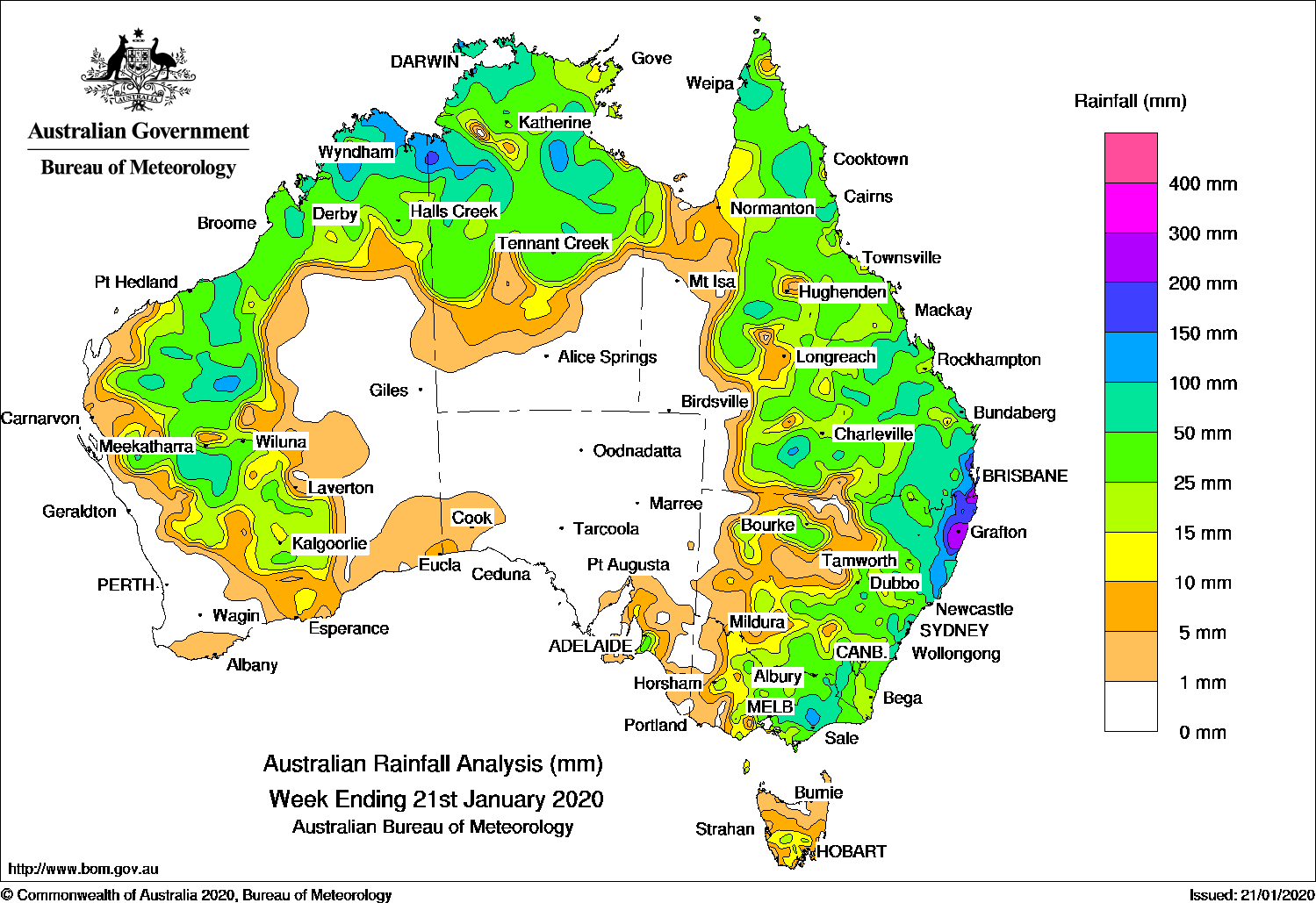
Past seven days: For the week to 21 January 2020, rainfall was recorded in the west, north, and east of Australia. Little to no rainfall was recorded in South Australia away from the southeast, and through Central Australia.
In the first half of the week, broad low pressure troughs extended along the west, north, and east of Australia. Showers and thunderstorms brought moderate falls to the Pilbara, Gascoyne, Goldfields, Kimberley, and northwest coast of Western Australia; and the Top End in the Northern Territory.
A surface trough extending across eastern Australia interacted with an upper-level trough and brought enhanced shower activity and thunderstorms through northern, central, and southern Queensland, and from central to eastern New South Wales. Showers and moderate falls were also recorded in southern central Victoria, and inland southern Tasmania.
Another surface trough developed near the northeast New South Wales coast, extending north into southeastern Queensland in the middle of the week. Showers and thunderstorms produced widespread moderate falls, with locally heavier falls around far southeastern Queensland and far northeastern New South Wales.
In the last part of the week, a low pressure system developed over western New South Wales and northern Victoria, with a trough along the New South Wales coast. The low deepened and moved eastward across eastern New South Wales and Victoria, passing over the Tasman Sea, with showers and thunderstorms producing moderate to locally heavy falls in southern inland New South Wales, and central to eastern Victoria. Severe thunderstorms produced large hail, damaging winds and heavy rainfall in some areas in the southeast, including in Melbourne and Canberra.
Isolated convection continued across the northwest and north of the country during the rest of the week, with a westerly wind surge over northern Australia bringing increased showers and thunderstorms in the Kimberley and north of Northern Territory at the end of the week.
Rainfall totals in excess of 200 mm were recorded in northeastern New South Wales and southeast Queensland, including the highest weekly total of 373 mm at Miami Bardon Avenue in the Gold Coast in southeast Queensland.
Rainfall totals in excess of 100 mm were recorded in southeastern Queensland and northeastern New South Wales; in isolated areas in eastern Victoria; the north Kimberley coast in Western Australia; parts of the Top End in the Northern Territory, and isolated spots in Queensland’s inland south.
Rainfall totals in excess of 50 mm were recorded in the east Pilbara and Gascoyne in Western Australia; large parts of the Top End in the Northern Territory; parts of northern, central and southern Queensland; parts of eastern New South Wales; and eastern Victoria.
Rainfall totals between 10 mm and 50 mm were recorded in a broad area of Western Australia from the Kimberley, through the Pilbara, down to the Goldfields and Southeast Coastal districts; the northern half of the Northern Territory; most of Queensland, New South Wales and Victoria except the far west of those States; southern Tasmania; and southeastern South Australia.
Highest weekly totals
New South Wales and Australian Capital Territory
307 mm Lowanna (Lowanna Road)
304 mm Nana Glen (Cowling Close), Grafton Airport Aws
Victoria
178 mm Mount Moornapa
167 mm Stratford
129 mm Kinglake West
Queensland
373 mm Miami Bardon Ave
323 mm Gold Coast Seaway
306 mm Springbrook Road
Western Australia
206 mm Youno Downs
181 mm Kununurra Checkpoint
141 mm Port Smith
South Australia
54 mmProspect Hill
51 mmMeadows
46 mmHeathfield Works Depot
Tasmania
22 mm Melton Mowbray (North Stockman
20 mm Wayatinah (Saltas)
19 mm Lucaston (Bakers Creek Road)Tea Tree Point
Northern Territory
194 mm Darwin Hospital
188 mm Shoal Bay
162 mm Csiro Berrimah
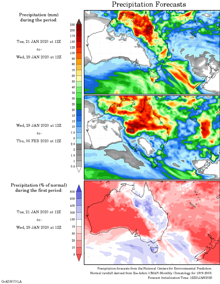
Rainfall outlook
HAVE YOUR SAY