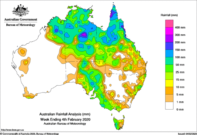
Past seven days: At the start of the week, a tropical low pressure system lingered about the southern Gulf of Carpentaria coast, with the monsoon trough stretching across the Cape York Peninsula to the north tropical Queensland coast, and across the base of the Top End in the Northern Territory. The low then moved southwest through central and southwestern parts of the Northern Territory. Moderate to heavy falls and squally thunderstorms affected the north tropical coast and northwest Queensland, while there were widespread moderate falls across northern and western Queensland, the Northern Territory and eastern inland parts of Western Australia.
By the middle of the week, cloud with embedded thunderstorms extended over northern Western Australia and much of the Northern Territory, associated with an inland trough stretching from northwest Western Australia to the Bight. A cloudband developed in a very humid northerly airstream along the line of the trough and ahead of a cold front approaching the Bight. Cloud extended over eastern South Australia, Victoria, and Tasmania ahead of the cold front as it tracked across southern Australia, bringing rain, showers and thunderstorms with locally heavy falls in parts of South Australia.
In the latter part of the week further moderate falls were recorded in parts of central to eastern New South Wales and western Tasmania associated with the passage of a second cold front.
Towards the end of the week a tropical low formed in the inland west of the Northern Territory, then moved west into the east Kimberley, with associated monsoonal trough extending across the Australian tropics. Thunderstorms and showers resulted across the Northern Territory, parts of northern Queensland, and the Kimberly in Western Australia during the last days of the week.
Rainfall totals in excess of 100 mm were recorded in parts of the Kimberly in Western Australia, the Carpentaria and Barkly districts in the Northern Territory, the Gulf Country, and in northern Queensland. Falls in excess of 100 mm were also recorded at some locations in southeast South Australia. The highest weekly total was 320 mm at Victoria Sugar Mill in north Queensland, to the north of Townsville.
Rainfall totals in excess of 50 mm were recorded across much of the Kimberley in Western Australia, much of the Northern Territory, across northern Queensland, areas from northern to southeast South Australia, parts of western Victoria, and an area of western Tasmania.
Rainfall totals between 10 mm and 50 mm were recorded in the Kimberley and parts of inland northeastern Western Australia; most of the Northern Territory; much of western and northern to central Queensland; parts of central to eastern New South Wales; most of Victoria except the far north and far east; most of Tasmania; and most of South Australia except the west and far northeast.Little to no rainfall was recorded in remaining areas of Western Australia, most of the southern third of Queensland, most of New South Wales away from central to eastern parts, northern border regions of Victoria, and western and northeastern South Australia.
Highest weekly totals
New South Wales and Australian Capital Territory
119 mm Abbotsford (Blackwall Point Rd)
110 mm Comboyne (Public School)
95 mm Killabakh
Victoria
69 mm Nhill Aerodrome
56 mm Merino
54 mm Dimboola
Queensland
320 mm Victoria Sugar Mill
296 mm Kuranda Railway Station
287 mm Macknade Sugar Mill
Western Australia
240 mm Lansdowne
187 mm Yulmbu
163 mm Truscott
South Australia
105 mm Yudnapinna
86 mm Yacka
82 mm Brinkworth
Tasmania
106 mm Mount Read
70 mm Queenstown (South Queenstown)
62 mm Lake Margaret Dam
Northern Territory
187 mm Pigeon Hole
164 mm Timber Creek
161 mm Humbert River
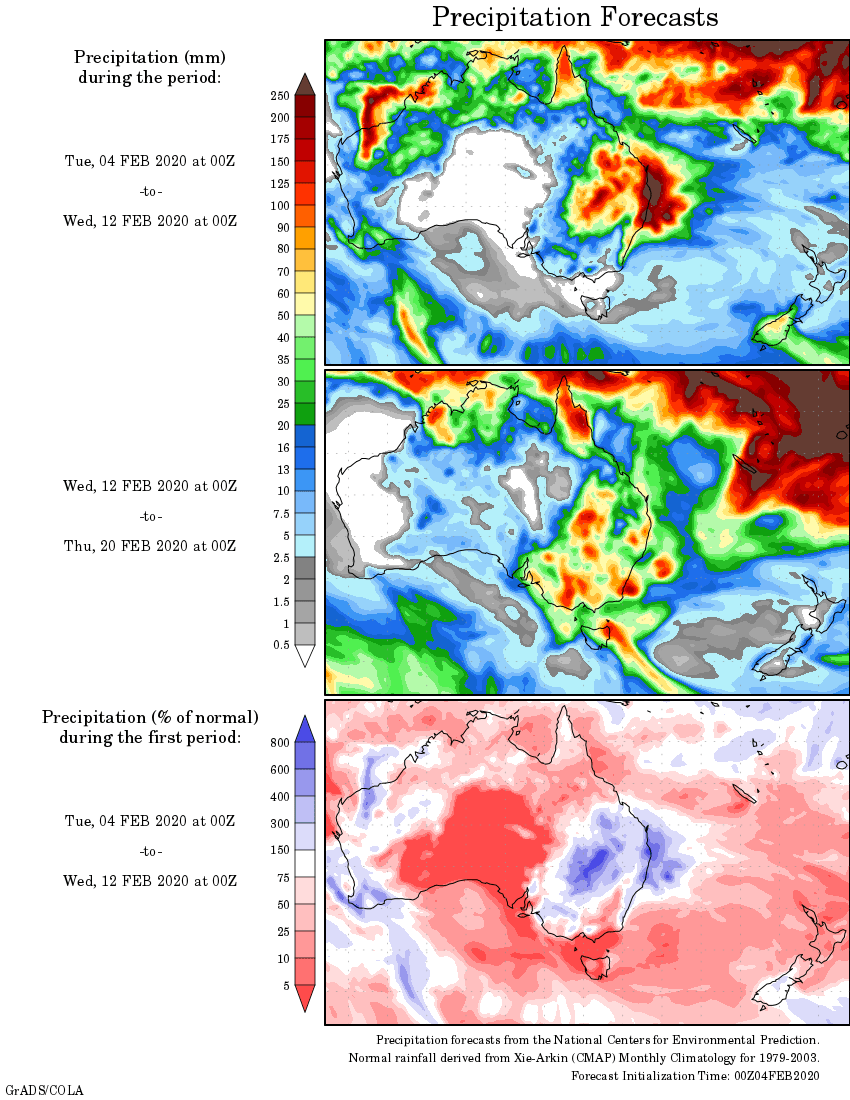
Rainfall outlook
HAVE YOUR SAY