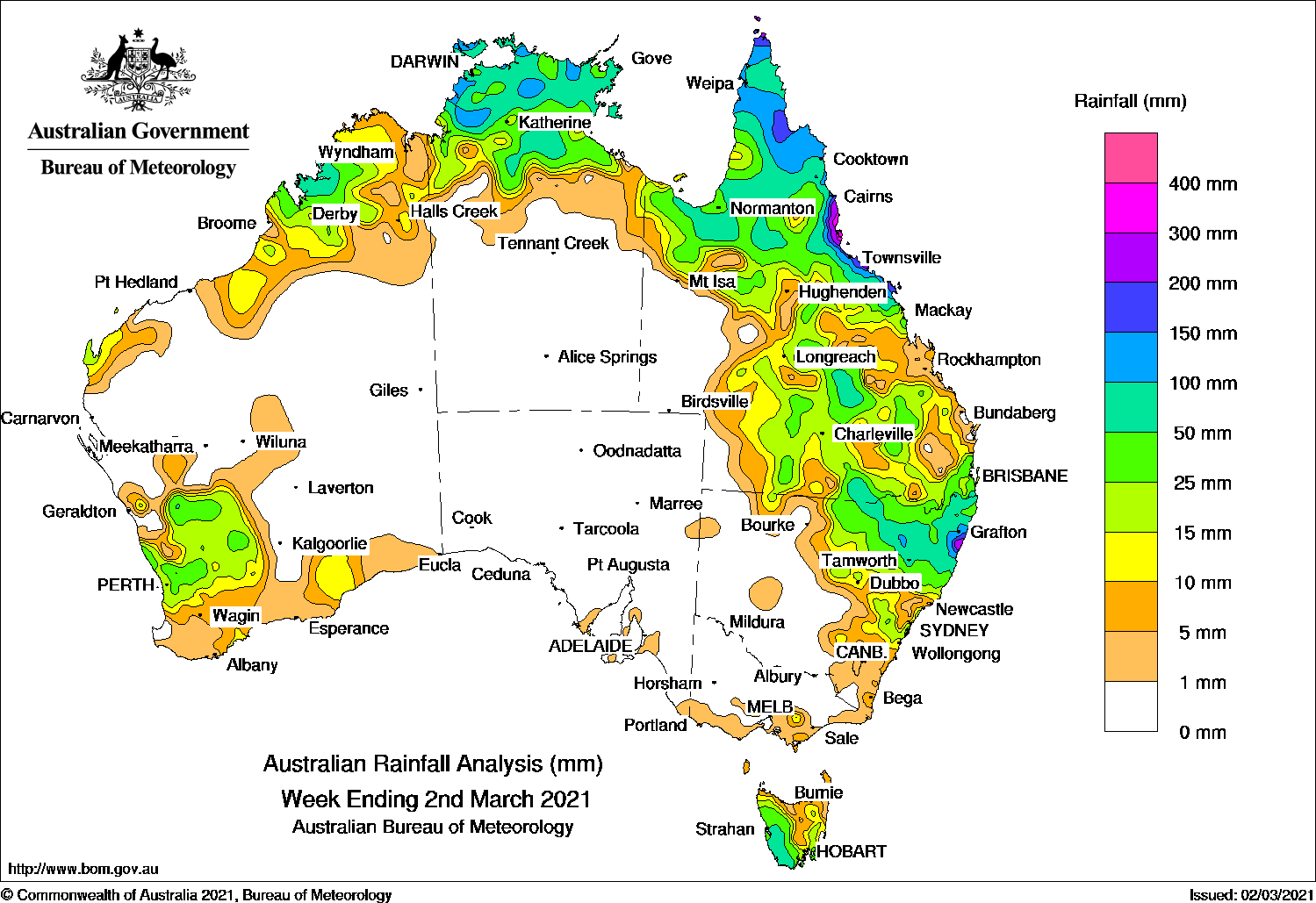
Past seven days: In the early part of the week, surface troughs extended across northern and eastern Australia. Thunderstorms and showers developed over the northern tropics, and from the Gulf Country through central Queensland, to south-east Queensland and north-eastern New South Wales.
A number of cold fronts tracked over Tasmania, and an associated low pressure system moved across the state’s south, producing moderate falls in western Tasmania. Showers and thunderstorms continued over parts of eastern and northern New South Wales, and across the border in southern inland Queensland
In the west, a surface trough triggered thunderstorms in parts of the south coast of Western Australia.
A tropical low, off the north-west Australian coast and to the south of Cocos (Keeling) Islands, developed into tropical cyclone Marian on 26 February, and had no impact on the Australian mainland.
In the second part of the week, a tropical low was located off the Queensland north tropical coast, east of Cairns, on a monsoon trough. The low remained stationary and intensified to tropical cyclone Niran on 2 March. Widespread moderate falls were recorded across northern Queensland with locally heavier falls over 100 mm to 200 mm in the north tropical coast, in the vicinity of the tropical system.
A surface trough extended from the Gulf Country to north-eastern New South Wales. Thunderstorms and showers also produced moderate falls over southern inland Queensland and northern New South Wales.
In the west, a broad trough drew a moist tropical air mass down to the state’s south-west, and triggered thunderstorms around the Central West and Lower West districts in Western Australia, with moderate falls reported.
At the end of the week, a cold front moved across Tasmania and an associated low pressure system tracked to the state’s south-east, with moderate rainfall recorded in western and south-eastern Tasmania.
Rainfall totals in excess of 200 mm were reported along the north tropical coast of Queensland between Cairns and south of Townsville, and in an area of the Mid North Coast in New South Wales. The highest weekly total was 461 mm at Bingil Bay in northern Queensland.
Rainfall totals in excess of 100 mm were reported in areas of the northern Top End in the Northern Territory, the Cape York Peninsula and north tropical coast of Queensland, and in north-eastern New South Wales.
Rainfall totals between 50 mm and 100 mm were recorded in western Tasmania, north-eastern New South Wales, southern and central inland Queensland as well as that state’s north, across much of the Top End in the Northern Territory, and an area of the west Kimberley in Western Australia.
Rainfall totals between 10 mm and 50 mm were recorded parts of southern and northern Western Australia, the Top End in the Northern Territory, most of northern, and central to eastern Queensland, northern and eastern parts of New South Wales, and most of Tasmania away from the north.
Highest weekly totals
New South Wales and Australian Capital Territory
258 mm Baryulgil (Clarence River)
250 mm Lowanna (Lowanna Road)
225 mm Glenreagh (Coramba Street)
Victoria
33 mm Mount Baw Baw
12 mm Wilsons Promontory Lighthouse
10 mm Erica (Parkers Corner)
Queensland
461 mm Bingil Bay
446 mm Cardwell Range
434 mm Lucinda Township
Western Australia
120 mmKimbolton
91 mm Exmouth Town
79 mm Mount Noddy
South Australia
6 mm Rodwell Creek (Highland Valley, Strathalbyn Racecourse
5 mm Palmer
Tasmania
103 mm Scotts Peak Dam
96 mm Mount Read
79 mm Strathgordon Village
Northern Territory
167 mm Kangaroo Flats (Defence)
154 mm Labelle Downs
149 mm BonalboDum In Mirrie Airstrip
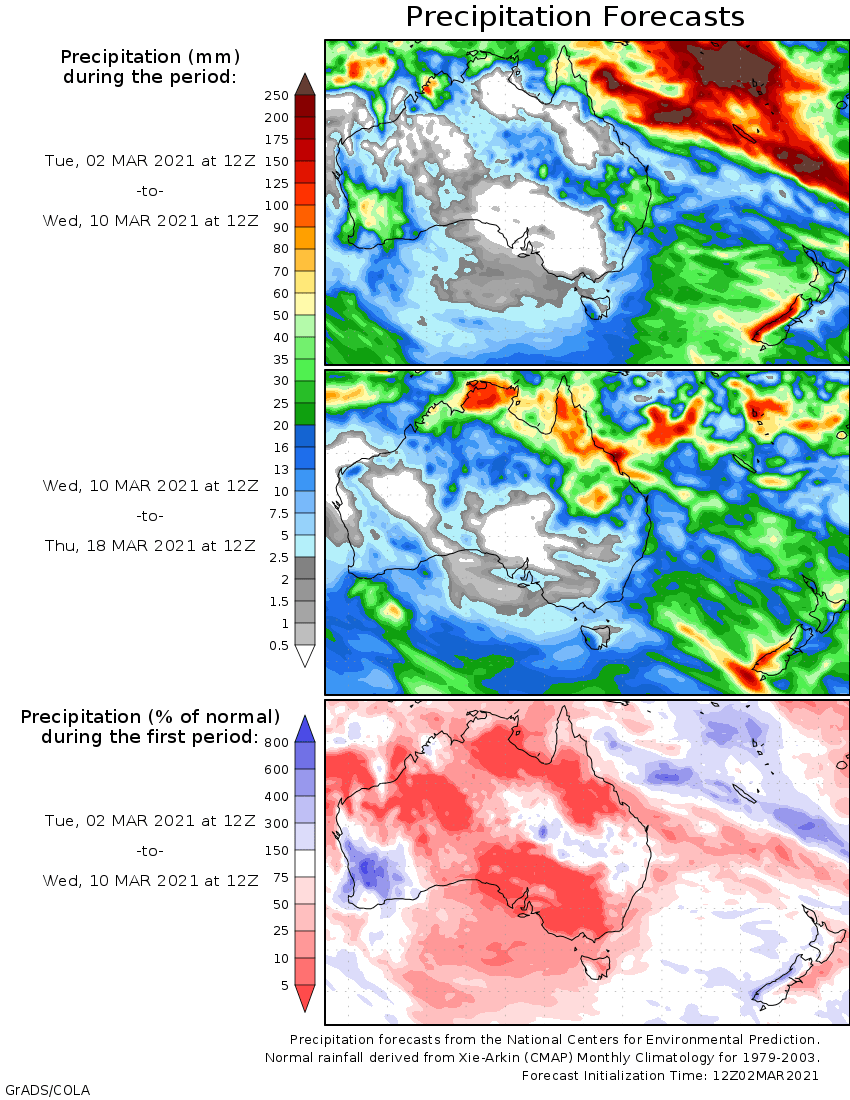
Rainfall outlook
HAVE YOUR SAY