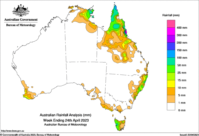
A COLD front crossed the south-east states at the beginning of the week bringing gusty winds and showers that impacted mostly Tasmania and southern Victoria.
A low pressure trough across northern Queensland combined with south-easterly airflow resulting in locally heavy falls in parts of the North Tropical Coast and Gulf Country in the first part of the week.
Onshore airflow brought locally heavy showers to coastal parts of northern New South Wales and northern Queensland coasts in the latter part of the week.
Weekly rainfall totals of more than 200 mm resulted from storms across parts of the Top End (Northern Territory) and the Qld North Tropical Coast.
The highest weekly total (at a Bureau gauge) of 489mm was recorded at Tung Oil Alert, Qld, including the highest daily total of 329mm in the 24 hours to 9am on April 24.
Weekly totals greater than 50mm were recorded in parts of the tropical north and western Tasmania, while totals of 15-50mm were recorded in parts of eastern Top End, most of Cape York Peninsula and pockets of inland Qld, along much of the NSW coast and in western Tasmania.


HAVE YOUR SAY