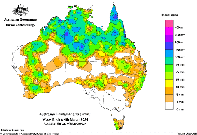
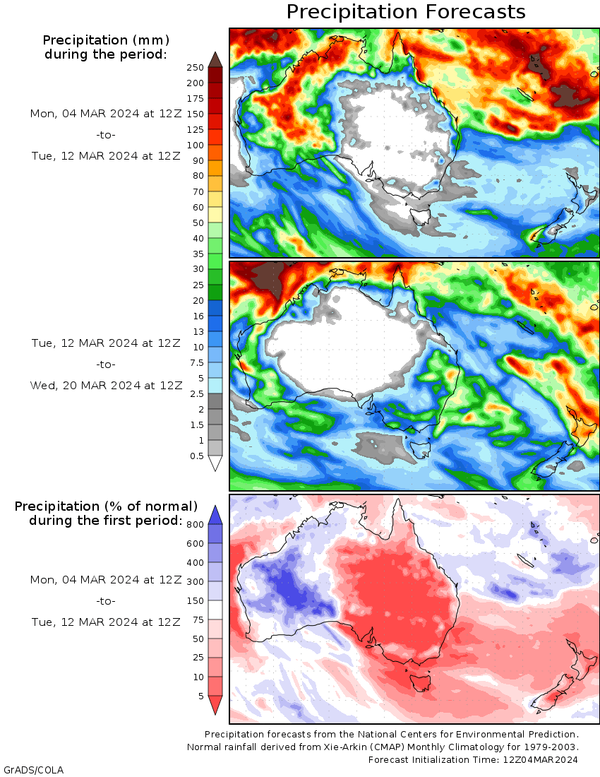
A LOW-PRESSURE system and associated monsoon trough generated showers and isolated thunderstorms across the Top End of the Northern Territory through to the Cape York Peninsula in Queensland.
During the week, a series of troughs moved across Western Australia, Qld, the NT, South Australia and New South Wales, generating widespread showers and some isolated thunderstorms across much of the mainland, while a cold front moved across Tasmania on March 1 and 3, bringing rainfall to the state.
Weekly rainfall totals of 100-200mm were recorded across northern, central and western areas of the NT, and small pockets of north-west Western Australia and northern parts of Qld.
An isolated area on Queensland’s North Tropical Coast and Tablelands district receiving more than 200 mm.
Weekly rainfall totals of 50-100mm were recorded across much of northern Australia and small areas across WA.
The highest weekly rainfall total was 326mm at Paluma Ivy Cottage, Qld.
The highest daily rainfall total during the week was 239mm at South Johnstone Exp Stn, Qld, in the 24 hours to 9am on February 29.


HAVE YOUR SAY